- Oakesdale, Washington
-
Oakesdale, Washington — Town — Location of Oakesdale, Washington
Coordinates: 47°7′50″N 117°14′40″W / 47.13056°N 117.24444°WCoordinates: 47°7′50″N 117°14′40″W / 47.13056°N 117.24444°W Country United States State Washington County Whitman Area – Total 1.0 sq mi (2.7 km2) – Land 1.0 sq mi (2.7 km2) – Water 0.0 sq mi (0.0 km2) Elevation 2,464 ft (751 m) Population (2010) – Total 422 – Density 404.2/sq mi (156.1/km2) Time zone Pacific (PST) (UTC-8) – Summer (DST) PDT (UTC-7) ZIP code 99158 Area code 509 FIPS code 53-50325[1] GNIS feature ID 1507134[2] Oakesdale is a town in Whitman County, Washington, United States. The population was 422 at the 2010 census.
Contents
History
Oakesdale was first settled in 1876 by James McCoy.[3] Oakesdale was incorporated in 1890.
Historical population
- 1890...528
- 1900...928
- 1910...882
- 1920...816
- 1930...637
- 1940...590
- 1950...576
- 1960...474
- 1970...447
- 1980...444
- 1990...346
- 2000...420
- 2010...422
Notable natives
- Virgil T. McCroskey, creator of Steptoe Butte State Park and McCroskey State Park
Geography
Oakesdale is located at 47°7′50″N 117°14′40″W / 47.13056°N 117.24444°W (47.130573, -117.244359).[4]
According to the United States Census Bureau, the town has a total area of 1.0 square miles (2.7 km²), all of it land.
Demographics
As of the census[1] of 2000, there were 420 people, 172 households, and 127 families residing in the town. The population density was 404.2 people per square mile (155.9/km²). There were 194 housing units at an average density of 186.7 per square mile (72.0/km²). The racial makeup of the town was 98.33% White, 0.24% Asian, 0.95% from other races, and 0.48% from two or more races. Hispanic or Latino of any race were 0.95% of the population.
There were 172 households out of which 34.3% had children under the age of 18 living with them, 64.5% were married couples living together, 7.6% had a female householder with no husband present, and 25.6% were non-families. 23.8% of all households were made up of individuals and 14.5% had someone living alone who was 65 years of age or older. The average household size was 2.44 and the average family size was 2.88.
In the town the age distribution of the population shows 25.7% under the age of 18, 3.8% from 18 to 24, 25.2% from 25 to 44, 26.7% from 45 to 64, and 18.6% who were 65 years of age or older. The median age was 43 years. For every 100 females there were 97.2 males. For every 100 females age 18 and over, there were 91.4 males.
The median income for a household in the town was $31,094, and the median income for a family was $42,813. Males had a median income of $27,500 versus $30,714 for females. The per capita income for the town was $16,159. About 9.0% of families and 11.7% of the population were below the poverty line, including 21.2% of those under age 18 and 4.3% of those age 65 or over.
References
- ^ a b "American FactFinder". United States Census Bureau. http://factfinder.census.gov. Retrieved 2008-01-31.
- ^ "US Board on Geographic Names". United States Geological Survey. 2007-10-25. http://geonames.usgs.gov. Retrieved 2008-01-31.
- ^ Majors, Harry M. (1975). Exploring Washington. Van Winkle Publishing Co. p. 112. ISBN 9780918664006. http://books.google.com/books?id=CoWrPQAACAAJ.
- ^ "US Gazetteer files: 2010, 2000, and 1990". United States Census Bureau. 2011-02-12. http://www.census.gov/geo/www/gazetteer/gazette.html. Retrieved 2011-04-23.
External links
Municipalities and communities of Whitman County, Washington Cities 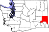
Towns Unincorporated
communitiesGhost town Categories:- Towns in Washington (state)
- Populated places in Whitman County, Washington


Wikimedia Foundation. 2010.