- Garfield, Washington
Infobox Settlement
official_name = Garfield, Washington
settlement_type =Town
nickname = Jewell of the Palouse
motto =
imagesize =
image_caption =
image_
imagesize =
image_caption =
image_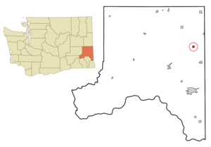
mapsize = 250px
map_caption = Location of Garfield, Washington
mapsize1 =
map_caption1 =subdivision_type = Country
subdivision_name =United States
subdivision_type1 = State
subdivision_name1 =Washington
subdivision_type2 = County
subdivision_name2 = Whitmangovernment_footnotes =
government_type =
leader_title =
leader_name =
leader_title1 =
leader_name1 =
established_title =
established_date = 1890unit_pref = Imperial
area_footnotes =area_magnitude =
area_total_km2 = 1.7
area_land_km2 = 1.7
area_water_km2 = 0.0
area_total_sq_mi = 0.7
area_land_sq_mi = 0.7
area_water_sq_mi = 0.0population_as_of = 2000
population_footnotes =
population_total = 641
population_density_km2 = 368.3
population_density_sq_mi = 953.8timezone = Pacific (PST)
utc_offset = -8
timezone_DST = PDT
utc_offset_DST = -7
elevation_footnotes =
elevation_m = 754
elevation_ft = 2474
latd = 47 |latm = 0 |lats = 33 |latNS = N
longd = 117 |longm = 8 |longs = 31 |longEW = Wpostal_code_type =
ZIP code
postal_code = 99130
area_code = 509
blank_name = FIPS code
blank_info = 53-26140GR|2
blank1_name = GNIS feature ID
blank1_info = 1505083GR|3
website =
footnotes =Garfield is a
town in Whitman County,Washington ,United States . Thepopulation was 641 at the 2000 censusand 630 at the 2008 Washington Office of Financial Management estimate.Historical Population
1900....697
1910....932
1920....776
1930....703
1940....674
1950....674
1960....607
1970....610
1980....599
1990....544
2000....641
2008est.630
Geography
Garfield is located at coor dms|47|0|33|N|117|8|31|W|city (47.009053, -117.141814)GR|1.
According to the
United States Census Bureau , the town has a total area of 0.7square mile s (1.7km² ), all of it land.Demographics
As of the
census GR|2 of 2000, there were 641 people, 256 households, and 174 families residing in the town. Thepopulation density was 953.8 people per square mile (369.4/km²). There were 288 housing units at an average density of 428.5/sq mi (166.0/km²). The racial makeup of the town was 97.50% White, 0.47% Native American, 0.16% Asian, 0.16% from other races, and 1.72% from two or more races. Hispanic or Latino of any race were 0.31% of the population.There were 256 households out of which 34.8% had children under the age of 18 living with them, 54.7% were married couples living together, 9.8% had a female householder with no husband present, and 32.0% were non-families. 28.5% of all households were made up of individuals and 12.5% had someone living alone who was 65 years of age or older. The average household size was 2.50 and the average family size was 3.09.
In the town the population was spread out with 30.7% under the age of 18, 4.2% from 18 to 24, 26.4% from 25 to 44, 22.5% from 45 to 64, and 16.2% who were 65 years of age or older. The median age was 39 years. For every 100 females there were 100.3 males. For every 100 females age 18 and over, there were 93.0 males.
The median income for a household in the town was $36,250, and the median income for a family was $41,923. Males had a median income of $32,917 versus $22,222 for females. The
per capita income for the town was $17,804. About 5.9% of families and 12.9% of the population were below thepoverty line , including 21.4% of those under age 18 and 11.5% of those age 65 or over.References
External links
* [http://www.garfield-wa.com/ Garfield community website]
Wikimedia Foundation. 2010.