- McCroskey State Park
-
McCroskey State Park Idaho State Park  The park's scenic Skyline Drive, much of it built by Virgil T. McCroskey himself
Named for: Mary Minerva McCroskey Country  United States
State  Idaho
IdahoCounties Benewah, Latah Location Plummer - coordinates 47°3′54″N 116°57′2″W / 47.065°N 116.95056°W Highest point - elevation 4,324 ft (1,318 m) Lowest point - elevation 3,039 ft (926 m) Area 5,300 acres (2,145 ha) Founded 1955 Management Idaho Department of Parks and Recreation 
 Location of McCroskey State Park in Idaho
McCroskey State Park (full name: Mary Minerva McCroskey State Park) is a state park of Idaho, USA, stretching along a ridge in the Palouse region. At 5,300 acres (21 km2) this wilderness area is Idaho's second-largest state park. The park is located in Latah and Benewah Counties along the border of Washington.
Contents
History
McCroskey State Park was gifted to Idaho in 1955 by a local conservationist, Virgil T. McCroskey, who gradually bought up land endangered by logging and cobbled his purchases into a 4,400-acre (18 km2) parcel.[1] To make the land more attractive to tourists, he cut viewpoints into some of the slopes, built picnic areas, planted flowers, and established a road. The Idaho legislature, however, had serious doubts about the new park – thinking it would not generate enough revenue to justify the loss in taxes – and agreed to accept the gift only if McCroskey, then in his late seventies, would maintain the park at his own expense for the next fifteen years. McCroskey accepted the terms, and lived exactly fifteen more years, fulfilling his obligation to the state of Idaho just weeks before his death in 1970 at age 93.[2]
McCroskey named the park in honour of his mother, a pioneer woman who came to Eastern Washington with her husband and children to establish a homestead near Steptoe Butte; he dedicated it to all pioneer women.[1]
Description
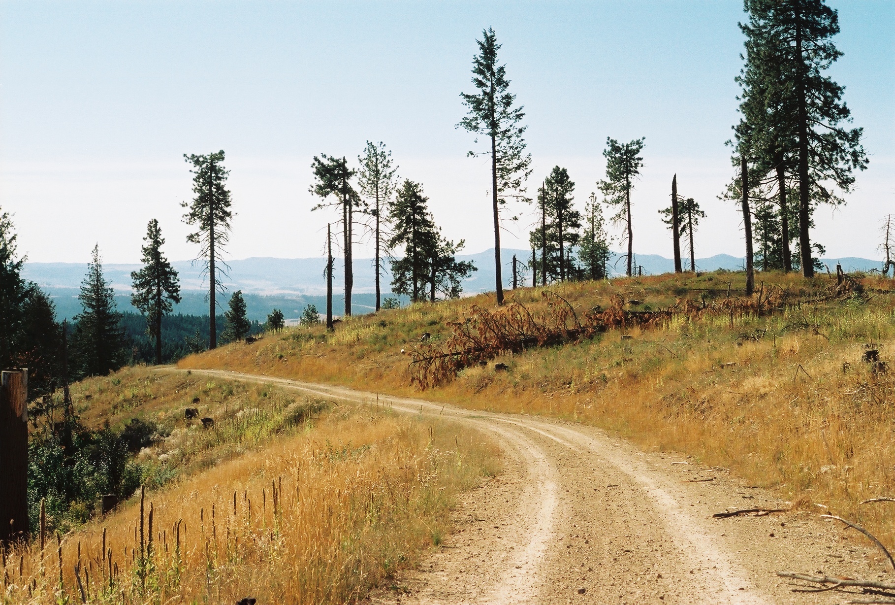
 Looking south from Skyline Drive
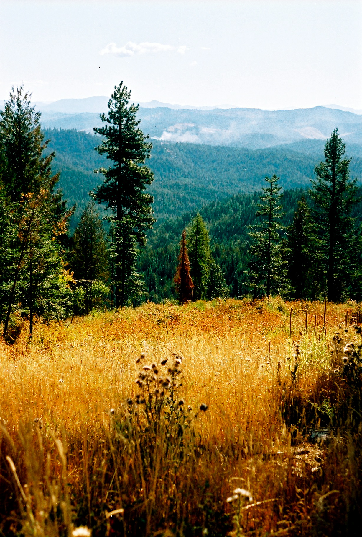
McCroskey State Park occupies the rocky slopes of Skyline Ridge on Mineral Mountain, in a transitional zone between the palouse prairie to the west and the Rocky Mountains to the east. The park's chief attraction is a narrow unimproved road called Skyline Drive, which winds for 18 miles (29 km) along a steep ridge, climbing through dense cedar forest that gives way to stands of ponderosa pine and, eventually, to prairie. The road also links a scattering of interpretive signs and vista points.[3] In addition, there are 32 miles (51 km) of trails open to hiking, mountain biking, horses, and all-terrain vehicles. Picnic areas, pit toilets and primitive campsites are available, along with a single source of drinking water near the midpoint of Skyline Drive. Since the park is large, remote, and underutilized, it provides excellent habitat for an assortment of wildlife, including deer, moose, and black bears. Despite McCroskey's "park" status, however, significant logging still takes place within park boundaries.[citation needed]
The park lies about 10 miles (16 km) north of Potlatch, Idaho. The best access point is from Highway 95, but visitors can also enter the park from Farmington road on the west side, a few miles north of Farmington, Washington. On the Farmington side, the only indication of the park's presence is the Skyline Drive sign, and the roads are much rougher.[4]
References
- ^ a b Arksey, Laura (2006-11-05). "McCroskey, Virgil Talmadge (1876-1970)". Historylink: The Online Encyclopedia of Washington State History. http://www.historylink.org/essays/output.cfm?file_id=7989.
- ^ Vogt, Andrea (Fall 2006). "The Man Who Gave Away Mountains". Washington State Magazine (Pullman, Wash.: Washington State University). http://washington-state-magazine.wsu.edu/stories/2006/August/McCroskey.html.
- ^ Idaho Department of Parks and Recreation. "McCroskey State Park". http://parksandrecreation.idaho.gov/parks/maryminervamccroskey.aspx. Retrieved 2011-03-05.
- ^ Brians, Paul. "McCroskey State Park". Tour WSU and the Palouse (And the Surrounding Region). http://www.wsulibs.wsu.edu/Holland/masc/paul_brians/palouse/mccroskey/index.html.
External links
Federal National ParksNational MonumentsNational ForestsBitterroot • Boise • Caribou-Targhee • Clearwater • Coeur d'Alene • Idaho Panhandle • Kaniksu • Kootenai • Nez Perce • Payette • Salmon-Challis • Sawtooth • St. Joe • Wallowa–Whitman • Wasatch-CacheNational Wildlife RefugesBear Lake • Camas • Deer Flat • Grays Lake • Kootenai • Minidoka • Oxford Slough Waterfowl Production AreaBig Jacks Creek • Bruneau-Jarbidge Rivers • Craters of the Moon • Frank Church-River of No Return • Gospel Hump • Hells Canyon • Little Jacks Creek • North Fork Owyhee • Owyhee River • Pole Creek • Selway-Bitterroot • SawtoothState Bear Lake • Bruneau Dunes • Castle Rocks • City of Rocks • Coeur d'Alene Parkway • Dworshak • Eagle Island • Farragut • Harriman • Hells Gate • Henrys Lake • Heyburn • Lake Cascade • Lake Walcott • Land of the Yankee Fork • Lucky Peak • Massacre Rocks • McCroskey • Old Mission • Ponderosa • Priest Lake • Round Lake • Thousand Springs • Three Island Crossing • Trail of the Coeur d'Alenes • Winchester Lake •Idaho Department of Parks & Recreation (website)Categories:- Protected areas of Benewah County, Idaho
- Idaho state parks
- Protected areas of Latah County, Idaho
- Protected areas established in 1955

Wikimedia Foundation. 2010.