- Thousand Springs State Park
-
Thousand Springs State Park Idaho State Park Country  United States
State  Idaho
IdahoCounty Gooding Location Hagerman - elevation 2,800 ft (853 m) - coordinates 42°51′28″N 114°52′35″W / 42.85778°N 114.87639°W Area 1,500 acres (607 ha) Founded 2005 Management Idaho Department of Parks and Recreation 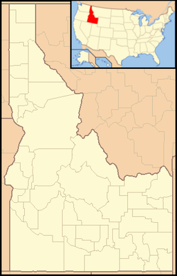
 Location of Thousand Springs State Park in Idaho
Thousand Springs State Park is a state park of Idaho, USA, comprising 5 units in the Hagerman Valley. In 2005 as part of a master planning process, it was decided to combine 4 existing state parks under a single new entity.[1] A fifth unit has since been added. The units as they currently stand are Billingsley Creek, Earl M. Hardy Box Canyon Springs Nature Preserve, Malad Gorge, Niagara Springs, and Ritter Island.[2]
Contents
Billingsley Creek
This former ranch was purchased by the state in 2001.[2] One feature is the homesite of western author Vardis Fisher.[1] Billingsley Creek Unit totals 286 acres (116 ha).[3]
Earl M. Hardy Box Canyon Springs Nature Preserve
This 350-acre (140 ha) box canyon has 250-foot-high (76 m) walls. At its head is the eleventh-largest spring in North America, gushing 180,000 US gallons (680,000 L) per minute.[3] There is a 20-foot (6.1 m) waterfall.[2] This 350-acre (140 ha) property is in development and is co-managed with The Nature Conservancy.[4]
Malad Gorge
Malad Gorge is a 250-foot-deep (76 m) canyon formed by the Malad River, downstream from a 60-foot (18 m) waterfall. This 652-acre (264 ha) day-use-only unit is just off Interstate 84 and offers hiking and picnicking. A section of the Oregon Trail is visible.[2] Rock pigeons, red-tailed hawks and golden eagles nest in the canyon. Yellow-bellied marmots are found on the canyon floor.
Niagara Springs
Proclaimed a National Natural Landmark, this area borders the Snake River and features sheer basalt cliffs 350 feet (110 m) high.[3] There are 179 acres (72 ha) in two parcels, acquired in 1971 and 1976.[3]
Ritter Island
This unit lies along the Snake River between two large springs.[2]
References
- ^ a b Idaho Department of Parks and Recreation (2006-08). "Thousand Springs State Park Master Plan, Chapter 1". http://parksandrecreation.idaho.gov/assets/content/docs/Development/Thousand%20Springs%20State%20Park/Chapter%201.pdf. Retrieved 2001-03-04.
- ^ a b c d e Idaho Department of Parks and Recreation. "Thousand Springs State Park". http://parksandrecreation.idaho.gov/parks/thousandsprings.aspx. Retrieved 2001-03-04.
- ^ a b c d Idaho Department of Parks and Recreation (2006-08). "Thousand Springs State Park Master Plan, Chapter 3". http://parksandrecreation.idaho.gov/assets/content/docs/Development/Thousand%20Springs%20State%20Park/Chapter%203.pdf. Retrieved 2001-03-04.
- ^ Idaho Division of Tourism Development. "Earl M. Hardy Box Canyon Springs Nature Preserve". http://www.visitidaho.org/thingstodo/parks/earl-m-hardy-box-canyon-springs-nature-preserve.aspx. Retrieved 2011-03-04.
External links
Federal National ParksNational MonumentsNational ForestsBitterroot • Boise • Caribou-Targhee • Clearwater • Coeur d'Alene • Idaho Panhandle • Kaniksu • Kootenai • Nez Perce • Payette • Salmon-Challis • Sawtooth • St. Joe • Wallowa–Whitman • Wasatch-CacheNational Wildlife RefugesBear Lake • Camas • Deer Flat • Grays Lake • Kootenai • Minidoka • Oxford Slough Waterfowl Production AreaBig Jacks Creek • Bruneau-Jarbidge Rivers • Craters of the Moon • Frank Church-River of No Return • Gospel Hump • Hells Canyon • Little Jacks Creek • North Fork Owyhee • Owyhee River • Pole Creek • Selway-Bitterroot • SawtoothState Bear Lake • Bruneau Dunes • Castle Rocks • City of Rocks • Coeur d'Alene Parkway • Dworshak • Eagle Island • Farragut • Harriman • Hells Gate • Henrys Lake • Heyburn • Lake Cascade • Lake Walcott • Land of the Yankee Fork • Lucky Peak • Massacre Rocks • McCroskey • Old Mission • Ponderosa • Priest Lake • Round Lake • Thousand Springs • Three Island Crossing • Trail of the Coeur d'Alenes • Winchester Lake •Categories:- Protected areas of Gooding County, Idaho
- Idaho state parks
- Protected areas established in 2005
- Snake River

Wikimedia Foundation. 2010.