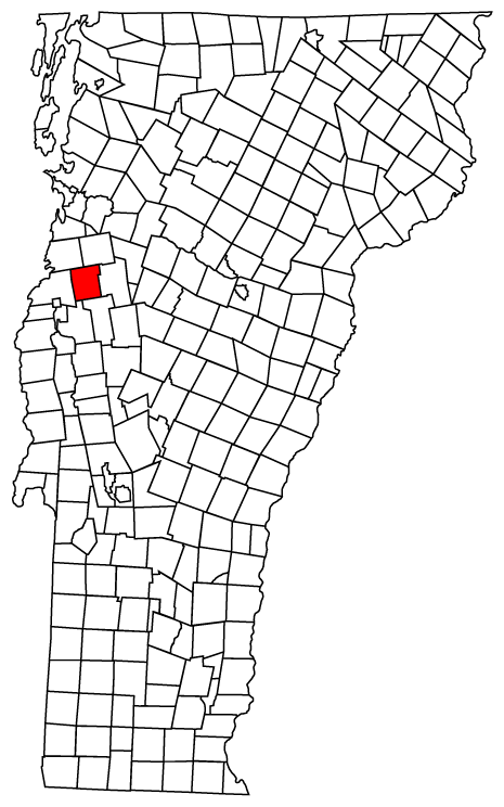
- Monkton, Vermont
-
Monkton, Vermont — Town — Monkton town hall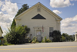 Monkton, Vermont
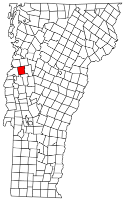
Coordinates: 44°13′12″N 73°7′32″W / 44.22°N 73.12556°WCoordinates: 44°13′12″N 73°7′32″W / 44.22°N 73.12556°W Country United States State Vermont County Addison Area – Total 36.2 sq mi (93.8 km2) – Land 36.0 sq mi (93.3 km2) – Water 0.2 sq mi (0.5 km2) Elevation 1,119 ft (341 m) Population (2000) – Total 1,759 – Density 48.8/sq mi (18.9/km2) Time zone Eastern (EST) (UTC-5) – Summer (DST) EDT (UTC-4) ZIP code 05469 Area code(s) 802 FIPS code 50-45550[1] GNIS feature ID 1462150[2] Monkton is a town in Addison County, Vermont, United States. The population was 1,759 at the 2000 census.
Contents
Geography
Monkton is located at 44°15′14.5″N 73°7′26.13″W / 44.254028°N 73.123925°W. According to the United States Census Bureau, the town has a total area of 36.2 square miles (93.8 km2), of which, 36.0 square miles (93.3 km2) of it is land and 0.2 square miles (0.5 km2) of it (0.58%) is water.
History
Monkton was chartered in 1762.
Monkton's observance of the U.S. Bicentennial began with a number of small community projects which culminated with a two-day extravaganza on August 21 and August 22, 1976. The first of the preliminary projects was to place American flags on all the veterans' graves in the town cemeteries, with the second the making of over forty quilts. Finally, two banners were made to announce the upcoming weekend of events.
Community organizations
Cedar Lake Homemakers Club This club is intended to be an informal means of sharing ideas and methods for better homemaking through charity work and donations.
Florona Grange The Grange, which helped sponsor 1976 Bicentennial events, was organized at the Town Hall on July 17, 1940 with 96 members. Throughout World War II, the Grange helped in the war effort and supported the servicemen and women.
Friendly Circle This club's community outreach is expressed by visits to the sick, gifts to the needy and annual pre-Thanksgiving dinner for senior citizens.
Monkton Museum and Historical Society The purpose of this organization is to encourage and make possible the study of Monkton history and to provide a central location where Monkton residents can share their interests in local history.
Monkton Volunteer Fire Department The fire department was founded on February 9, 1972, at a public meeting in the Monkton Central School.
Monkton Parents Teachers Organization The PTO has been a town organization for many years.
Demographics
 Russell Memorial Library
As of the census[1] of 2000, there were 1,759 people, 642 households, and 503 families residing in the town. The population density was 48.8 people per square mile (18.9/km2). There were 687 housing units at an average density of 19.1 per square mile (7.4/km2). The racial makeup of the town was 98.64% White, 0.17% African American, 0.23% Native American, 0.40% Asian, 0.06% from other races, and 0.51% from two or more races. Hispanic or Latino of any race were 0.51% of the population.
There were 642 households out of which 41.4% had children under the age of 18 living with them, 69.3% were married couples living together, 6.1% had a female householder with no husband present, and 21.5% were non-families. 15.0% of all households were made up of individuals and 4.5% had someone living alone who was 65 years of age or older. The average household size was 2.74 and the average family size was 3.06.
In the town the population was spread out with 28.5% under the age of 18, 4.8% from 18 to 24, 32.7% from 25 to 44, 27.8% from 45 to 64, and 6.1% who were 65 years of age or older. The median age was 37 years. For every 100 females there were 97.9 males. For every 100 females age 18 and over, there were 91.3 males.
The median income for a household in the town was $53,807, and the median income for a family was $58,611. Males had a median income of $38,424 versus $27,179 for females. The per capita income for the town was $22,256. About 1.9% of families and 3.6% of the population were below the poverty line, including 3.8% of those under age 18 and 8.7% of those age 65 or over.
References
- ^ a b "American FactFinder". United States Census Bureau. http://factfinder.census.gov. Retrieved 2008-01-31.
- ^ "US Board on Geographic Names". United States Geological Survey. 2007-10-25. http://geonames.usgs.gov. Retrieved 2008-01-31.
External links
Municipalities and communities of Addison County, Vermont City 
Towns CDP Other
communitiesChimney Point | Satans Kingdom
Categories:- Towns in Vermont
- Monkton, Vermont
- Populated places in Addison County, Vermont


Wikimedia Foundation. 2010.