- Goree, Texas
-
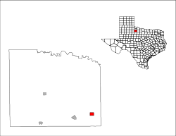
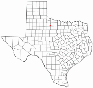
Goree, Texas — City — Location of Goree, Texas
Coordinates: 33°28′7″N 99°31′26″W / 33.46861°N 99.52389°WCoordinates: 33°28′7″N 99°31′26″W / 33.46861°N 99.52389°W Country United States State Texas County Knox Area – Total 1.5 sq mi (3.8 km2) – Land 1.5 sq mi (3.8 km2) – Water 0.0 sq mi (0.0 km2) Elevation 1,453 ft (443 m) Population (2000) – Total 321 – Density 220.7/sq mi (85.2/km2) Time zone Central (CST) (UTC-6) – Summer (DST) CDT (UTC-5) ZIP code 76363 Area code(s) 940 FIPS code 48-30296[1] GNIS feature ID 1358194[2] Historical populations Census Pop. %± 1920 614 — 1930 457 −25.6% 1940 425 −7.0% 1950 640 50.6% 1960 543 −15.2% 1970 538 −0.9% 1980 524 −2.6% 1990 412 −21.4% 2000 321 −22.1% Est. 2008 257 −19.9% Goree is a city in Knox County, Texas, United States. The population was 321 at the 2000 census. A July 1, 2008 U.S. Census Bureau estimate placed the population at 257.[3]
Contents
Geography
Goree is located at 33°28′7″N 99°31′26″W / 33.46861°N 99.52389°W (33.468707, -99.523874)[4]. It is situated at the junction of U.S. Highway 277 and FM 266 in southeastern Knox County, approximately 84 miles north of Abilene.[5]
According to the United States Census Bureau, the city has a total area of 1.5 square miles (3.9 km2), all of it land.
History
Settlers first arrived in the area around 1886. By 1887, a settlement was centered around a store and post office built by Bill Benedict. Originally known as Riley Springs, the community was renamed Goree after Robert D. Goree, a Confederate veteran and Knox County pioneer. Benedict's store was bought by J.W. McLendon in 1890 and moved it with its post office to a new site that became known as North Goree. A school was built near the relocated store in 1901. In 1904, North Goree was renamed Hefner.[6]
At its president-day location, the first plans for a new community began in 1905 with the announcement that the Wichita Valley Railroad would be built through the area.[7] 1906 was an important year in Goree's history as the railroad arrived, homes and businesses were erected, and the community became an incorporated municipality.[8] The school relocated from the Hefner location to Goree in 1906 as well and was renamed Chigger Hill School.
Goree had a population of 614 in 1920, but that figure had fallen to 425 by 1940. The number of residents rose to 640 in 1950, but declined throughout the remainder of the twentieth century.[6]
Demographics
As of the census[1] of 2000, there were 321 people, 116 households, and 88 families residing in the city. The population density was 220.7 people per square mile (85.5/km²). There were 157 housing units at an average density of 107.9/sq mi (41.8/km²). The racial makeup of the city was 61.37% White, 8.10% African American, 3.74% Native American, 25.23% from other races, and 1.56% from two or more races. Hispanic or Latino of any race were 43.30% of the population.
There were 116 households out of which 32.8% had children under the age of 18 living with them, 56.9% were married couples living together, 12.9% had a female householder with no husband present, and 24.1% were non-families. 21.6% of all households were made up of individuals and 14.7% had someone living alone who was 65 years of age or older. The average household size was 2.77 and the average family size was 3.16.
In the city the population was spread out with 31.2% under the age of 18, 5.0% from 18 to 24, 24.9% from 25 to 44, 20.2% from 45 to 64, and 18.7% who were 65 years of age or older. The median age was 36 years. For every 100 females there were 92.2 males. For every 100 females age 18 and over, there were 88.9 males.
The median income for a household in the city was $25,104, and the median income for a family was $25,556. Males had a median income of $19,063 versus $20,536 for females. The per capita income for the city was $13,169. About 24.4% of families and 31.8% of the population were below the poverty line, including 59.8% of those under age 18 and 10.1% of those age 65 or over.
Education
The City of Goree had its own Independent School District until 2003, when it merged with the Munday Independent School District, forming the Munday Consolidated Independent School District.
The school in Goree is now Munday Junior High, serving the district's seventh and eighth grade students.
Bobby Boatright Memorial Music Camp
Goree is the site of the annual Bobby Boatright Memorial Music Camp, an event for aspiring Western Swing musicians of all ages to showcase their musical talents. The camp's namesake was a fiddle player who was originally from Goree. The camp was profiled in a story that aired on July 21, 2010 on National Public Radio's Morning Edition program.[9]
References
- ^ a b "American FactFinder". United States Census Bureau. http://factfinder.census.gov. Retrieved 2008-01-31.
- ^ "US Board on Geographic Names". United States Geological Survey. 2007-10-25. http://geonames.usgs.gov. Retrieved 2008-01-31.
- ^ "Table 4: Annual Estimates of the Resident Population for Incorporated Places in Texas, Listed Alphabetically: April 1, 2000 to July 1, 2008" (CSV). United States Census Bureau, Population Division. 2009-07-01. http://www.census.gov/popest/cities/tables/SUB-EST2008-04-48.csv. Retrieved 2009-08-02.
- ^ "US Gazetteer files: 2010, 2000, and 1990". United States Census Bureau. 2011-02-12. http://www.census.gov/geo/www/gazetteer/gazette.html. Retrieved 2011-04-23.
- ^ "Goree, Texas". Texas Escapes Online Magazine. http://www.texasescapes.com/TexasTowns/Goree-Texas.htm. Retrieved 2009-08-02.
- ^ a b "Goree, Texas". The Handbook of Texas online. http://www.tshaonline.org/handbook/online/articles/GG/hlg30.html. Retrieved 2009-08-02.
- ^ "History of Goree, Part I". John H. Bates (1964). http://cityofgoree.blogspot.com/2007/12/history-of-goree-part-i.html. Retrieved 2009-08-02.
- ^ "History of Goree, Part 9 (Goree Township)". John H. Bates (1964). http://cityofgoree.blogspot.com/2009/06/history-of-gore-part-9-goree-township.html. Retrieved 2009-08-02.
- ^ Highlights, transcript, and audio links to NPR story on the Bobby Boatright Memorial Music Camp that aired 07/21/10
External links
Municipalities and communities of Knox County, Texas Cities 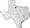
Town Unincorporated
communitiesRhineland | Truscott | Vera
Categories:- Cities in Texas
- Populated places in Knox County, Texas


Wikimedia Foundation. 2010.