- Montluçon
-
Montluçon

Castle of Montluçon 

 Montluçon
Administration Country France Region Auvergne Department Allier Arrondissement Montluçon Canton Domérat-Montluçon-Nord-Ouest Intercommunality Montluçon Mayor Daniel Dugléry
(2008–2014)Statistics Elevation 194–364 m (636–1,194 ft)
(avg. 207 m/679 ft)Land area1 20.67 km2 (7.98 sq mi) Population2 39,492 (2008) - Density 1,911 /km2 (4,950 /sq mi) INSEE/Postal code 03185/ 03100 1 French Land Register data, which excludes lakes, ponds, glaciers > 1 km² (0.386 sq mi or 247 acres) and river estuaries. 2 Population without double counting: residents of multiple communes (e.g., students and military personnel) only counted once. Coordinates: 46°20′27″N 2°36′12″E / 46.3408333333°N 2.60333333333°E
Montluçon (Occitan: Montluçon) is a commune in central France. It is the largest commune in the Allier department, although the department's préfecture is located in the smaller town of Moulins. Its inhabitants are known as Montluçonnais. The town is in the traditional province of Bourbonnais and was part of the mediaeval duchy of Bourbon.
Contents
Geography
Montluçon is located in the northwest of the Allier department near the frontier of the Centre and Limousin regions.
Montluçon is linked with surrounding regions and towns via 4 main road axes, plus the highway A71 from Orléans to Clermont-Ferrand ; through a railway linking in the North Vierzon then Paris (3-5h). Formerly the canal de Berry linked Montluçon towards the north.
Montluçon is 106 km south of Bourges, 340 km from Paris, 95 km from Clermont-Ferrand, 280 km (3h) from Lyon, 150 km (2h) from Limoges and 400 km from the Atlantic coast.
Montluçon is close to the Méridienne verte (an architectural project marking the Paris meridian) and to the Greenwich meridian.
History
Montluçon was built in the Middle Ages. The first mention of a place called Monte Lucii (Mont de Lucius) dates from the eleventh century. Guillaume, son of Archambaud IV of Bourbon, built the castle in a defensible position on a small rocky hill on a bend in the Cher River.
The town, which formed part of the duchy of Bourbon, was taken by the English in 1171, and by Philip Augustus in 1181; the English were finally driven out in the 14th century.
In the 14th century, Louis II de Bourbon re-built the castle and walls. Montluçon and other Burgundian lands were reverted to the French crown in 1529, and Henry IV further improved the defenses.
Montluçon became the administrative seat of the area in 1791, then entered the industrial revolution thanks to the presence of coalpits at 12 km in Commentry, the (Canal de Berry in 1830 and the railway in 1864. These transport links allowed the import of ore and export of coal, wood and manufactured goods. The population grew from 5000 inhabitants in 1830 to 50 000 in 1950.
World War II
During the Second World War, the Germans occupied the Dunlop tyre plant of (even though Montluçon was in the free zone) to exploit the research lab to synthesize rubber, since natural rubber could not be imported by the Nazis. The manufacturing of tyres for Luftwaffe aircraft was also of interest for the Nazis.
A notable act of resistance occurred in the city on January 6, 1943 when a mob of citizens overran guards supervising a massive deportation of men to Germany in accordance with the Service de Travail Obligatoire (Obligatory Work Service) plan that sent able Frenchmen to fill vacancies in German factories during the war. All the men who were to be deported managed to escape into the countryside, evading the forced industrial service awaiting them in the Reich.[1]
For this reason, the Allies bombed the site on 12–16 September 1943, as well as part of the nearby town Saint-Victor, causing 36 deaths and injuring more than 250 civilians.
Since 1945, traditional industry (blast furnaces and glassware) has declined. Today Montluçon has chemical industries, tyre manufacture (Dunlop), and electronics (Sagem), and more recently a technopole at La Loue was established for high-tech companies.
Population
Historical population of Montluçon 1793 1800 1806 1821 1831 1836 1841 1846 1851 1856 5521 5684 5212 4716 4991 5034 5740 7331 8922 15,289 1861 1866 1872 1876 1881 1886 1891 1896 16,212 18,675 21,247 23,416 26,079 27,818 27,878 31,595 1901 1906 1911 1921 1926 1931 1936 1946 35,062 34,251 33,799 36,114 37,504 41,052 42,515 46,826 1954 1962 1968 1975 1982 1990 1999 2008 48,743 55,184 57,871 56,468 49,912 44,248 41,362 39,492 Transportation
Air Transport There is a small airport 30 km from Montluçon (Montluçon - Guéret Airport) with flights mainly for Paris, and a smaller aerodrome one in Montluçon itself (Montluçon - Domérat Aerodrome). The nearest international airports are Clermont-Ferrand Airport and Limoges Airport.
Road Transport Montluçon is linked to French and European road networks, by three major routes:
- the highway A71 from Orléans to Clermont-Ferrand.
- the national route to Clermont-Ferrand (E11) and to Bourges/Vierzon
- the E62/RN145 joinging Limoges to Moulins
Rail Transport
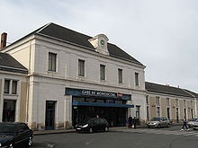 Montluçon-Ville railway station
The Gare de Montluçon-Ville railway station is served by three main passenger rail lines.
- 'Montluçon - Bourges - Vierzon - Paris' (fastest travel time to Paris: 3h08)
- 'Montluçon - Gannat - Clermont Ferrand'
- 'Montluçon - Guéret - Saint-Sulpice-Laurière - Limoges' (on the Lyon-Bordeaux line)
City Buses - Montluçon's local buses are run by Maelis.
Sights
The upper town, on the right bank of the Cher, consists of steep, narrow, winding streets, and preserves several buildings of the 15th and 16th centuries. The lower town, traversed by the Cher, is the industrial zone.
The church of Notre-Dame dates from the fourteenth century, the church of St Pierre partly from the 12th. The town hall, with a library, occupies the site of an old Ursuline convent, and two other convents are used as a college and hospital. Overlooking the town is the castle rebuilt by Louis II, Duke of Bourbon, and taken by Henry IV during the French Wars of Religion; it serves as a barracks.
Monuments
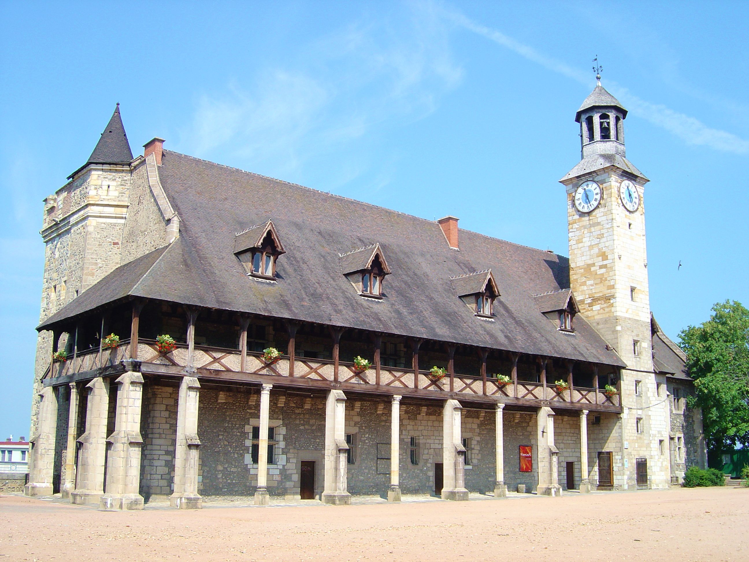
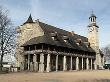 Le château des ducs de Bourbon
- Le château des ducs de Bourbon, dating from the 13th and 14th centuries
- Church of Notre-Dame, XVe
- Church of Saint-Pierre, XIIe
- Church of Saint-Paul, XIXe
- Church of Sainte-Thérèse, XXe
- Church of Saint-Martin, XXe
- Church of Sainte-Jeanne d'Arc, built in 1966
- Temple de l'Eglise Réformée de France, (1888)
- Tour des forges (or 'tour fondue'), XIIe siècle
- Crown, XIIe
- Maison des Douze apôtres du XIIe
- Museum of popular musiques
- Town Hall, XIXe
- Ancienne chapelle Saint-Louis
- Passage du doyenné
- Castle la Louvière
- Castle de Bien-Assis
- Canal de Berry: locks, canal bridge
Culture
- Musée des Musiques Populaires
Miscellaneous
Administration: Montluçon is a sub-prefecture and has courts, a board of trade arbitration, a chamber of commerce and several schools (general public, private, commercial).
Sport:
Twin cities: Montluçon is twinned with Hagen, Germany and Leszno, Poland.
Personalities
Montluçon was the birthplace of:
- André Messager (1853–1929), composer
- Jehan (born 1957), songwriter
- Marx Dormoy (1888–1941), politician
- Bernadette Vergnaud (born 1950), French politician and Member of the European Parliament
- Roger Walkowiak (born 1927), cyclist, winner of the 1956 Tour de France
- Jean Val Jean born 1980
- Jules Cluzel (born 1988), motorcycle Grand Prix road racer
- Moise Rimbon, mixed martial arts fighter
See also
References
- INSEE
 This article incorporates text from a publication now in the public domain: Chisholm, Hugh, ed (1911). Encyclopædia Britannica (11th ed.). Cambridge University Press.
- ^ John F. Sweets, Choices in Vichy France, (Oxford: Oxford University Press: 1994): 25.
External links
- Town council website (in French)
Categories:- Communes of Allier
- Subprefectures in France


Wikimedia Foundation. 2010.