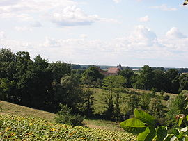
- Châtelperron
-
Châtelperron


Administration Country France Region Auvergne Department Allier Arrondissement Vichy Canton Jaligny-sur-Besbre Intercommunality Val de Besbre Sologne Bourbonnaise Mayor André Ratinier
(2008–2014)Statistics Elevation 234–352 m (768–1,155 ft)
(avg. 253 m/830 ft)Land area1 20.8 km2 (8.0 sq mi) Population2 144 (2008) - Density 7 /km2 (18 /sq mi) INSEE/Postal code 03067/ 03220 1 French Land Register data, which excludes lakes, ponds, glaciers > 1 km² (0.386 sq mi or 247 acres) and river estuaries. 2 Population without double counting: residents of multiple communes (e.g., students and military personnel) only counted once. Coordinates: 46°23′59″N 3°38′14″E / 46.399722°N 3.637222°E
Châtelperron is a commune in the Allier department in central France.
It is the location of site known as Grotte des Fées at Châtelperron.[1][2] [3] [4]
Population
Historical population of Châtelperron 1962 1968 1975 1982 1990 1999 2008 259 287 250 219 189 137 144 See also
References
- ^ The Châtelperron Skull; A Rediscovered Human Skull-Cap from the French Early Upper Palaeolithic; M. F. Ashley Montagu; American Anthropologist, New Series, Vol. 51, No. 2 (Apr. - Jun., 1949), pp. 328-329
- ^ Delporte, H., 1999. Chatelperron, un grand gisement prehistorique de l'Allier. - Avec la collaboration de F. Surmely et A. Urgal. Clermont-Ferrand, Conseil General de l'Allier, Direction regionale des Affaires Culturelles d'Auvergne et Association pour le developpement de l'Archeologie en Auvergne, collection Archeologie en Auvergne
- ^ Confirmation of Neanderthal/modern human interstratification at the Chatelperronian type-site; by: Paul Mellars, Brad Gravina, Bronk; PNAS, Vol. 104, No. 9. (27 February 2007), pp. 3657-3662.[1]
- ^ Analysis of Aurignacian interstratification at the Chatelperronian-type site and implications for the behavioral modernity of Neandertals.; by: Zilhão J, d'Errico F, Bordes JG, Lenoble A, Texier JP, Rigaud JP; [2]
Categories:- Communes of Allier
- Allier geography stubs
Wikimedia Foundation. 2010.

