- Inner Terai Valleys of Nepal
-
The Inner Terai Valleys or Bhitri tarai (भित्री तराइ) are various elongated valleys in Nepal situated between the Himalayan foothills, the 600–900 m high Siwalik or Churia Range and the 2,000-3,000 m high Mahabharat Range further north. Major examples are the Chitwan Valley southwest of Kathmandu and the parallel Dang and Deukhuri Valleys in western Nepal. Similar valleys in India are called Dun or Doon after Dehradun.
Outer Terai refers to the plains extending south of the Churia or Siwalik Hills bordering India.The valleys are low-lying, hot and humid, part of the Himalayan subtropical broadleaf forests and Terai-Duar savanna and grasslands ecoregions with swamps, grasslands and forests holding a rich variety of plant and animal life. They were virulently malarial until suppression with DDT beginning in the 1950s and 1960s enabled intensive settlement that displaced or disenfranchised indigenous people, cleared forests and modified local environments in ways that may threaten biodiversity and contribute to increasingly severe flooding downstream in India and Bangladesh. Nevertheless, the valleys are still areas of great natural beauty with rich ecosystems.
Contents
Geology
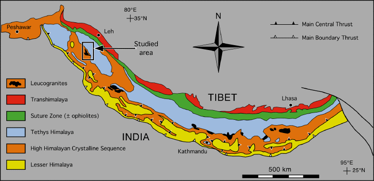
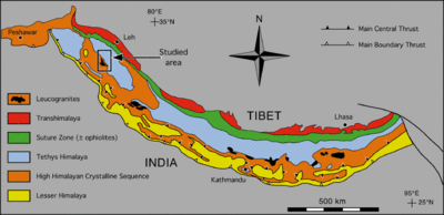 Fig 5: Geologic – Tectonic map of the Himalaya, modified after Le Fort (1988).
 Main article: Geology of the Himalaya
The Himalayas were formed by the collision of the Indian sub-continent with Eurasia, which began about 50 million years ago and continues today. The oceanic crust in front of India slid under Eurasia, pushing up the Tibetan plateau. The Indian continental crust is also pushing under Tibet, but is partly compressed and thrust upward to form the Himalayan mountain range, extending for over 2400 km and rising as high as 8848 m at Mt. Everest Chomolangma.
The Himalayas have four tectonic subdivisions:
- The Indus Suture Zone, where the Indian Plate meets the Eurasian Transhimalaya or Karakoram-Lhasa Block.
- The Central Himalayan Domain, the high backbone of the Himalayas bounded on the south by a fault zone called the MCT (Main Central Thrust) that has elevated these peaks three or four thousand meters above lower ranges to the south.
- The "middle hills" below the MCT south to the Lesser Himalaya or Mahabharat Range which is bounded by another fault zone, the MBT (Main Boundary Thrust) that abruptly elevates the Mahabharats 1,000 to 2,000 meters above hills further south.
- The Subhimalaya also known as the Muree, Chure Hills or Siwaliks, which are the southernmost foothills of the Himalayan Range and mainly composed of folded and overlapping sheets of sediment from the erosion of the Himalaya. They are bounded on the south by the HFT (Himalayan Frontal Thrust) elevating them about 500 meters above the Gangetic plain.
The Inner Terai valleys lie between the Siwalik and Mahabharat ranges or sometimes between different ranges in the Siwaliks. They hold flat plains with winding rivers that shift course from time to time, running northwest or southeast along the axis of the Siwalik ranges until they find a break and flow into the Outer Terai and Gangetic plain. Usually there is little difference in elevation between the Inner Terai valley floors and the plains of the Outer Terai.
Climate and economy
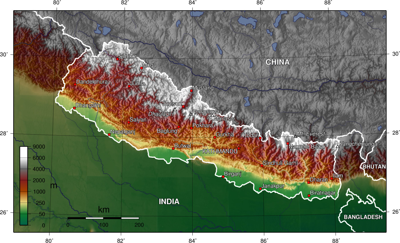
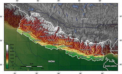 Nepal topography. The green/yellow zones hold the Inner Terai valleys.Main article: Madhesh
The Terai has a humid, subtropical climate, warm in the winter and hot (often over 40°C) in the summer. The monsoon period of torrential rains lasts from mid-June to mid-September. Most areas in the Terai get over 1,500 mm of rain in a year. In the past, the inner and outer Terai were a formidable barrier between Nepal and potential invaders from India because marshes and forests were infested by anopheline mosquitos that transmitted virulent strains of malaria, especially during the hot spring and rainy summer monsoon. The Inner Terai is also rich in animal life, including rhinoceros, tiger, and reptiles including gharial and mugger crocodiles.
Inner Terai valleys were historic strongholds of Tharu,[1] Danuwar and other peoples who had evolved genetic, behavioral and architectural means to resist malaria. Beginning in the 1950s, malaria suppression programs using DDT opened the Inner Terai to settlement by investors from India and the more developed parts of Nepal who introduced modern agricultural methods. Subsistence farmers from the hills where population growth was outstripping finite amounts of cultivable land also arrived. Indigenous terai peoples were largely illiterate and often exploited by moneylenders, losing landholdings and even being reduced to debt bondage.[2][3]
Both Inner and Outer Terai have become Nepal's richest economic regions, with fertile farms and forests because of the area's generally flat terrain that is drained and nourished by several rivers. The Terai also has the largest commercially exploitable forests.
Environmental Issues
The well-meaning malaria eradication campaign has had unexpected consequences by opening up the Terai region to human settlement. The Inner Terai valleys are home to a rich and diverse ecosystem. Since the early 1990s, however, the forests have been increasingly destroyed because of growing demands for timber and agricultural land[4][5] This has led to concerns about the risk of losing many rare plant,[6][7] animal and insect species.
The valleys also mitigate the severity of floods on the Gangetic plains. During heavy rainfall forests absorb water. During floods, rivers overflow their banks and flood adjacent forests. Later the forests gradually release water back into the rivers. Deforestation reduces this buffering effect. It also accelerates soil erosion, causing downstream rivers to silt up and overflow their banks.[8]
The frequency and severity of flooding in the Gangetic plain and Bangladesh has steadily increased in recent years. Deforestation of the Terai appears to be one of the major causes.[9] The Indian and Nepalese governments are cooperating in measures including construction of barrages and dams in the Terai, such as the Koshi Barrage.[10] However, these efforts may have mixed results. They contain floodwater in the short term, but may increase the problem in the longer term by reducing water velocity in the rivers downstream, and thus accelerating silting and reducing the drainage capacity of the rivers.[11]
Valleys
This section describes the major Inner Terai valleys. A picture is worth a thousand words. Click on the terrain and satellite imagery links to see vegetation, rivers, topography, roads and towns.
Central and Eastern Terai
Imagery with markers at valleys Kamala (K), Marin Khola (M) and Chitwan (C) terrain satellite
Kamala Valley
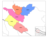
 Sagarmatha zone: Udayapur district in green
Imagery of Kamala valley (K): terrain satellite
Kamala or Udayapur Valley (Nepali: कमला or उदयपुर उपत्यका) is in Udayapur district in the southeast of Nepal (Sketch map). About 30 km long and between 2 km and 4 km wide, it is drained by the Triyuga river flowing east to join the great Koshi. Kamala Valley lies between the Mahabharat Range to the north and the Churia or Sivalik Hills to the south, with an average elevation of about 430 meters.[12] Gaighat (or Triyuga) is the main town.
The mouth of the valley opens onto a 175 km2. rectangle of land where the Triyuga meets the Koshi river above the Koshi Barrage. It was designated the Koshi Tappu Wildlife Reserve[13] in 1976, and is home to the last remaining population of Wild Asian Water Buffalo in Nepal. The reserve is mostly wetlands, subject to seasonal flooding, but also includes some grasslands and small patches of riverine forest. It is the only Ramsar Site (a wetland of international significance) in Nepal.
Traditionally, the Kamala valley was primarily inhabited by the Dhanwar people (or Danuwar),[14] but there is a fast-growing population of migrants from the Nepali hills and from India.
Marin Khola Valley
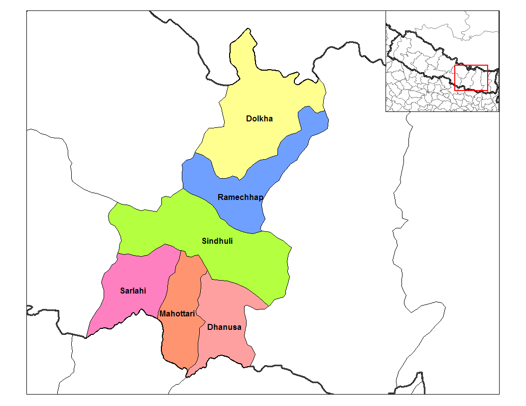
 Janakpur zone: Sindhuli district is green band in center
Imagery of Marin Khola (M): terrain satellite
The Marin Khola Valley (Nepali: मरिन खोला उपत्यका) is one of the smaller Inner Terai Valleys, in the central south region, Sindhulī Garhi district. (Sketch Map) Three streams – Kokhajor Khola, Marin Khola and Kyan Khola – join in the valley to form Kamala River, a major tributary to the Bhurengi[15]..
The main town is Kamalamai.
The Indian government is concerned about flooding from the Kamala and is funding engineering projects to mitigate risks.
Marin Khola Valley is inhabited by Hayu people, who also live along the Rosi Khola and Sun Kosi River north of the Mahabharat Range.[16]
Chitwan Valley
 Natayani zone: the Chitwan district is yellow area to the westMain article: Chitwan Valley
Imagery of Chitwan (C): terrain satellite
Chitwan Valley (Nepali: चितवन उपत्यका) is in central Nepal in Narayani Zone. It is 150 km long and roughly 30-48 km wide, the largest of Nepal's inner Terai valleys. (Sketch Map) The cities Bharatpur, Hetauda and Ratnanagar are in the valley. It is drained by the (East) Rapti river flowing from the Mahabharat Range near Hetauda, then west down the valley to join the Narayani west of Meghauli. The Narayani is also called Gandaki further upstream and Gandak in India.
Chitwan National Park[17] is one of the most important sub-tropical parks on the Indian subcontinent. It has good populations of the endangered Bengal tiger, great one-horned rhinos, gangetic dolphin, wild Asian elephant, gaur, golden monitor lizard and gharial crocodile. In 1963 the southern two-thirds of the park were declared a Rhino Sanctuary, with a moratorium on hunting and the relocation of 22,000 people from the Chitwan valley. Since then, wildlife populations and ecosystems have rebounded. In 1973 Chitwan became Nepal’s first National Park. UNESCO declared the park a World Heritage site in 1984.
Western Terai
Imagery of western Terai. Markers at valleys Jogbudha (J), Surkhet (S), Dang (A) and Deukhuri (E) terrain satellite
Dang and Deukhuri Valleys
 Rapti zone: Dang Deokhuri district salmon color in south west
Imagery of Dang (A) and Deukhuri (E): terrain satellite
Parallel Dang Valley (Nepali: दाङ उपत्यका) and Deukhuri Valley (Nepali: देउखुरी उपत्यका) are in Rapti Zone of mid-western Nepal, in Dang Deokhuri district (Sketch map). Both valleys have large Tharu populations and are used as winter pasture by Kham Magar from the hills.
Deukhuri Valley is the longer but narrower valley where the West Rapti River emerges from its gorge through the Mahabharat Range and is constrained to flow WNW along the axis of the Siwalik Range between the Dundwa subrange along the India border and the Dang subrange to the north. It flows 100 km in this direction until the Dundwas fall away near Nepalganj and the river can resume flowing SE toward the Ganges. Mahendra Highway crossing Nepal east to west follows Deukhuri Valley. .[18] The low surrounding mountains, the river, the jungle interspersed with fields and distinctive ethnic groups gave Deukhuri a timeless Garden of Eden quality that development brought by the highway may now be diminishing.
The wider Dang valley lies north of Deukhuri between the Dang subrange and the higher Mahabharat or Lesser Himalayan Range further north. Tulsipur has a fair-weather airport and is the administrative center of Rapti Zone. Tribhuvannagar (or Ghorahi) is a sizeable bazaar and the administrative center of Dang District. The Babai River drains the valley, also flowing WNW along the Siwalik axis. It finally exits the Siwaliks at Bardia National Park. (Map). This park is the largest and most undisturbed wilderness area in the Terai. About 70% of the park is covered with forest with the balance a mixture of grassland, savannah and riverine forest. [19]
Main article: Rapti ZoneSurkhet Valley
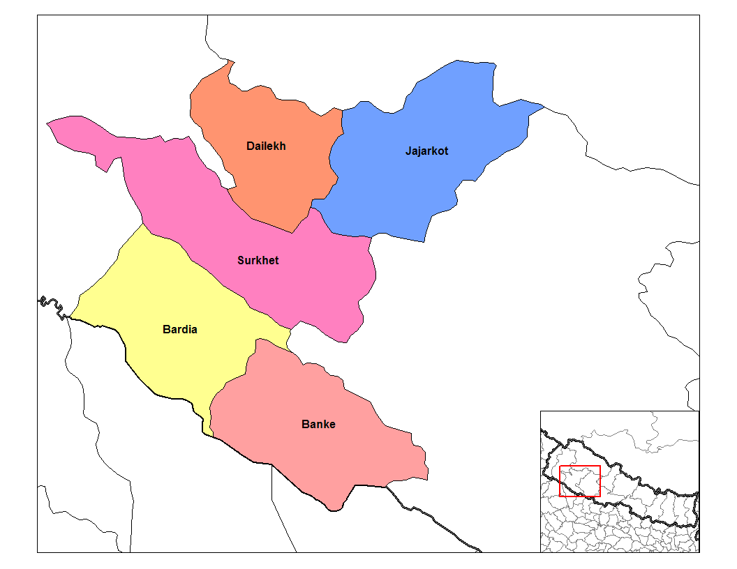
 Bheri Zone districts. Surkhet district is the magenta area in the center
Imagery of Surkhet (S): terrain satellite
Surkhet Valley (Nepali: सुर्खेत उपत्यका)[20] is in the mid-west of Nepal, in Surkhet district (Sketch map). The valley is about 700 meters above sea level, an ellipse about 9 km east-west by 6 km north-south. It is drained by the Bheri River,[21] a tributary of the Karnali. Historically Tharu and local Rajhi people populated the valley. In recent decades there has been increased migration from surrounding mountain districts as well as other parts of the country. Birendranagar is the district's main population center.
Jogbudha Valley
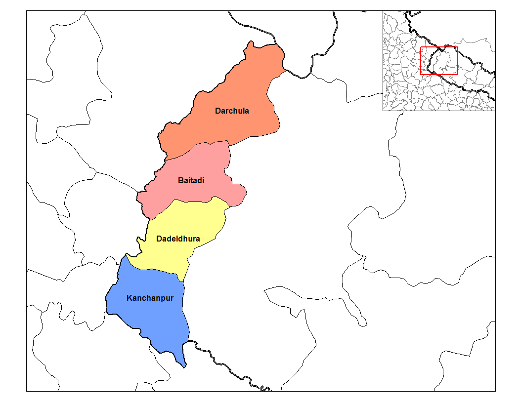
 Mahakali zone: Dadeldhura district is the yellow area towards the south
Imagery of Jogbudha valley (J): terrain satellite
Jogbudha Valley (Nepali: जोगबुढा उपत्यका) is in the far west of Nepal, in Dadeldhura district of Mahakali zone (Sketch map). Streams of this relatively small and undeveloped valley empty into the Mahakali or Sarda River which rises in the high Himalaya and defines most of Nepal's western border with Uttarakhand, India.
In the outer Terai south of this valley is Sukla Phanta Wildlife Reserve,[22] home of the largest herd of Swamp Deer in the world. In 1984 UNESCO listed it as a World Heritage Site.
References
- ^ http://www.macalester.edu/~guneratne/Teaching/TharuResources.html
- ^ http://www.nepalitimes.com.np/issue/315/Nation/12487
- ^ http://www.galdu.org/web/calahus.php?odas=1479&giella1=eng
- ^ Regional Workshop on Issues, Challenges and Opportunities for Forest Management of Terai, Inner Terai and Churia in Nepal
- ^ Forests Monitor: The Terai Forests
- ^ Orchids in the Churiya Hills and their survival in Nepal
- ^ An Overview of Floral Diversity in Wetlands of Terai Region of Nepal: M. Siwakoti, Natural History Museum, Tribhuvan University Swayambhu, Nepal
- ^ Fluvial geomorphological analysis with special reference to flood hazard, Baghmati River basin, north Bihar, India
- ^ RECENT FLOODS IN BANGLADESH: POSSIBLE CAUSES AND SOLUTIONS
- ^ Indian Ministry of Water Resources – Flood and centrally sponsored schemes (c)
- ^ Causes, Effects and responses to flooding: The UK and Bangladesh
- ^ Notes on the Mosquitoes of Nepal (1991)
- ^ Koshi Tappu Wildlife Reserve
- ^ The Manjani System of the Danuwar State of the Kamala Valley: A Brief Study of an Egalitarian Judiciary
- ^ Rivers Of North Bihar and Nepal – Dr. (Mrs.) Jyoti Singh, Economist 20.02.1999
- ^ Dallith: Hayu : introduction
- ^ Environmental Implications of East Rapti Irrigation Project for Royal Chitwan National Park, Nepal
- ^ Nepal News: West Rapti High Dam Project
- ^ ASSESSING WATER QUALITY FOR ECOSYSTEM HEALTH OF THE BABAI RIVER IN ROYAL BARDIA NATIONAL PARK, NEPAL.
- ^ Surkhet.com
- ^ Hydrological Analysis for Bheri-Babai Hydropower Project Nepal
- ^ http://www.resourceshimalaya.org/accomplishments/accomplishments384039.pdf Suklaphanta Wildlife Reserve and Buffer Zone Management Plan 2004
Categories:- Valleys of Nepal
- Plains of Nepal
- Wetlands of Nepal


Wikimedia Foundation. 2010.