- Mahakali Zone
-
Mahakali
महाकाली— Zone — 
Country  Nepal
NepalRegion Time zone Nepal Time (UTC+5:45) Main language(s) Mahakali(Nepali: महाकाली अञ्चल
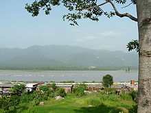
 Listen (help·info), is one of the fourteen zones of Nepal, covering an area of 6205 km2 in the most western part of the country. It stretches along Nepal's far western border with India, marked by the Kali River or Mahakali River, which originates from Kalapani.
Mahakali's headquarter is Mahendranagar in Kanchanpur District. The zone covers the Himalayan range including Api Peak in the North, Hill valleys, Inner Terai valleys such as Patan in Baitadi District in the center and the outer Terai in the South. The name of this zone is derived from the Kali River.
Contents
Geography
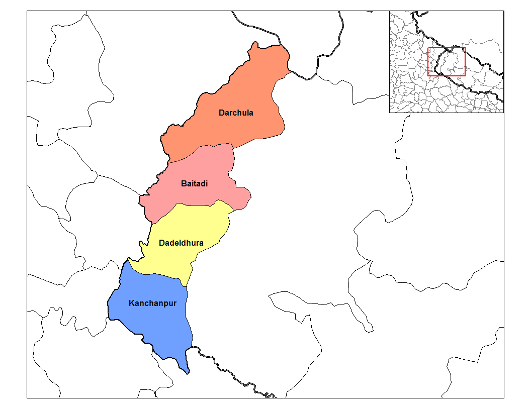
The Boundary of this Region was Kali river on the west and Seti Zone on the east. After the Sugauli Treaty (also spelled Segowlee) was signed on December 2, 1815 and ratified on March 4, 1816, between the British East India Company and The Kingdom of Nepal, Kali river became the international boundary with Uttrakhand of India . The zone involves Coldest Byans to hottest Kanchanpur. Api Himalaya Lies on this zone from where Chameliya river originates. Mahakali Zone is divided into four districts:
- Baitadi District with Baitadi as its headquarters, covers an area of 1,519 km2.
- Dadeldhura District with Dadeldhura as its headquarters, covers an area of 1,538 km2.
- Darchula District with Darchula as its headquarters, covers an area of 2,322 km2.
- Kanchanpur District with Mahendranagar as its headquarters, covers an area of 1610 km2.
Language, culture and history
Mahakali Zone of Nepal has a distinct language, culture and history. Various dialects of Kumauni language are spoken in this region. Even in the Kanchanpur District 80% of the people speak Kumauni language. Dotiyali dialect of Kumauni language is spoken in Dadeldhura District and Baitada dialect of Kumauni language is spoken in Baitadi and Darchula districts.
Gora is a famous festival observed in Mahakali Zone. In ancient times, this region was a part of the Katyuri kingdom. After its collapse, this zone became a part of Doti kingdom, a branch of the Katyuri Kings. Brahmadev Mandir in Kanchanpur District was built during the reign of the Katyuri king Brahmadev.
Important cities
The largest city in the Mahakali Zone is Mahendranagar, which is also the headquarter of Kanchanpur district. Other main towns of Mahakali Zone are Dashrathchand, Patan (Baitadi)and Darchula Bajar.
The Amargadhi, the district headquarter, is named after General Amarshing Thapa (a famous Gorkha General) who formed a fort to expand Gorkha Empire capturing Kumaoun state after had defeated in previous war with Kumaoun during 1790 A.D.
Protected areas
Mahakali Zone hosts the Sukla Phanta Wildlife Reserve in Kanchanpur District in the Terai, which covers an area of 305 km2 and surrounded by a buffer zone of 243.5 km2.[1]
See also
References
- Pande, B.D. (1993) History of Kumaun. Shree Almora Book Depot. ISBN 8185865019, 9788185865010
- ^ Majupuria, T.C., Kumar, R. (1998) Wildlife, National Parks and Reserves of Nepal. S. Devi, Saharanpur and Tecpress Books, Bangkok. isbn 974-89833-5-8
External links
Government of Nepal: The Population and Socio-Economic Atlas of Nepal
Regions and Zones of Nepal Eastern Region (Purwanchal) Kosi · Mechi · Sagarmatha

Central Region (Madhyamanchal) Western Region (Pashchimanchal) Mid-Western Region (Madhya Pashchimanchal) Far-Western Region (Sudur Pashchimanchal) Mahakali · Seti
Categories:

Wikimedia Foundation. 2010.