- Mahendranagar, Mahakali
-
Bhim Dhutta
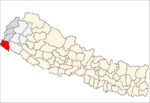
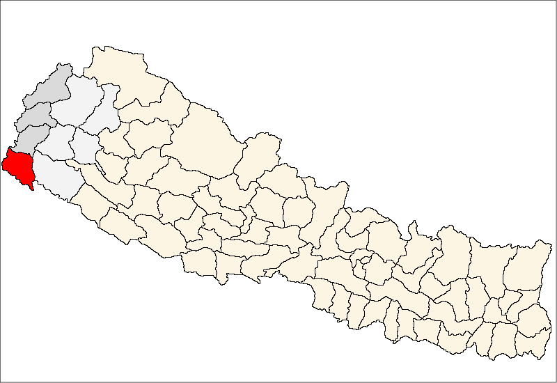
former name: Mahendranagar महेन्द्रनगर— Municipality — Location of Mahendranagar in Nepal
 Bhim Dhutta
Coordinates: 28°55′N 80°20′E / 28.917°N 80.333°ECoordinates: 28°55′N 80°20′E / 28.917°N 80.333°E Country Nepal Zone Mahakali Zone District Kanchanpur District Population (2005{estimate}) - Total 99,124 Time zone Nepal Time (UTC+5:45) Bhim Dutta, formerly Mahendranagar (महेन्द्रनगर), is a city and municipality in far western Nepal, six kilometres from the border of India and the Mahakali River. It is the headquarters of the district of Kanchanpur in the Mahakali Zone, which is inhabited by people of various races including the indigenous Tharu people.
Mahendranagar is the 8th largest city in Nepal after the cities of Kathmandu, Pokhara, Lalitpur, Biratnagar, Dharan, Birganj and Bharatpur. It is 5 km east of the Indian border and 700 km west of Kathmandu. At the time of the 1991 Nepal census, it had a population of 62,050.[1] According to the census of 2001, the city's population was 80,839.
The name of Mahendranagar is related to the name of late king Mahendra of Nepal. After becoming a republic in 2008, the city name was changed to Bhim Dutta.
Contents
Society
Indigenous people are the Ranatharus but now people from all over country have migrated to the area but mostly from the districts such as Baitadi and Dadeldhura. Mahendranagar is now the unique combination of all ethnic groups representing the overall society of Nepal. The festivals celebrated by people in Mahendranagar fully reflects the blend of all groups. The ethnic Tharu people celebrate Dhikri festival while Brahmin and Chhetri of Farwestern origin primarily celebrate Gora (commonly called Gaura Parba). Later Deepawali or Diwali appears as a major festival which includes Laxmi Pooja , Gai Tihar , and Bhai Tika. More recently Dashain has been accepted as a major festival. It appears the people of Mahendaranagar have truly accepted all festivals as an integral part of their joyful life.
Services
Mahendranagar is the main business centre of the Mahakali Zone. Mahendranagar is a major provider of education, health and employment opportunities in west Nepal. Mahakali Zonal Hospital and other private hospitals provide health care. Similarly, Siddhanath Science Campus, Siddhanath Multiple Campus, Mahendranagar Medical College, Radiant Higher Secondary School, Adarsh College (Brixton College), International Public Higher Secondary School and other colleges provide advanced education. That is why students from other regions migrate here for education.
Transport and Communication
Telephone fax, email and Internet is available from here, there is a domestic airport in Mahendranagar with air service to Kathmandu. Bus service connects Mahendaranagar to all the other parts of the country. Mahendra Highway, the longest highway of Nepal has its one end in Mahendranbagar the other being in eastern city Kankarbhitta And is also connected by some of the sub highways with the hill towns of Dipayal, Baitadi, Amargadhi, and Darchula.
Road transport is also linked with bordering India to Banbasa and Tanakpur through the bridges in Mahakali river making Mahendranagar the nearest city of Nepal from New Delhi, the capital of city of India.Mahendranagar is also hub of activity for various industries running between India and Nepal. It is 8 miles away from the famous Mahakali river. It is one of the best places to live in Nepal and also is host to Shuklafanta National Park.
References
- ^ "Nepal Census 2001". Nepal's Village Development Committees. Digital Himalaya. http://www.digitalhimalaya.com/collections/nepalcensus/form.php?selection=1. Retrieved November 24, 2008.
 Categories:
- Populated places in Kanchanpur District
- India–Nepal border crossings

Wikimedia Foundation. 2010.