- Millersburg, Oregon
-
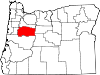
Millersburg, Oregon — City — Motto: Linking Agriculture with Industry Location in Oregon
Coordinates: 44°40′30″N 123°4′10″W / 44.675°N 123.06944°WCoordinates: 44°40′30″N 123°4′10″W / 44.675°N 123.06944°W Country United States State Oregon County Linn Incorporated 1974 Government – Mayor Clayton Wood Area – Total 4.7 sq mi (12.2 km2) – Land 4.5 sq mi (11.6 km2) – Water 0.6 sq mi (0.2 km2) Elevation 235 ft (71.6 m) Population (2000) – Total 651 – Density 145.9/sq mi (56.4/km2) Time zone Pacific (UTC-8) – Summer (DST) Pacific (UTC-7) ZIP code 97321 Area code(s) 458 and 541 FIPS code 41-48300[1] GNIS feature ID 1637924[2] Website www.albany-millersburg.com/millersburg.htm Millersburg is a city in Linn County, Oregon, United States. Millersburg originally was the name of a station on the Southern Pacific railroad line, which was named for a local farming family. The population was 651 at the 2000 census, and the Portland research Center shows the population at 1,170.
Contents
History
Millersburg came into being in 1974, to prevent the city of Albany from attempting to extend its city limits to include where Wah Chang Corporation operated a zirconium processing plant for the United States Bureau of Mines.
Although now owned by Teledyne, this processing plant is the city's largest employer.[citation needed]
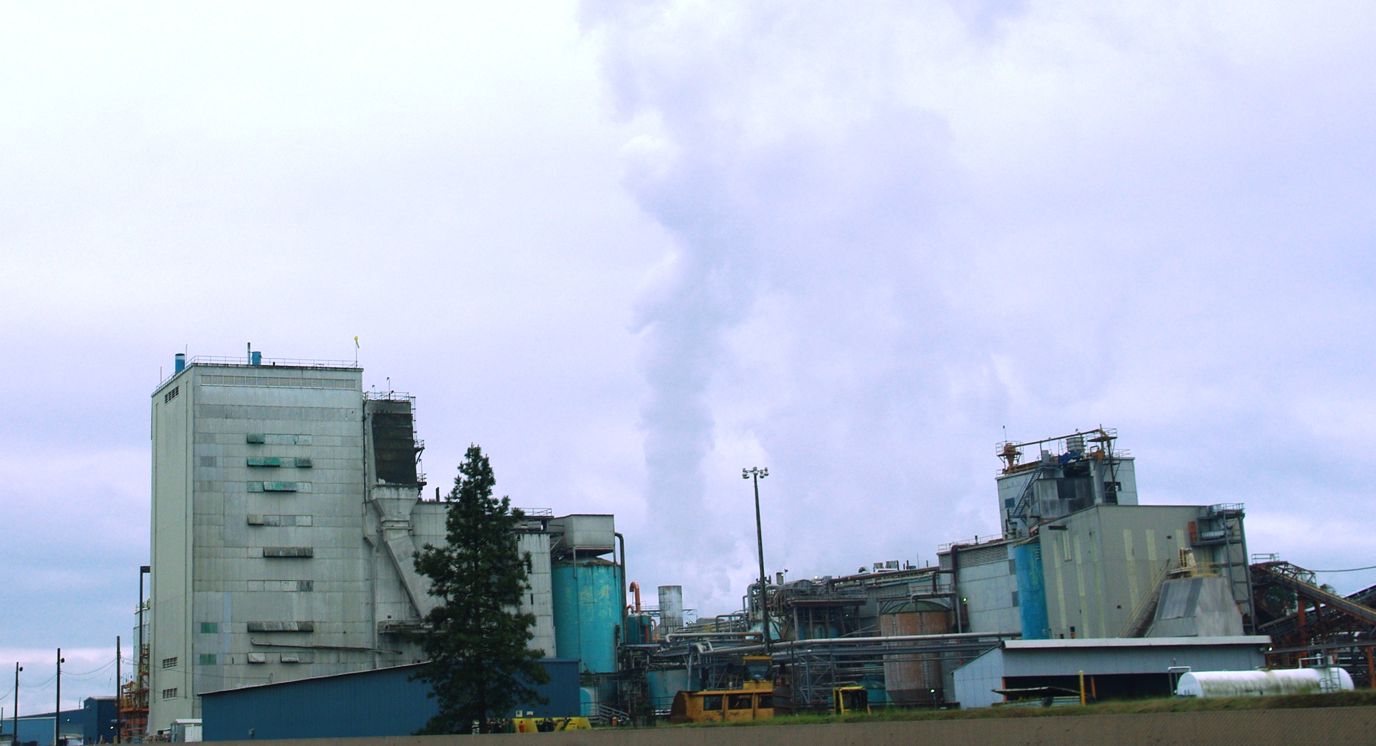
Millersburg's infamous stench of past years, often attributed to the Wah Chang facility, is actually generated by the nearby Weyerhaeuser wood products processing mill. This has lent support to various attempts to close both plants. In August 2008, Weyerhauser sold the mill to International Paper. International Paper then closed the mill at the end of 2009, laying off 270 employees.[3] As of summer 2010, the mill sits idle.
In 2008, Peak Sun Silicon built a 10,000-square-foot (930 m2) polysilicon production facility in Millersburg. They currently employ about 50 people with plans to expand up to 500 jobs by 2013.[4]
Geography
According to the United States Census Bureau, the city has a total area of 4.7 square miles (12 km2), of which, 4.5 square miles (12 km2) of it is land and 0.2 square miles (0.52 km2) of it (5.11%) is water.[5]
Demographics
As of the census[1] of 2000, there were 651 people, 263 households, and 179 families residing in the city. The population density was 145.9 people per square mile (56.4/km²). There were 288 housing units at an average density of 64.6 per square mile (24.9/km²). The racial makeup of the city was 96.47% White, 0.77% Native American, 0.92% Asian, 0.15% from other races, and 1.69% from two or more races. Hispanic or Latino of any race were 2.76% of the population.
There were 263 households out of which 30.4% had children under the age of 18 living with them, 59.3% were married couples living together, 6.1% had a female householder with no husband present, and 31.6% were non-families. 25.1% of all households were made up of individuals and 8.4% had someone living alone who was 65 years of age or older. The average household size was 2.48 and the average family size was 2.98.
In the city the population was spread out with 24.4% under the age of 18, 6.0% from 18 to 24, 29.3% from 25 to 44, 29.0% from 45 to 64, and 11.2% who were 65 years of age or older. The median age was 37 years. For every 100 females there were 105.4 males. For every 100 females age 18 and over, there were 103.3 males.
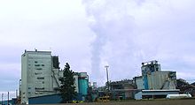 Weyerhaeuser facility
The median income for a household in the city was $35,469, and the median income for a family was $48,393. Males had a median income of $35,909 versus $25,625 for females. The per capita income for the city was $16,964. About 7.1% of families and 8.7% of the population were below the poverty line, including 5.0% of those under age 18 and 12.9% of those age 65 or over.
References
- ^ a b "American FactFinder". United States Census Bureau. http://factfinder.census.gov. Retrieved 2008-01-31.
- ^ "US Board on Geographic Names". United States Geological Survey. 2007-10-25. http://geonames.usgs.gov. Retrieved 2008-01-31.
- ^ "Paper mill to close near Albany". http://www.oregonlive.com/business/index.ssf/2009/10/paper_mill_to_close_near_alban.html. Retrieved 2010-08-11.
- ^ "Peak Sun Silicon: Polysilicon from Oregon". http://guntherportfolio.blogspot.com/2008/07/peak-sun-silicon-polysilicon-from.html. Retrieved 2010-08-11.
- ^ "US Gazetteer files: 2010, 2000, and 1990". United States Census Bureau. 2011-02-12. http://www.census.gov/geo/www/gazetteer/gazette.html. Retrieved 2011-04-23.
External links
Municipalities and communities of Linn County, Oregon Cities Albany‡ | Brownsville | Gates‡ | Halsey | Harrisburg | Idanha‡ | Lebanon | Lyons | Mill City‡ | Millersburg | Scio | Sodaville | Sweet Home | Tangent | Waterloo
CDP Unincorporated
communitiesCascadia | Crabtree | Crawfordsville | Foster | Jordan | Kingston | Lacomb | Marion Forks | New Idanha | Riverside | Santiam Junction | Shedd
Footnotes ‡This populated place also has portions in an adjacent county or counties
Categories:- Cities in Oregon
- Populated places in Linn County, Oregon


Wikimedia Foundation. 2010.