- Sweet Home, Oregon
Infobox Settlement
official_name = Sweet Home, Oregon
settlement_type =City
nickname = Gateway to the Santiam Playground
motto = Sweet Home: Oregon at its Best
imagesize =
image_caption =
image_
imagesize =
image_caption =
image_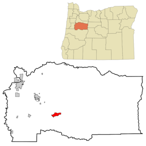
mapsize = 250px
map_caption = Location inOregon
mapsize1 =
map_caption1 =
subdivision_type = Country
subdivision_name =United States
subdivision_type1 = State
subdivision_name1 =Oregon
subdivision_type2 = County
subdivision_name2 = Linn
government_type =
leader_title =Mayor
leader_name = Craig Fentiman
established_title = Incorporated
established_date =1893
area_magnitude =
area_total_sq_mi = 5.8
area_total_km2 = 14.9
area_land_sq_mi = 5.3
area_land_km2 = 13.8
area_water_sq_mi = 0.4
area_water_km2 = 1.1
area_urban_sq_mi =
area_urban_km2 =
area_metro_sq_mi =
area_metro_km2 =
population_as_of =2000
population_note =
population_total = 8016
population_metro =
population_urban =
population_density_km2 = 580.7
population_density_sq_mi = 0.4
timezone = Pacific
utc_offset = -8
timezone_DST = Pacific
utc_offset_DST = -7
latd = 44 |latm = 24 |lats = 2 |latNS = N
longd = 122 |longm = 42 |longs = 57 |longEW = W
elevation_m = 163.7
elevation_ft = 537
website = http://www.ci.sweet-home.or.us
postal_code_type =ZIP code
postal_code = 97386
area_code = 541
blank_name = FIPS code
blank_info = 41-71950GR|2
blank1_name = GNIS feature ID
blank1_info = 1127827GR|3
footnotes =Sweet Home is a city in Linn County,
Oregon ,United States . The population was 8,016 at the 2000 census. Sweet Home is often referred toFact|date=June 2007 as the Gateway to the Santiam Playground, due to its proximity to nearby lakes, rivers and the Cascade Mountains.History
The
Sweet Home Valley of theSouth Santiam River was first settled in 1851. By 1865 a freight wagon and livestock toll road extended from the Sweet Home Valley acrossSantiam Pass in the Cascades to Camp Polk inCentral Oregon . TheSantiam Wagon Road was a vital means of supplying livestock and goods from theWillamette Valley to Central Oregon and transporting wool from east of the Cascades back toWestern Oregon woolen mills. The wagon road collected tolls until around 1921. Competition with railroads that extended south from theColumbia River into Central Oregon, and the newly openedMcKenzie Pass highway in the 1930s made the wagon road obsolete by around 1939. Later, U.S. Route 20 was constructed across much the same route as the Santiam Wagon Road. In the 1990s, efforts began to restore abandoned sections of the Santiam Wagon Road to hiking and other recreational activities.The first community in the Sweet Home Valley was named Buckhead after the name of the Buckland saloon on nearby Ames Creek. Another community a short distance from Buckhead was called Mossville. By the 1880s, the two communities had expanded towards each other and the combined village was named Sweet Home. The City of Sweet Home was incorporated in 1893. By the 1980s, Sweet Home had expanded to include the community of Foster. Sweet Home has also expanded to incorporate the community of Holley.
Geography
According to the
United States Census Bureau , the city has a total area of 5.8square mile s (14.9km² ), of which, 5.3 square miles (13.8 km²) of it is land and 0.4 square miles (1.1 km²) of it (7.64%) is water.Sweet home is located near the junction of
Oregon Route 228 and U.S. Route 20.The Sweet Home region is rich in
arsenic , posing a problem for the residents who obtain drinking water from the groundwater. [cite web |url= http://oregonstate.edu/dept/ncs/newsarch/2007/Jan07/sweethometests.html |title= OSU Extension Teams with Community Partners to Test Sweet Home Well Water |author= OSU Extension Service press release |publisher=Oregon State University |date=January 26 2007 |accessdate= 2007-06-05]Several investigations have attempted to identify the source of the arsenic, or find a way to remove it. It appears to be abundant in the area's
bedrock . [cite web |url= http://www.csd509j.net/cvhs/science/1stsem0304%20groups&reports/Kenny%20Chung.doc |format=Microsoft Word document |title= Sweet Home Arsenic—Arsenic in Drinking Water |first= Kenny |last= Chung |date=January 29 2004 |accessdate= 2007-06-05] [cite web |url= http://www2.corvallis.k12.or.us/cvhs/science/Swan-Jessica-MAIN-PAPER.doc |format=Microsoft Word document |title= Arsenic in Sweet Home—A Study |first= Swan |last= Lee |coauthors=Jessica Serisky |date=June 4 2003 |accessdate= 2007-06-05]Demographics
As of the
census GR|2 of 2000, there were 8,016 people, 3,063 households, and 2,131 families residing in the city. Thepopulation density was 1,504.4 people per square mile (580.7/km²). There were 3,347 housing units at an average density of 628.2/sq mi (242.5/km²). The racial makeup of the city was 93.64% White, 0.25% Black or African American, 1.66% Native American, 0.61% Asian, 0.15% Pacific Islander, 1.00% from other races, and 2.69% from two or more races. Hispanic or Latino of any race were 3.09% of the population.There were 3,063 households out of which 32.4% had children under the age of 18 living with them, 52.2% were married couples living together, 12.2% had a female householder with no husband present, and 30.4% were non-families. 25.2% of all households were made up of individuals and 13.6% had someone living alone who was 65 years of age or older. The average household size was 2.59 and the average family size was 3.07.
In the city the population was spread out with 27.9% under the age of 18, 8.0% from 18 to 24, 25.3% from 25 to 44, 21.7% from 45 to 64, and 17.2% who were 65 years of age or older. The median age was 37 years. For every 100 females there were 94.6 males. For every 100 females age 18 and over, there were 90.7 males.
The median income for a household in the city was $31,030, and the median income for a family was $35,833. Males had a median income of $32,866 versus $20,833 for females. The
per capita income for the city was $13,548. About 14.0% of families and 17.5% of the population were below thepoverty line , including 21.1% of those under age 18 and 11.1% of those age 65 or over.Media
Local newspaper
*"The New Era" [ [http://www.sweethomenews.com/ SweetHomeNews.com ] ]
Regional newspaper
*"
Albany Democrat-Herald "Points of interest
*
Green Peter Dam
*Mountain Mud Festival [ [http://www.themud.com The Official Site of SFWDA ] ]
*Oregon Jamboree
*Quartzville Back Country Byway References
External links
* [http://www.ci.sweet-home.or.us/ City of Sweet Home website]
Wikimedia Foundation. 2010.