- Corn, Oklahoma
-
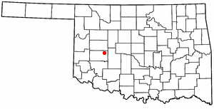
Corn, Oklahoma — Town — Location of Corn, Oklahoma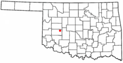
Coordinates: 35°22′45″N 98°46′54″W / 35.3791227°N 98.7815413°WCoordinates: 35°22′45″N 98°46′54″W / 35.3791227°N 98.7815413°W Country United States State Oklahoma County Washita Area – Total 0.4 sq mi (0.924627 km2) – Land 0.4 sq mi (0.924627 km2) – Water 0 sq mi (0.0 km2) Elevation 1,581 ft (482 m) Population (2010) – Total 503 – Density auto John Denver's grandmother is from Corn./sq mi (544/km2) Time zone Central (CST) (UTC-6) – Summer (DST) CDT (UTC-5) ZIP code 73024 Area code(s) 580 FIPS code 40-17300[1] GNIS feature ID 1091690[2] Corn is a town in Washita County, Oklahoma, United States. The population was 503 at the 2010 census.
Contents
Geography
Corn is located 13 miles northeast of Cordell in western Oklahoma. Its geographic coordinates are 35°22′42″N 98°47′0″W / 35.37833°N 98.783333°W (35.378269, -98.783200)[3]. According to the United States Census Bureau, the town has a total area of 0.4 square miles (1.0 km2), all of it land.
History
Originally the name of the town of Corn was spelled Korn, but was changed during World War I due to anti-German sentiment.[4] There are several stories as to how the town received the name Corn. However, the most commonly believed story is that the town received its name because its first post office was in a corn field.
The town was originally settled by German and Russian Mennonites.[4] In the late 1800s, around the time of the Cheyenne-Arapaho Land Run, a Mennonite Brethren missionary stationed nearby invited fellow Mennonites from Kansas to homestead in the area. They brought along "Turkey Red" wheat, which grew well in the western Oklahoma soil. On its one-hundredth birthday the town received a historical marker celebrating this accomplishment.
World War I brought harassment by vigilantes and the county Council of Defense on many of the Germans and Mennonites that lived in and around Corn.[5] Not only did the town change its name during this time, but a German newspaper ceased operation.[5]
The town is also known for being the second tornado filmed in history (and the first in the United States), on June 8, 1951[citation needed]. The first known tornado captured on film was a waterspout in Cuba in 1933.[citation needed]
On April 23, 2010 the public school in Corn, Washita Heights, closed due to lack of students in the district and lack of funding from the state. The nearby town of Cordell took over the district. The private school, Corn Bible, still remains open.
Corn was home to the grandmother of Henry John Deutschendorf Jr., otherwise known as John Denver [6] .
Demographics
Historical populations Census Pop. %± 1960 317 — 1980 542 — 2000 591 — 2010 503 −14.9% As of the census[1] of 2000, there were 591 people, 198 households, and 136 families residing in the town. The population density was 1,630.2 people per square mile (633.9/km²). There were 226 housing units at an average density of 623.4 per square mile (242.4/km²). The racial makeup of the town was 91.71% White, 0.34% African American, 1.86% Native American, 2.88% from other races, and 3.21% from two or more races. Hispanic or Latino of any race were 4.57% of the population.
There were 198 households out of which 32.3% had children under the age of 18 living with them, 61.1% were married couples living together, 6.1% had a female householder with no husband present, and 31.3% were non-families. 30.3% of all households were made up of individuals and 19.2% had someone living alone who was 65 years of age or older. The average household size was 2.52 and the average family size was 3.17.
In the town the population was spread out with 24.9% under the age of 18, 4.6% from 18 to 24, 21.8% from 25 to 44, 15.2% from 45 to 64, and 33.5% who were 65 years of age or older. The median age was 44 years. For every 100 females there were 78.5 males. For every 100 females age 18 and over, there were 72.1 males.
The median income for a household in the town was $31,154, and the median income for a family was $33,281. Males had a median income of $23,750 versus $18,750 for females. The per capita income for the town was $15,632. About 14.4% of families and 14.9% of the population were below the poverty line, including 21.1% of those under age 18 and 2.4% of those age 65 or over.
Economy
Agriculture has been a primary base for Corn and the surrounding county.[5] Crops include wheat, cotton, sorghum, barley, rye, and peanuts.[5]
References
- ^ a b "American FactFinder". United States Census Bureau. http://factfinder.census.gov. Retrieved 2008-01-31.
- ^ "US Board on Geographic Names". United States Geological Survey. 2007-10-25. http://geonames.usgs.gov. Retrieved 2008-01-31.
- ^ "US Gazetteer files: 2010, 2000, and 1990". United States Census Bureau. 2011-02-12. http://www.census.gov/geo/www/gazetteer/gazette.html. Retrieved 2011-04-23.
- ^ a b Heinrichs, Don, "Corn," Encyclopedia of Oklahoma History and Culture (accessed June 24, 2010).
- ^ a b c d O'Dell, Larry, "Washita County," Encyclopedia of Oklahoma History and Culture (accessed June 24, 2010).
- ^ Reilly, Debra"[1]," [2] (accessed September 23, 2011).
External links
Municipalities and communities of Washita County, Oklahoma Cities 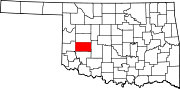
Towns Unincorporated
communitiesBurns | Cloud Chief | Cowden | Lake Valley | Port
Footnotes ‡This populated place also has portions in an adjacent county or counties
Categories:- Towns in Oklahoma
- Populated places in Washita County, Oklahoma

Wikimedia Foundation. 2010.