- Mount Vernon, Ohio
-
For the neighborhood in Columbus, Ohio, see Mount Vernon, Columbus, Ohio.
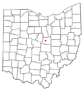
Mount Vernon, Ohio — City — Monument in the central square in downtown Mount Vernon Location of Mount Vernon, Ohio
Coordinates: 40°23′34″N 82°28′52″W / 40.39278°N 82.48111°WCoordinates: 40°23′34″N 82°28′52″W / 40.39278°N 82.48111°W Country United States State Ohio County Knox Government – Mayor Richard K. Mavis Area – Total 8.4 sq mi (21.9 km2) – Land 8.4 sq mi (21.8 km2) – Water 0.0 sq mi (0.1 km2) Elevation[1] 1,001 ft (305 m) Population (2010) – Total 16,990 – Density 1,710.4/sq mi (660.4/km2) Time zone Eastern (EST) (UTC-5) – Summer (DST) EDT (UTC-4) ZIP code 43050 Area code(s) 740 FIPS code 39-53102[2] GNIS feature ID 1056436[1] Website http://www.mountvernonohio.org/ Mount Vernon is a city in Knox County, Ohio, United States. The population was 16,990 at the 2010 census. It is the county seat of Knox County[3]. The city is named after Mount Vernon, the plantation owned by George Washington.
Contents
History
The community was founded in 1805 by Joseph Walker, Thomas B. Patterson and Benjamin Butler.
By 1840, 2,363 people lived in Mount Vernon.
Mount Vernon was a stop along the Cleveland, Akron and Columbus Railway (Later Pennsylvania, Penn-Central and Conrail) between Cleveland, Orrville and Columbus, Ohio. It was also a stop along the Sandusky, Mansfield and Newark Railroad (Later Baltimore and Ohio Railroad, Chessie System and Ohio Central). It is presently at the end of the line from Newark of the Ohio Central Railroad.
Local history
The Woodward Opera House, the oldest opera theater of its kind in the United States, is located downtown. The theater is currently under major renovation and will, upon its completion, be transformed into a local cultural and performing-arts center.
The Knox County Historical Society, with a building and extensive exhibits, makes its headquarters on Harcourt Road in Mount Vernon. Exhibits feature information about Daniel Decatur Emmett, Paul Lynde, The Cooper Company and other subjects.
At 4:30 PM local time on August 3, 2006, an F0 tornado touched down on the west side of town. It demolished a barn at the local 84 Lumber, and the resulting debris blew across the road to the DeCosky GM car dealership. It caused at least $150,000 of damage.[4]
Geography
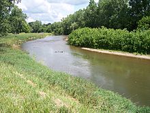 The Kokosing River in Mount Vernon in 2006.
Mount Vernon is located at 40°23′34″N 82°28′52″W / 40.39278°N 82.48111°W (40.392738, -82.481151)[5].
According to the United States Census Bureau, the city has a total area of 8.4 square miles (22 km2), of which, 8.4 square miles (22 km2) of it is land and 0.04 square miles (0.10 km2) of it (0.47%) is water. The city lies in the Glaciated Allegheny Plateau and is surrounded by rolling hills and valleys.
The Kokosing River and U.S. Route 36 pass through the city.
Demographics
Historical populations Census Pop. %± 1850 3,711 — 1860 4,202 13.2% 1870 4,876 16.0% 1880 5,249 7.6% 1890 6,027 14.8% 1900 6,638 10.1% 1910 9,087 36.9% 1920 9,237 1.7% 1930 9,370 1.4% 1940 10,122 8.0% 1950 12,185 20.4% 1960 13,284 9.0% 1970 13,373 0.7% 1980 14,362 7.4% 1990 14,550 1.3% 2000 15,256 4.9% 2010 16,990 11.4% As of the census[2] of 2000, there were 15,256 people, 6,187 households, and 3,730 families residing in the city. The population density was 1,710.4 people per square mile (660.7/km²). There were 6,713 housing units at an average density of 798.7 per square mile (308.6/km²). The racial makeup of the city was 96.66% White, 1.15% African American, 0.31% Native American, 0.54% Asian, 0.29% from other races, and 1.04% from two or more races. Hispanic or Latino of any race were 0.87% of the population.
There were 6,187 households out of which 28.0% had children under the age of 18 living with them, 43.8% were married couples living together, 12.7% had a female householder with no husband present, and 39.7% were non-families. 34.2% of all households were made up of individuals and 16.1% had someone living alone who was 65 years of age or older. The average household size was 2.25 and the average family size was 2.88.
In the city the population was spread out with 23.7% under the age of 18, 10.1% from 18 to 24, 27.2% from 25 to 44, 20.7% from 45 to 64, and 18.3% who were 65 years of age or older. The median age was 37 years. For every 100 females there were 86.2 males. For every 100 females age 18 and over, there were 81.3 males.
The median income for a household in the city was $29,801, and the median income for a family was $38,217. Males had a median income of $31,900 versus $21,969 for females. The per capita income for the city was $16,471. About 12.7% of families and 15.6% of the population were below the poverty line, including 20.7% of those under age 18 and 9.2% of those age 65 or over.
Economy
Mount Vernon was the birthplace of Cooper Industries. There is a large industrial complex in the western part of the city that manufactures and repairs products for the gas and oil power generation industries. It is now Rolls-Royce Energy Systems, Inc., a subsidiary of Rolls-Royce North America, which is in turn, a subsidiary of Rolls-Royce plc.
Ariel Corporation, a major manufacturer[6] of reciprocating natural gas (and other gasses) compressors, is also located in Mount Vernon. Its history is tied to that of Cooper Industries in that Jim Doane, one of the founders of Ariel, was a former engineer for Cooper Industries Mount Vernon. Ariel's website can be found at arielcorp.com.
Two universities in Mount Vernon and Gambier, Ohio provide thousands of jobs to the local residents. Mount Vernon is home to Mount Vernon Nazarene University and Gambier, Ohio is home to Kenyon College.
Education
Colleges and Universities
- Kenyon College (located in nearby Gambier, Ohio)
- Mount Vernon Nazarene University
Notable residents
 Buildings along East High Street in downtown Mount Vernon. In the foreground is St. Paul's Episcopal Church, and the Knox County Courthouse is visible behind.
- Chris Allen - third line right-winger for the Dallas Stars
- Eldad Cicero Camp - coal tycoon
- Thom Collier - former Ohio state representative
- Fred Dailey - former State of Ohio Agriculture Director, Former US Congressional Candidate
- Hiram and Barney Davis - two dwarf brothers and side-show performers
- Columbus Delano - Whig and Republican politician and lawyer.
- Daniel Decatur Emmett - author of "Dixie"
- Lansford Hastings - noted California pioneer.
- Paul Lynde - comedian and actor
- Ralph W. Sockman - noted clergyman, author, and radio speaker.
- Jim Stillwagon - American football player
- Jesse B. Thomas - first senator of Illinois and the proposer of the Missouri Compromise
References
- ^ a b "US Board on Geographic Names". United States Geological Survey. 2007-10-25. http://geonames.usgs.gov. Retrieved 2008-01-31.
- ^ a b "American FactFinder". United States Census Bureau. http://factfinder.census.gov. Retrieved 2008-01-31.
- ^ "Find a County". National Association of Counties. http://www.naco.org/Counties/Pages/FindACounty.aspx. Retrieved 2011-06-07.
- ^ Tuggle, Z. "Quick-strike tornado hits MV" Mount Vernon News, 04 August 2006.
- ^ "US Gazetteer files: 2010, 2000, and 1990". United States Census Bureau. 2011-02-12. http://www.census.gov/geo/www/gazetteer/gazette.html. Retrieved 2011-04-23.
- ^ See http://www.pandmt.com/compressor_manuf_.htm as an example
External links
 Media related to Mount Vernon, Ohio at Wikimedia Commons
- City of Mount Vernon Web Site
- Mount Vernon News, a newspaper based in Mt. Vernon
Municipalities and communities of Knox County, Ohio County seat: Mount VernonCity Mount Vernon

Villages Centerburg | Danville | Fredericktown | Gambier | Gann | Martinsburg | Utica‡
Townships Unincorporated
communitiesFootnotes ‡This populated place also has portions in an adjacent county or counties
Categories:- Populated places established in 1805
- Cities in Ohio
- County seats in Ohio
- Populated places in Knox County, Ohio
- Micropolitan areas of Ohio


Wikimedia Foundation. 2010.