- Denholm, Saskatchewan
-
Village of Denholm Location of Denholm in Saskatchewan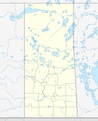

Coordinates: 52°39′25″N 108°00′40″W / 52.657°N 108.011°W Country Canada Province Saskatchewan Region Saskatchewan Census division 16 Rural Municipality Mayfield Post office Founded N/A Incorporated (Village) N/A Incorporated (Town) N/A Government – Mayor Terry Welch – Administrator Lila Yuhasz – Governing body Denholm Village Council Area – Total 0.33 km2 (0.1 sq mi) Population (2006) – Total 61 – Density 186.9/km2 (484.1/sq mi) Time zone CST Postal code S0M 0R0 Area code(s) 306 Highways Highway 687 Waterways [1][2][3][4] Denholm is a village in the Canadian province of Saskatchewan.
Contents
Demographics
Canada census – Denholm, Saskatchewan Community Profile 2006 Population:
Land area:
Population density:
Median age:
Total private dwellings:
Mean household income:61 (-22.8% from 2001)
186.9 km2 (72.2 sq mi)
81.3 /km2 (211 /sq mi)
31.8 (males: 43.0, females: 29.5)
32
$Not Available
References: 2006[5]See also


 Denholm

External links
- Saskatchewan City & Town Maps
- Saskatchewan Gen Web - One Room School Project
- Post Offices and Postmasters - ArchiviaNet - Library and Archives Canada
- Saskatchewan Gen Web Region
- Online Historical Map Digitization Project
- GeoNames Query
- 2006 Community Profiles
Footnotes
- ^ National Archives, Archivia Net, Post Offices and Postmasters, http://www.collectionscanada.ca/archivianet/post-offices/001001-100.01-e.php
- ^ Government of Saskatchewan, MRD Home (– Scholar search), Municipal Directory System, http://www.municipal.gov.sk.ca/index.html[dead link]
- ^ Canadian Textiles Institute. (2005), CTI Determine your provincial constituency, http://www.textiles.ca/eng/nonAuthProg/redirect.cfm?path=IssPolContacts§ionID=7601.cfm
- ^ Commissioner of Canada Elections, Chief Electoral Officer of Canada (2005), Elections Canada On-line, http://www.elections.ca/home.asp
- ^ "2006 Community Profiles". Statistics Canada. Government of Canada. 2009-02-24. http://www12.statcan.ca/census-recensement/2006/dp-pd/prof/92-591/index.cfm?Lang=E. Retrieved 2009-02-24.
 Subdivisions of Saskatchewan
Subdivisions Communities Cities Estevan · Flin Flon (part) · Humboldt · Lloydminster (part) · Martensville · Meadow Lake · Melfort · Melville · Moose Jaw · North Battleford · Prince Albert · Regina · Saskatoon · Swift Current · Weyburn · YorktonTopics Coordinates: 52°39′25″N 108°00′40″W / 52.657°N 108.011°W
Categories:- Villages in Saskatchewan
- Saskatchewan geography stubs

Wikimedia Foundation. 2010.