- McIntosh, Minnesota
-
McIntosh, Minnesota — City — Location of McIntosh, Minnesota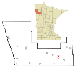
Coordinates: 47°38′11″N 95°53′14″W / 47.63639°N 95.88722°W Country United States State Minnesota County Polk Government – Type Statutorial Area – Total 1.0 sq mi (2.6 km2) – Land 1.0 sq mi (2.6 km2) – Water 0.0 sq mi (0.0 km2) Elevation 1,234 ft (376 m) Population (2010)[1] – Total 625 – Density 642.0/sq mi (247.9/km2) Time zone Central (CST) (UTC-6) – Summer (DST) CDT (UTC-5) ZIP code 56556 Area code(s) 218 FIPS code 27-39050[2] GNIS feature ID 0647687[3] Website www.ci.mcintosh.mn.us McIntosh is a city in Polk County, Minnesota, United States. It is part of the 'Grand Forks-ND-MN Metropolitan Statistical Area'. The population was 625 at the 2010 census.[1]
Contents
History
When the "Thirteen Towns", 13 townships in Polk County, Minnesota, were opened for settlement in 1883, settlers homesteaded the region. King Township, in which the village of McIntosh was located, was one of those 13 townships. The village was named for Angus John (A.J.) McIntosh, a man of Scottish descent, who immigrated from French Canada to the United States in 1870. However, he lived most of his years on the White Earth Indian Reservation north of Detroit Lakes, Minnesota. The only census in which he was residing in King Township was the Minnesota State Census in 1895.
Geography
According to the United States Census Bureau, the city has a total area of 1.0 square mile (2.6 km2), of which, 1.0 square mile (2.6 km2) of it is land and 1.00% is water.
Demographics
Historical populations Census Pop. %± 1900 569 — 1910 634 11.4% 1920 805 27.0% 1930 688 −14.5% 1940 903 31.3% 1950 881 −2.4% 1960 785 −10.9% 1970 753 −4.1% 1980 681 −9.6% 1990 670 −1.6% 2000 638 −4.8% 2010 625 −2.0% U.S. Decennial Census As of the census[2] of 2000, there were 638 people, 262 households, and 160 families residing in the city. The population density was 642.0 people per square mile (248.8/km²). There were 285 housing units at an average density of 286.8 per square mile (111.2/km²). The racial makeup of the city was 97.65% White, 0.78% Native American, 0.31% Asian, and 1.25% from two or more races. Hispanic or Latino of any race were 2.04% of the population.
There were 262 households out of which 24.8% had children under the age of 18 living with them, 48.5% were married couples living together, 9.2% had a female householder with no husband present, and 38.9% were non-families. 37.8% of all households were made up of individuals and 26.3% had someone living alone who was 65 years of age or older. The average household size was 2.12 and the average family size was 2.71.
In the city the population was spread out with 18.8% under the age of 18, 4.1% from 18 to 24, 17.6% from 25 to 44, 24.5% from 45 to 64, and 35.1% who were 65 years of age or older. The median age was 53 years. For every 100 females there were 88.8 males. For every 100 females age 18 and over, there were 94.0 males.
The median income for a household in the city was $31,328, and the median income for a family was $38,529. Males had a median income of $31,250 versus $21,875 for females. The per capita income for the city was $20,676. About 4.9% of families and 7.6% of the population were below the poverty line, including 5.9% of those under age 18 and 13.5% of those age 65 or over.
References
- ^ a b "2010 Census Redistricting Data (Public Law 94-171) Summary File". American FactFinder. U.S. Census Bureau, 2010 Census. http://factfinder2.census.gov/faces/tableservices/jsf/pages/productview.xhtml?pid=DEC_10_PL_GCTPL2.ST13&prodType=table. Retrieved 23 April 2011.
- ^ a b "American FactFinder". United States Census Bureau. http://factfinder.census.gov. Retrieved 2008-01-31.
- ^ "US Board on Geographic Names". United States Geological Survey. 2007-10-25. http://geonames.usgs.gov. Retrieved 2008-01-31.
Municipalities and communities of Polk County, Minnesota Cities 
Townships Andover | Angus | Badger | Belgium | Brandsvold | Brandt | Brislet | Bygland | Chester | Columbia | Crookston | Eden | Esther | Euclid | Fairfax | Fanny | Farley | Fisher | Garden | Garfield | Gentilly | Godfrey | Grand Forks | Grove Park-Tilden | Gully | Hammond | Helgeland | Higdem | Hill River | Hubbard | Huntsville | Johnson | Kertsonville | Keystone | King | Knute | Lessor | Liberty | Lowell | Nesbit | Northland | Onstad | Parnell | Queen | Reis | Rhinehart | Roome | Rosebud | Russia | Sandsville | Scandia | Sletten | Sullivan | Tabor | Tynsid | Vineland | Winger | Woodside
Unincorporated
communitiesGreater Grand Forks Metropolitan Area (ND-MN) Counties 

Main cities Surrounding areas † - county seatCoordinates: 47°38′13″N 95°53′11″W / 47.63694°N 95.88639°W
Categories:- Cities in Minnesota
- Populated places in Polk County, Minnesota


Wikimedia Foundation. 2010.