- Nepean Point
-
Coordinates: 45°25′46″N 75°42′4.1″W / 45.42944°N 75.701139°W

Nepean Point is a hill in Ottawa, Ontario, Canada, overlooking the Ottawa River, Parliament, the Museum of Civilization, and other features of downtown Ottawa and Gatineau. It is located between the National Gallery of Canada and Alexandra Bridge.
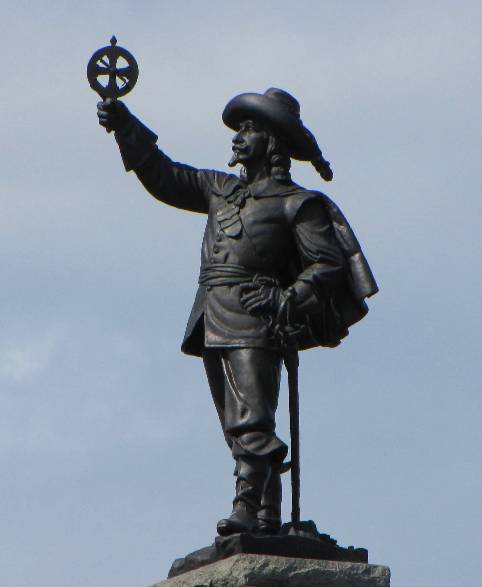
At the peak of the hill is a statue of French explorer Samuel de Champlain holding his famous astrolabe upsidedown. It was made by sculptor Hamilton MacCarthy in 1915.[1]
Previously, the statue also featured a kneeling First Nations (Anishinabe) scout, added in 1918 to "signify how the native people helped Champlain navigate through the waters of the Ottawa River", but this has been relocated to nearby Major's Hill Park.[2]
The small amphitheatre on the point is known as "Astrolabe Theatre", presumably a reference to Champlain.
References
- ^ "Champlain Statue". National Capital Commission. http://www.canadascapital.gc.ca/bins/ncc_web_content_page.asp?cid=16297-24563-24548-24557&lang=1. Retrieved 2008-03-26.
- ^ "Anishinabe Scout". National Capital Commission. http://www.canadascapital.gc.ca/bins/ncc_web_content_page.asp?bhjs=0&cid=16297-24563-24548-24553&lang=1. Retrieved 2008-03-26.
External links
- CTV.ca, "Gerard Kennedy joins the Liberal leadership race" – Gerard Kennedy announced his candidacy for the leadership of the Liberal Party of Canada at Nepean Point.
-

Statue of Samuel de Champlaign with "Anishinabe Scout" statue in front. The latter was later moved to Major's Hill Park.
-
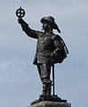
Closeup of Champlaign holding astrolabe upside down
Categories:- Parks in Ottawa
- Ottawa stubs


Wikimedia Foundation. 2010.