- Derker
-
Coordinates: 53°32′56″N 2°05′50″W / 53.549°N 2.097359°W
Derker is an area of Oldham, a town in Greater Manchester, England. It lies in north-central Oldham, close to the boundary with Royton.
Historically a part of Lancashire, Derker was recorded as a place of residence in 1604 with the name Dirtcar.[1]
Derker is located next to the Greenacres, Higginshaw and Mumps areas of Oldham.[2]
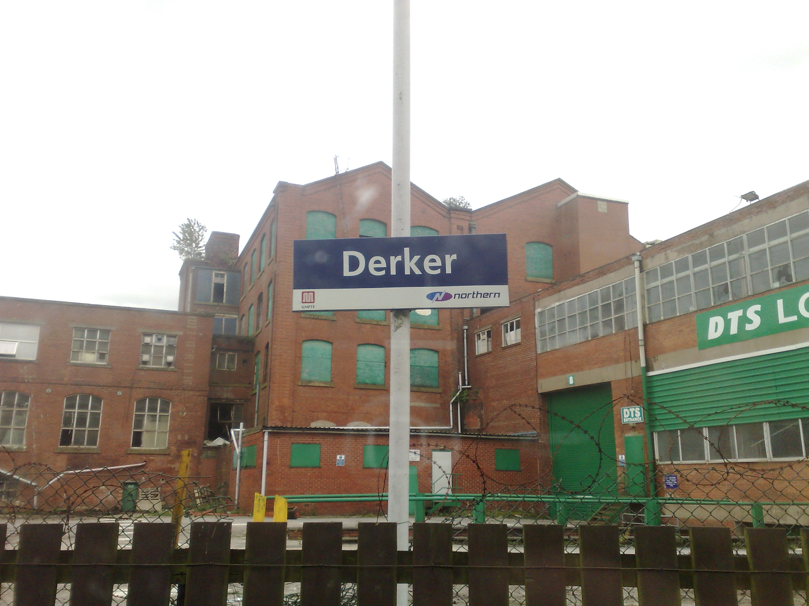
It is the location of Derker railway station.
Derker is said to have terraced residences "unsuited to modern needs", however that is believed to be untrue, it was a small developed, modernly civilized community who looked out for each other, is currently being redeveloped as part of the Housing Market Renewal Initiative.[3] This has been controversial and has been opposed by some local residents[4] who have lobbied Parliament to protest at the demolitions.[5] The then local MP Phil Woolas opposed the demolitions.[6]
References
- ^ Bateson, Hartley (1949). A Centenary History of Oldham. Oldham County Borough Council. ISBN 5-00-095162-X.
- ^ "OldhamArea". pat.nhs.uk. Archived from the original on 2007-10-23. http://web.archive.org/web/20071023200810/http://www.pat.nhs.uk/visiting/documents/OldhamArea.PDF. Retrieved 2007-11-11.
- ^ Oldham Rochdale Housing Market Renewal Pathfinder. "Oldham Rochdale Housing Market Renewal Pathfinder; Derker". oldhamrochdalehmr.co.uk. Archived from the original on 2007-06-07. http://web.archive.org/web/20070607095603/http://www.oldhamrochdalehmr.co.uk/derker.htm. Retrieved 2007-10-14.
- ^ "Residents fight demolition plans". BBC News. 6 August 2004. http://news.bbc.co.uk/1/hi/england/manchester/3540378.stm.
- ^ "March against demolishing homes". BBC News. 8 April 2005. http://news.bbc.co.uk/1/hi/england/manchester/4426619.stm.
- ^ "News - Telegraph". The Daily Telegraph (London). http://www.telegraph.co.uk/news/main.jhtml?xml=/news/2005/04/28/nelec828.xml.
Areas and suburbs of Oldham Abbeyhills · Alt · Bardsley · Barrowshaw · Clarksfield · Coldhurst · Coppice · Derker · Fitton Hill · Freehold · Garden Suburb · Glodwick · Greenacres · Hathershaw · Higginshaw · Hollinwood · Limeside · Moorside · Mumps · Salem · Sholver · Waterhead · Watersheddings · Werneth · WestwoodCategories:- Geography of Oldham
- Districts of Greater Manchester
- Greater Manchester geography stubs

Wikimedia Foundation. 2010.