- Coldhurst
-
Coordinates: 53°32′56″N 2°07′07″W / 53.548981°N 2.118491°W
Coldhurst 
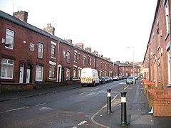
Horsedge Street in Coldhurst
 Coldhurst shown within Greater Manchester
Population 11,935 (2001 Census) OS grid reference SD921058 Metropolitan borough Oldham Metropolitan county Greater Manchester Region North West Country England Sovereign state United Kingdom Post town OLDHAM Postcode district OL1 Dialling code 0161 Police Greater Manchester Fire Greater Manchester Ambulance North West EU Parliament North West England UK Parliament Oldham West and Royton List of places: UK • England • Greater Manchester Coldhurst (or more rarely Cold Hurst) is an area of Oldham and an electoral ward of the wider Metropolitan Borough of Oldham, in Greater Manchester, England. At the time of the United Kingdom Census 2001, it had a population of 11,935.[1] The electoral ward spans most of Oldham's town centre,[2] although the name Coldhurst more usually applies to the area immediately to its north.
Historically a part of Lancashire, Coldhurst was once constituted a chapelry within the ancient ecclesiastical parish of Prestwich-cum-Oldham, in the Salfordshire hundred.[3]
Coldhurst was the site of considerable industry and commerce, including coal mining, cotton spinning and hat manufacture.[3]
An old Hall existed in the locality, belonging to Abram Crompton, Esq, which, although no longer exists today, gives its name to Crompton Street.
Coldhurst is said to have been the scene of an action in the English Civil War, in which the parliamentarians were defeated.[3]
Coldhurst is located next to Westwood, and is between Oldham town centre, and the Royal Oldham Hospital. Coldhurst is home to the Coldhurst Community Centre.
Coldhurst is the home of a significant community of South Asian (particularly Bangladeshi) heritage.[1] 37% of the population is non-white and most of the white residents live in "bleak council developments".[2]
The area is in the 5% most deprived wards in the United Kingdom.[4]
References
Notes
- ^ a b United Kingdom Census 2001. "Coldhurst (Ward)". neighbourhood.statistics.gov.uk. http://www.neighbourhood.statistics.gov.uk/dissemination/LeadKeyFigures.do?a=7&b=5941622&c=coldhurst&d=14&e=16&g=352331&i=1001x1003x1004&m=0&enc=1. Retrieved 2007-04-07.
- ^ a b Criddle 2002, p. 602.
- ^ a b c British History Online (1848). "'Cold-Ashby - Coley' A Topographical Dictionary of England". Victoria County History. http://www.british-history.ac.uk/report.asp?compid=50889&strquery=prestwich-cum-oldham#s5. Retrieved 2007-04-07.
- ^ David Ritchie (2001-12-11). "The Ritchie Report". Oldham Independent Review. http://www.oldhamir.org.uk/OIR%20Report.pdf. Retrieved 2007-04-07.
Bibliography
Areas and suburbs of Oldham Abbeyhills · Alt · Bardsley · Barrowshaw · Clarksfield · Coldhurst · Coppice · Derker · Fitton Hill · Freehold · Garden Suburb · Glodwick · Greenacres · Hathershaw · Higginshaw · Hollinwood · Limeside · Moorside · Mumps · Salem · Sholver · Waterhead · Watersheddings · Werneth · WestwoodCategories:- Geography of Oldham
- Districts of Greater Manchester
- Greater Manchester geography stubs
Wikimedia Foundation. 2010.

