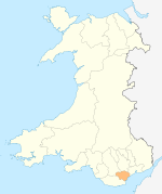
- Danescourt
-
Danescourt is a suburban area in the west of the Welsh capital city of Cardiff.
Contents
History and amenities
Danescourt is a housing estate located on the edge of the suburb of Llandaff leading to Fairwater and Radyr. Most of the area is covered by housing estates which were built in the late 20th century.
The name is derived from the names of the two buildings on the site before the modern housing; Radyr Court Farm and Danesbrook House.[1]
The area is served by Danescourt railway station and there are also several bus routes through the area which are operated by Cardiff Bus.
Local facilities in Danescourt are the Primary School, the Parish Church of Saint John the Baptist and a Shopping Centre which consists of a Co-operative Group store, a Newsagent, a Post Office, a public house namely the Radyr Court Inn, a Woman's Gym and Forte School of Music. There is also a Dentist and Doctor's Surgery adjacent to the Shopping Centre. Danescourt Christian Fellowship meets on Sundays in St John's Church Hall [2]
References
See also
External links
Communities of Cardiff Adamsdown · Butetown · Caerau · Canton · Cardiff Bay · Cathays · Creigiau · Culverhouse Cross · Cyncoed · Danescourt · Ely · Fairwater · Gabalfa · Grangetown · Heath · Lisvane · Llandaff · Llandaff North · Llanishen · Llanrumney · Morganstown · Pentwyn · Pentyrch · Penylan · Plasnewydd · Pontcanna · Pontprennau · Radyr · Rhiwbina · Riverside · Roath · Rumney · Splott · St Fagans · St Mellons & Old St Mellons · Thornhill · Tongwynlais · Trowbridge · Whitchurch
City of Cardiff About Cardiff Architecture · City centre (Arcades) · Culture and recreation · Economy and industry · History (Timeline) · Leisure Centres · Libraries · Media · People · Places · Politics · Sport · Tall Buildings · Transport (Bus · Rail · Cycle · Water · Air)
Cardiff templates North Birchgrove · Cathays · Cyncoed · Gabalfa · Heath · Lisvane · Llandaff · Llandaff North · Llanishen · Rhiwbina · Roath · Thornhill · Tongwynlais · WhitchurchWest Caerau · Canton · Creigiau · Culverhouse Cross · Danescourt · Ely · Fairwater · Pentyrch · Pontcanna · Radyr and Morganstown · St FagansSouth East Principal areas of WalesCoordinates: 51°30′14″N 3°14′31″W / 51.503873°N 3.241930°W
Categories:- Districts of Cardiff
- Glamorgan geography stubs
Wikimedia Foundation. 2010.
