- Damariscotta, Maine
-
Damariscotta, Maine — Town — Main Street c. 1907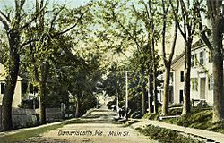 Location within the state of Maine
 Damariscotta, Maine
Coordinates: 44°2′16″N 69°29′39″W / 44.03778°N 69.49417°W Country United States State Maine County Lincoln Incorporated 1848 Area – Total 14.6 sq mi (37.8 km2) – Land 12.4 sq mi (32.2 km2) – Water 2.2 sq mi (5.6 km2) Elevation 148 ft (45 m) Population (2000) – Total 2,041 – Density 164.4/sq mi (63.5/km2) Time zone Eastern (EST) (UTC-5) – Summer (DST) EDT (UTC-4) ZIP code 04543 Area code(s) 207 FIPS code 23-16235 GNIS feature ID 0582432 Damariscotta is a town in Lincoln County, Maine, United States. The population was 2,041 at the 2000 census. A popular tourist resort area, the towns of Damariscotta and Newcastle are linked by the Main Street bridge over the Damariscotta River, forming the "Twin Villages." The name Damariscotta is an Indian name meaning "river of little fish".
Contents
History
The area was once inhabited by the Wawenock (or Walinakiak, meaning "People of the Bays") Abenaki Indians, who left behind 2,500-year-old oyster shell middens along the banks of the Damariscotta River. The Whaleback Shell Midden is now a state historic site. The land became part of the Pemaquid Patent, granted by the Plymouth Council in 1631 to Robert Aldsworth and Gyles Elbridge, merchants from Bristol, England. At Pemaquid (now Bristol), they built a fort and trading post.[1]
Some colonists moved upriver from the village at Pemaquid about 1640 to settle what is today Damariscotta. But the settlements were attacked in 1676 during King Philip's War, with the inhabitants either driven off or massacred. Attempts to rebuild alternated with further attacks during the French and Indian Wars. The Province of Massachusetts Bay constructed Fort William Henry at Pemaquid in 1692, but it was destroyed in 1696. Its replacement, Fort Frederick, in 1729, successfully resisted the region's final two attacks, and was pulled down at the Time of the Revolution so that the British could not occupy it. With peace at last, Damariscotta grew as a trade center. It was incorporated as a separate town on March 15, 1848, set off from parts of Bristol and Nobleboro.[2]
Damariscotta is an extreme corruption of the Algonquian word Madamescontee, meaning "place of an abundance of alewives," which are small, salty fish that spawn in Damariscotta Lake. The main village is located at the lower falls and head of navigation on the Damariscotta River. Early industries included two sawmills, a match factory and a tannery. Along the river were established several brickyards, which supplied much of the brick used to build Boston's Back Bay neighborhood. But shipbuilding in particular brought Damariscotta wealth in the 1800s, when clipper ships were launched at the town's shipyards.[3] During that time, many fine examples of Federal, Greek Revival and Italianate style architecture were erected, giving the old seaport a considerable charm which each summer attracts throngs of tourists.
The terminus of the Damariscotta River is the Great Salt Bay, which is the northernmost mating area for horseshoe crabs in North America, and the state's first marine protected area. Damariscotta is home of the Skidompha Public Library, whose name is an acronym formed from the first letter of several founders' surnames.
-
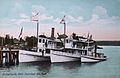
Steamboat fleet in 1906
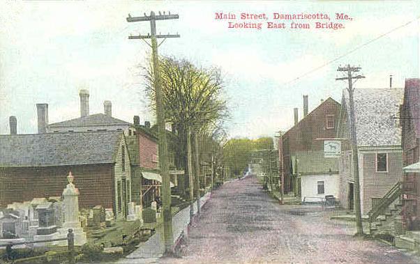
-
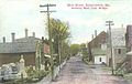
Main Street in 1910
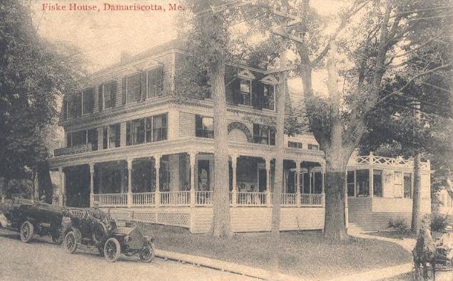
-
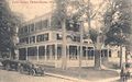
The Fiske House in 1914
Geography
According to the United States Census Bureau, the town has a total area of 14.6 square miles (38 km2), of which, 12.4 square miles (32 km2) of it is land and 2.2 square miles (5.7 km2) of it (14.87%) is water. Damariscotta is situated on the Damariscotta River, a tidal estuary of the Gulf of Maine. Hunt Hill, elevation 350 feet (108 m) above sea level, is the town's highest point.
Demographics
As of the census[4] of 2000, there were 2,041 people, 942 households, and 548 families residing in the town. The population density was 164.4 people per square mile (63.4/km²). There were 1,151 housing units at an average density of 92.7 per square mile (35.8/km²).
There were 942 households out of which 23.5% had children under the age of 18 living with them, 46.4% were married couples living together, 7.9% had a female householder with no husband present, and 41.8% were non-families. 36.6% of all households were made up of individuals and 19.9% had someone living alone who was 65 years of age or older. The average household size was 2.06 and the average family size was 2.65.
In the town the population was spread out with 19.6% under the age of 18, 5.2% from 18 to 24, 21.3% from 25 to 44, 23.4% from 45 to 64, and 30.5% who were 65 years of age or older. The median age was 48 years. For every 100 females there were 83.0 males. For every 100 females age 18 and over, there were 76.0 males.
The median income for a household in the town was $36,188, and the median income for a family was $47,105. Males had a median income of $31,953 versus $23,064 for females. The per capita income for the town was $23,146. About 6.7% of families and 11.7% of the population were below the poverty line, including 16.4% of those under age 18 and 5.7% of those age 65 or over.
Local Business
- Renys
- The Animal House
- Waltz Pharmacy
Sites of interest
- Chapman-Hall House (1754)
- Whaleback Shell Midden
Notable people
- Kate Aldrich, mezzo-soprano
- Anna Belknap, actress
- Bud Blake, cartoonist
- Charles A. Boutelle, naval officer, congressman
- Glenn Chadbourne, illustrator
- Vince Clarke, songwriter, involved with Erasure and Depeche Mode[citation needed]
- Barbara Cooney, children's author and illustrator
- Jessica Delfino, singer and songwriter, stand-up comic[5]
- Ezra B. French, congressman
- Hilton Kramer, art critic
- Bob Page, musician
- Sally Caldwell Fisher, artist
References
- ^ Coolidge, Austin J.; John B. Mansfield (1859). A History and Description of New England. Boston, Massachusetts. pp. 100–101. http://books.google.com/books?id=OcoMAAAAYAAJ&lpg=PA9&dq=coolidge%20mansfield%20history%20description%20new%20england%201859&pg=PA100#v=onepage&q&f=false.
- ^ Maine League of Historical Societies and Museums (1970). Doris A. Isaacson. ed. Maine: A Guide 'Down East'. Rockland, Me: Courier-Gazette, Inc.. pp. 258.
- ^ Varney, George J. (1886), Gazetteer of the state of Maine. Damariscotta, Boston: Russell, http://history.rays-place.com/me/damariscotta-me.htm
- ^ "American FactFinder". United States Census Bureau. http://factfinder.census.gov. Retrieved 2008-01-31.
- ^ "Jessica Delfino Bio". http://www.jessicadelfino.com/Jessica_Delfino_Bio.html. Retrieved 2011-10-2.
External links
Municipalities and communities of Lincoln County, Maine Towns Alna | Boothbay Harbor | Boothbay | Bremen | Bristol | Damariscotta | Dresden | Edgecomb | Jefferson | Newcastle | Nobleboro | Somerville | South Bristol | Southport | Waldoboro | Westport Island | Whitefield | Wiscasset
Plantation Gore CDPs Other
villagesCoordinates: 44°01′58″N 69°31′07″W / 44.03278°N 69.51861°W
Categories:- Towns in Lincoln County, Maine
-


Wikimedia Foundation. 2010.