- Dienheim
-
Dienheim 

 DienheimLocation of Dienheim within Mainz-Bingen district
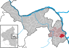
Coordinates 49°50′25″N 8°21′2″E / 49.84028°N 8.35056°ECoordinates: 49°50′25″N 8°21′2″E / 49.84028°N 8.35056°E Administration Country Germany State Rhineland-Palatinate District Mainz-Bingen Municipal assoc. Nierstein-Oppenheim Mayor Norbert Jochem Basic statistics Area 9.90 km2 (3.82 sq mi) Elevation 90-120 m Population 2,143 (31 December 2010)[1] - Density 216 /km2 (561 /sq mi) Other information Time zone CET/CEST (UTC+1/+2) Licence plate MZ Postal code 55276 Area code 06133 Website www.dienheim.de Dienheim is an Ortsgemeinde – a municipality belonging to a Verbandsgemeinde, a kind of collective municipality – in the Mainz-Bingen district in Rhineland-Palatinate, Germany.
Contents
Geography
Location
Dienheim lies between Mainz and Worms, in Rhenish Hesse. The winemaking centre belongs to the Verbandsgemeinde of Nierstein-Oppenheim, whose seat is in Oppenheim.
History
In the 8th century, Dienheim had its first documentary mention. The village passed in Charlemagne’s time to the Fulda Abbey. Later it ended up as an Imperial pledge in Electoral Palatinate’s ownership[2].
From the early 13th century, the Barons of Dienheim are witnessed, later, from the 16th to 18th century, being assigned to the Rhenish Knightly District’s (Rheinischer Ritterkreis) canton of Oberrheinstrom[3].
Politics
Municipal council
Town council
The council is made up of 17 council members, counting the parttime mayor, with seats apportioned thus:
SPD CDU FWG Total 2004 5 4 7 16 seats (as at municipal election held on 13 June 2004)
Coat of arms
The municipality’s arms might be described thus: Per pale sable and argent a lion rampant Or armed gules and a cross of the first[4].
Town partnerships
 Sours, Eure-et-Loir, France since 1977
Economy and infrastructure
Transport
Highways
The municipality lies on Bundesstraße 9 linking Mainz with Worms. Since December 2007, the B 9, which had until then run through the built-up area, has run instead along a bypass alongside the railway line.
The Autobahnen A 60 and A 63 can each be reached in roughly 20 minutes.
Local public transport
Once the Mainz-Ludwigshafen railway line is integrated into the RheinNeckar S-Bahn in 2015, there will be a stop somewhere near the sporting ground.
References
- ^ "Bevölkerung der Gemeinden am 31.12.2010" (in German). Statistisches Landesamt Rheinland-Pfalz. 31 December 2010. http://www.statistik.rlp.de/fileadmin/dokumente/berichte/A1033_201022_hj_G.pdf.
- ^ Gerhard Köbler, Historisches Lexikon der deutschen Länder: Die deutschen Territorien vom Mittelalter bis zur Gegenwart, 3., verbesserte, um ein Register erweiterte Auflage, C. H. Beck, München 1990, Dienheim (Reichsdorf) p. 110.
- ^ Gerhard Köbler, Historisches Lexikon der deutschen Länder: Die deutschen Territorien vom Mittelalter bis zur Gegenwart, 3., verbesserte, um ein Register erweiterte Auflage, C. H. Beck, München 1990, Dienheim (Freiherren, Reichsritter) p. 110.
- ^ The tinctures named here are the ones in the German blazon; the Or (gold) and gules (red) are not rendered in the image of the arms used in this article
External links
- Municipality’s official webpage (German)
- This article incorporates information from the German Wikipedia.
Appenheim · Aspisheim · Bacharach · Badenheim · Bingen am Rhein · Bodenheim · Breitscheid · Bubenheim · Budenheim · Dalheim · Dexheim · Dienheim · Dolgesheim · Dorn-Dürkheim · Eimsheim · Engelstadt · Essenheim · Friesenheim · Gau-Algesheim · Gau-Bischofsheim · Gensingen · Grolsheim · Guntersblum · Hahnheim · Harxheim · Heidesheim am Rhein · Hillesheim · Horrweiler · Ingelheim am Rhein · Jugenheim in Rheinhessen · Klein-Winternheim · Köngernheim · Lörzweiler · Ludwigshöhe · Manubach · Mommenheim · Münster-Sarmsheim · Nackenheim · Nieder-Hilbersheim · Nieder-Olm · Niederheimbach · Nierstein · Ober-Hilbersheim · Ober-Olm · Oberdiebach · Oberheimbach · Ockenheim · Oppenheim · Sankt Johann · Schwabenheim an der Selz · Selzen · Sörgenloch · Sprendlingen · Stadecken-Elsheim · Trechtingshausen · Uelversheim · Undenheim · Wackernheim · Waldalgesheim · Weiler bei Bingen · Weinolsheim · Welgesheim · Wintersheim · Wolfsheim · Zornheim · Zotzenheim Categories:
- Municipalities in Rhineland-Palatinate
- Mainz-Bingen geography stubs


Wikimedia Foundation. 2010.