- Ober-Hilbersheim
-
Ober-Hilbersheim 

 Ober-HilbersheimLocation of Ober-Hilbersheim within Mainz-Bingen district
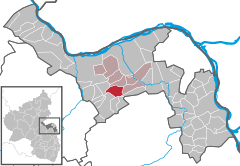
Coordinates 49°53′59″N 8°01′44″E / 49.89972°N 8.02889°ECoordinates: 49°53′59″N 8°01′44″E / 49.89972°N 8.02889°E Administration Country Germany State Rhineland-Palatinate District Mainz-Bingen Municipal assoc. Gau-Algesheim Mayor Heiko Schmuck Basic statistics Area 7.38 km2 (2.85 sq mi) Elevation 254 m (833 ft) Population 1,050 (31 December 2010)[1] - Density 142 /km2 (368 /sq mi) Other information Time zone CET/CEST (UTC+1/+2) Licence plate MZ Postal code 55437 Area code 06728 Website www.ober-hilbersheim.de Ober-Hilbersheim is an Ortsgemeinde – a municipality belonging to a Verbandsgemeinde, a kind of collective municipality – in the Mainz-Bingen district in Rhineland-Palatinate, Germany.
Contents
Geography
Location
The municipality lies southwest of Mainz on the Welzbach and is an agriculturally based community. The winegrowing centre belongs to the Verbandsgemeinde of Gau-Algesheim, whose seat is in the like-named town.
History
In 1108, Ober-Hilbersheim had its first documentary mention as Hilbridisheim.
Politics
Municipal council
The council is made up of 12 council members who were elected in a municipal election held on 13 June 2004 by majority vote.
Mayors
Coat of arms
The municipality’s arms might be described thus: Azure a horse’s head couped at the neck Or langued gules.
Culture and sightseeing
Regular events
- The Ober-Hilbersheim Wine and Art Fair takes place early every July.
- The Ober-Hilbersheim Christmas Market is held on the second weekend in Advent.
Economy and infrastructure
Transport
The municipality is crossed by the L 415 state road. The Autobahnen A 60, A 61 and A 63 can be reached by car in 10 to 20 minutes.
Education
- Municipal kindergarten
References
- ^ "Bevölkerung der Gemeinden am 31.12.2010" (in German). Statistisches Landesamt Rheinland-Pfalz. 31 December 2010. http://www.statistik.rlp.de/fileadmin/dokumente/berichte/A1033_201022_hj_G.pdf.
Further reading
Schmuck, Heiko: Ober-Hilbersheim. Illustrierte Dokumentation eines rheinhessischen Dorfes im 19. und 20. Jahrhundert. Horb am Neckar 1999.
External links
- Municipality’s official webpage (German)
- Homepage of Bürgerinitiative Umwelt und Gesundheit Ober-Hilbersheim e.V. (“Ober-Hilbersheim Environment and Health Citizens’ Initiative”) and information page about Ober-Hilbersheim (German)
- This article incorporates information from the German Wikipedia.
Appenheim · Aspisheim · Bacharach · Badenheim · Bingen am Rhein · Bodenheim · Breitscheid · Bubenheim · Budenheim · Dalheim · Dexheim · Dienheim · Dolgesheim · Dorn-Dürkheim · Eimsheim · Engelstadt · Essenheim · Friesenheim · Gau-Algesheim · Gau-Bischofsheim · Gensingen · Grolsheim · Guntersblum · Hahnheim · Harxheim · Heidesheim am Rhein · Hillesheim · Horrweiler · Ingelheim am Rhein · Jugenheim in Rheinhessen · Klein-Winternheim · Köngernheim · Lörzweiler · Ludwigshöhe · Manubach · Mommenheim · Münster-Sarmsheim · Nackenheim · Nieder-Hilbersheim · Nieder-Olm · Niederheimbach · Nierstein · Ober-Hilbersheim · Ober-Olm · Oberdiebach · Oberheimbach · Ockenheim · Oppenheim · Sankt Johann · Schwabenheim an der Selz · Selzen · Sörgenloch · Sprendlingen · Stadecken-Elsheim · Trechtingshausen · Uelversheim · Undenheim · Wackernheim · Waldalgesheim · Weiler bei Bingen · Weinolsheim · Welgesheim · Wintersheim · Wolfsheim · Zornheim · Zotzenheim Categories:
- Municipalities in Rhineland-Palatinate
- Mainz-Bingen geography stubs


Wikimedia Foundation. 2010.