- Ober-Olm
-
Ober-Olm 

 Ober-OlmLocation of Ober-Olm within Mainz-Bingen district
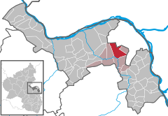
Coordinates 49°56′13″N 8°11′20″E / 49.93694°N 8.18889°ECoordinates: 49°56′13″N 8°11′20″E / 49.93694°N 8.18889°E Administration Country Germany State Rhineland-Palatinate District Mainz-Bingen Municipal assoc. Nieder-Olm Mayor Heribert Schmitt (SPD) Basic statistics Area 17.09 km2 (6.60 sq mi) Elevation 151 m (495 ft) Population 4,340 (31 December 2010)[1] - Density 254 /km2 (658 /sq mi) Other information Time zone CET/CEST (UTC+1/+2) Licence plate MZ Postal code 55270 Area code 06136 Website www.ober-olm.de Ober-Olm is an Ortsgemeinde – a municipality belonging to a Verbandsgemeinde, a kind of collective municipality – in the Mainz-Bingen district in Rhineland-Palatinate, Germany.
Contents
Geography
Neighbouring municipalities
Ober-Olm’s neighbours are Mainz-Layenhof, Mainz-Finthen, Mainz-Drais, Mainz-Lerchenberg, Mainz-Bretzenheim, Mainz-Marienborn, Klein-Winternheim, Mainz-Ebersheim, Nieder-Olm and Essenheim.
History
Finds in the municipal area have yielded the first clues to settlers here in the 4th century BC. In AD 97, Consul Vejento had a temple built to the forest goddess Nemetona near his Klein-Winternheim landholding, a richly furnished Roman settlement in the Ober-Olm cadastral area of Villenkeller. Ober-Olm itself arose in the 6th century as a Frankish establishment and had its first documentary mention in 994. The name “Ulmena Superior” from 1190 was formerly associated with elm trees, Ulme being the Modern High German word for this tree; however, this word was not borrowed into German from Latin (ulmus) until the 12th century. The formation of the placename Ulm and an ending —ena is typical for a brook’s name, and these were often also used as placenames. It can be assumed that Ulmena was the name that the Germanic settlers between Ober-Olm and Nieder-Olm gave the Selz. The few Roman people left still used the name Salusia for the brook, which was the name that eventually stuck to it. Ulmena, however, remained as well, and clove to both the centres now bearing Olm as part of their names.
In 1582, 1603 and 1857, Ober-Olm was destroyed by devastating fires.
Since 1972, Ober-Olm has belonged to the Verbandsgemeinde of Nieder-Olm, whose seat is in the like-named town.
Many ecclesiastical and monastic institutions had landholdings in the municipality, among whom were, for example, Eberbach Abbey, the Maria Dalheim monasteries in Mainz, the Dominicans and the Carthusians, the White Ladies (an order of nuns devoted to Mary Magdalene) in Mainz and All Hallows’ Monastery in Wesel. Furthermore, the Cathedral Chapter in Mainz, the Ravengiersburg Monastery, Saint John’s Church in Mainz, Saint Stephen’s Church in Mainz, Mariengreden, Saint Victor’s and Saint Peter’s were all landholders.
In 2003, the German-Pennsylvanian Association was founded in Ober-Olm. It's also the village, where the German-Pennsylvanian newspaper Hiwwe wie Driwwe is being published by the Private Archive of Pennsylvania German Literature.
World War II
During the Western Allied invasion of Germany in April 1945, the nearby Luftwaffe Mainz-Finthen airfield was seized by the United States Third Army, and used by the USAAF 354th Fighter Group which flew P-47 Thunderbolts from the aerodrome (designated ALG Y-64) from 8 to 30 April 1945. Acquired for use by the United States Army after the conclusion of the war, the former German Luftwaffe fighter base was named Finthen Army Airfield and has been used by Army aviation units ever since.[2][3][4][5]
Politics
Municipal council
Town council
The council is made up of 20 elected council members, in addition to the unsalaried, directly elected mayor. The mayor has voting rights just like the other council members. The seats divided by party membership:
SPD CDU FWG FDP Total 2009 8 7 3 2 20 seats (as per municipal election held on 7 June 2009)
Town partnerships
There are also friendship arrangements with the following places:
 Bobrowice, Lubusz Voivodeship, Poland
 Bruck in der Oberpfalz, Schwandorf district, Bavaria
- Seebach, Ortenaukreis, Baden-Württemberg
- Seiffen, Erzgebirgskreis, Saxony
 Wolfsegg am Hausruck, Upper Austria, Austria
Sightseeing
- Saint Martin’s Church (Martinskirche) with a tower from Carolingian times and a statue of Saint Urban from the 16th century.
- Hunting lodge of the Electors of Mainz (Altes Forsthaus) from 1764.
- Ober-Olmer Wald (forest), a 335-hectare recreation area.
- Saint Valentine’s Chapel (Valentinskapelle) with its Rococo altar, which stands picturesquely on the edge of the vineyards.
- The 650-year-old elm tree had to be cut down in 1985 after it fell victim to Dutch elm disease.
- Renovated Town Hall from 1550, floors added in 1721-1722.
Economy and infrastructure
Transport
- The Autobahn A 63 lies approximately 3 km away.
- The Deutsche Bahn railway station Klein-Winternheim/Ober-Olm is found in neighbouring Klein-Winternheim.
- City bus link to Mainz as far as Hochheim (route 68) and ORN bus links (regional route 650) to outlying areas in Rhenish Hesse as well as into the city of Mainz in the evening and back until after midnight.
Telecommunications
The Ober-Olm Transmission Tower (Fernmeldeturm Ober-Olm) was built as a 70.35 m-tall tower for Deutsche Telekom in 1966. Its nicknames include “Olmi”, “Ober-Olmer Spargel” (Spargel means “asparagus” in German) and “Fernsehturm” (“Television Tower”). It stands at 49°56′31″N 8°10′16″E / 49.94194°N 8.17111°E. In 1990, the transmission tower had another 38 m built onto the top, bringing its current height to 108.35 m.
Public Institutions
- Ulmenhalle, a multi-purpose hall at Essenheimer Straße 17a
- Sport facility with artificial-turf football pitch and competition-standard athletic facility, Am Sportplatz (location)
- Kindergarten Abenteuerland (“Kindergarten Adventureland”), Pfannenstiel 36
- Kindertagesstätte St. Elisabeth (daycare centre), Essenheimer Straße 17
Education
- Grundschule Ober-Olm (primary school), Schulstraße, sponsor: Verbandsgemeinde Nieder-Olm
- Kreisvolkshochschule (KVHS, district folk high school), Ober-Olm branch, Schulstraße 2
Famous people
- Margit Sponheimer
Honorary citizens
- Franz Nikolaus Becker
- Father Henri Thiebaut, Ramonchamp
Further reading
- Heribert Schmitt et al.: Das Dorf, in dem wir leben, Ober-Olm. Geiger-Verlag, Horb am Neckar 1994, ISBN 978-3-89264-913-7
- Maria Regina Kaiser: Die Trommeln der Freiheit novel, 1848 - Märzrevolution in Mainz, 1998, ISBN 3-00-003678-4
- Claudius Moseler: Der Ober-Olmer Wald - Raumnutzungsansprüche, Gefährdungspotentiale und Nutzungskonkurrenzen in einem rheinhessischen Waldareal Diplomarbeit Geographie, Uni Mainz, 1992
References
- ^ "Bevölkerung der Gemeinden am 31.12.2010" (in German). Statistisches Landesamt Rheinland-Pfalz. 31 December 2010. http://www.statistik.rlp.de/fileadmin/dokumente/berichte/A1033_201022_hj_G.pdf.
- ^ 354 Operations Group Fact Sheet, USAFHRA
- ^ USAAF Airfields in the ETO
- ^ AAF Airfields in France, Belgium, Netherlands, Luxembourg
- ^ Finthen Army Airfield History
External links
- Municipality’s official webpage (German)
- Hiwwe wie Driwwe - Pennsylvania German Newspaper published in Ober-Olm
- This article incorporates information from the German Wikipedia.
Appenheim · Aspisheim · Bacharach · Badenheim · Bingen am Rhein · Bodenheim · Breitscheid · Bubenheim · Budenheim · Dalheim · Dexheim · Dienheim · Dolgesheim · Dorn-Dürkheim · Eimsheim · Engelstadt · Essenheim · Friesenheim · Gau-Algesheim · Gau-Bischofsheim · Gensingen · Grolsheim · Guntersblum · Hahnheim · Harxheim · Heidesheim am Rhein · Hillesheim · Horrweiler · Ingelheim am Rhein · Jugenheim in Rheinhessen · Klein-Winternheim · Köngernheim · Lörzweiler · Ludwigshöhe · Manubach · Mommenheim · Münster-Sarmsheim · Nackenheim · Nieder-Hilbersheim · Nieder-Olm · Niederheimbach · Nierstein · Ober-Hilbersheim · Ober-Olm · Oberdiebach · Oberheimbach · Ockenheim · Oppenheim · Sankt Johann · Schwabenheim an der Selz · Selzen · Sörgenloch · Sprendlingen · Stadecken-Elsheim · Trechtingshausen · Uelversheim · Undenheim · Wackernheim · Waldalgesheim · Weiler bei Bingen · Weinolsheim · Welgesheim · Wintersheim · Wolfsheim · Zornheim · Zotzenheim Categories:
- Municipalities in Rhineland-Palatinate


Wikimedia Foundation. 2010.