- Crothersville, Indiana
-
Crothersville, Indiana — Town — Location in the state of Indiana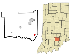
Coordinates: 38°47′46″N 85°50′27″W / 38.79611°N 85.84083°WCoordinates: 38°47′46″N 85°50′27″W / 38.79611°N 85.84083°W Country United States State Indiana County Jackson Township Vernon Area – Total 1.1 sq mi (3.0 km2) – Land 1.1 sq mi (3.0 km2) – Water 0.0 sq mi (0.0 km2) Elevation 558 ft (170 m) Population (2010) – Total 1,591 – Density 1,377.1/sq mi (531.7/km2) Time zone EST (UTC-5) – Summer (DST) EST (UTC-5) ZIP code 47229 Area code(s) 812 Exchange: 793 FIPS code 18-16084[1] GNIS feature ID 0433195[2] Website http://www.crothersville.net. Crothersville is a town in Vernon Township, Jackson County, Indiana, United States. The population was 1,591 at the 2010 census. It was founded in 1835 and named after Dr. Crothers, a railroad superintendent.
Contents
Geography
Crothersville is located at 38°47′46″N 85°50′27″W / 38.79611°N 85.84083°W (38.796099, -85.840878)[3].
According to the United States Census Bureau, the town has a total area of 1.1 square miles (2.8 km2), all of it land.
Demographics
As of the census[1] of 2000, there were 1,570 people, 648 households, and 458 families residing in the town. The population density was 1,372.2 people per square mile (531.7/km²). There were 720 housing units at an average density of 629.3 per square mile (243.9/km²). The racial makeup of the town was 98.41% White, 0.19% Native American, 0.38% Asian, 0.38% from other races, and 0.64% from two or more races. Hispanic or Latino of any race were 1.53% of the population.
There were 648 households out of which 30.7% had children under the age of 18 living with them, 53.5% were married couples living together, 11.9% had a female householder with no husband present, and 29.2% were non-families. 25.6% of all households were made up of individuals and 11.9% had someone living alone who was 65 years of age or older. The average household size was 2.42 and the average family size was 2.86.
In the town the population was spread out with 24.5% under the age of 18, 8.5% from 18 to 24, 29.4% from 25 to 44, 23.1% from 45 to 64, and 14.5% who were 65 years of age or older. The median age was 37 years. For every 100 females there were 93.1 males. For every 100 females age 18 and over, there were 91.7 males.
The median income for a household in the town was $32,768, and the median income for a family was $36,776. Males had a median income of $29,856 versus $21,486 for females. The per capita income for the town was $18,182. About 7.3% of families and 8.8% of the population were below the poverty line, including 8.5% of those under age 18 and 7.3% of those age 65 or over.
References
- ^ a b "American FactFinder". United States Census Bureau. http://factfinder.census.gov. Retrieved 2008-01-31.
- ^ "US Board on Geographic Names". United States Geological Survey. 2007-10-25. http://geonames.usgs.gov. Retrieved 2008-01-31.
- ^ "US Gazetteer files: 2010, 2000, and 1990". United States Census Bureau. 2011-02-12. http://www.census.gov/geo/www/gazetteer/gazette.html. Retrieved 2011-04-23.
External links
Municipalities and communities of Jackson County, Indiana City 
Towns Brownstown | Crothersville | Medora
Townships Brownstown | Carr | Driftwood | Grassy Fork | Hamilton | Jackson | Owen | Pershing | Redding | Salt Creek | Vernon | Washington
Unincorporated
communitiesAcme | Bald Knobs | Bobtown | Chestnut Ridge | Clear Spring | Cortland | Dudleytown | Ewing | Fleming | Freetown | Hangman Crossing | Houston | Kriete Corner | Kurtz | Little Acre | Maumee | New Elizabethtown | New Farmington | Norman | Reddington | Retreat | Rockford | Shields | Sparksville | Spraytown | Surprise | Tampico | Uniontown | Vallonia | Weddleville | Wegan
Categories:- Populated places in Jackson County, Indiana
- Towns in Indiana
- Populated places established in 1835

Wikimedia Foundation. 2010.