- College Hill, Cincinnati
-
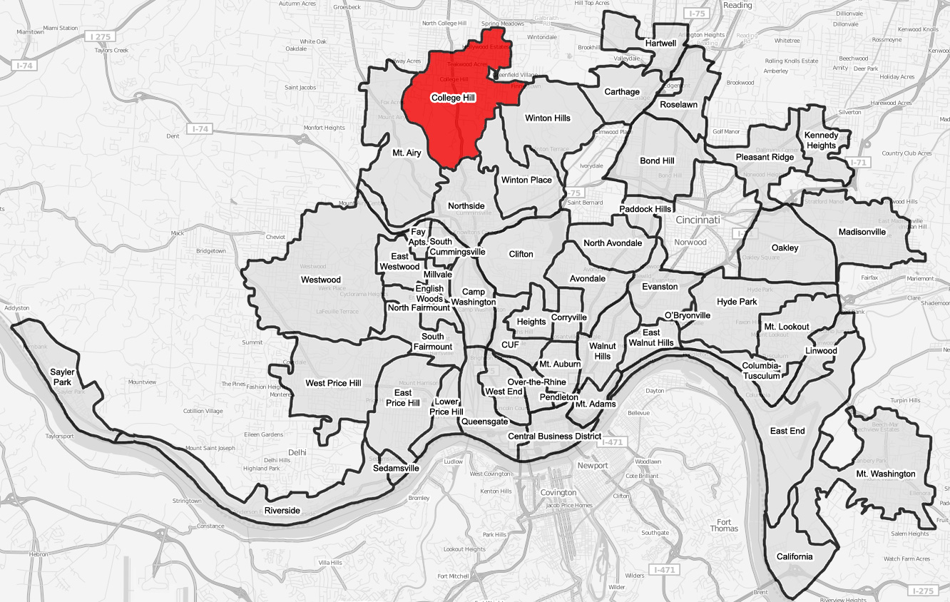
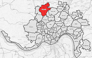 College Hill is a neighborhood of Cincinnati, Ohio.
College Hill is a residential neighborhood of Cincinnati, Ohio. Originally a wealthy suburb called Pleasant Hill due to its prime location, it was renamed College Hill because of the two colleges that were established there in the mid-nineteenth century. The neighborhood is not to be confused with North College Hill, which borders College Hill to the north but is not part of Cincinnati.[1]
In 1813-14, William Cary, having migrated from New Hampshire to Cincinnati in 1802,[2] purchased 491 acres (1.99 km2) north of Cincinnati along what is now Hamilton Avenue (U.S. Route 127). Cary built a log cabin and moved his family to this “wilderness,” then known as Mill Creek Township.[3] In 1833, Cary's son Freeman G. Cary established Pleasant Hill Academy for boys on part of his land. The academy became an agricultural school called Farmer's College (for which the area was renamed) in 1846. That school became Belmont College in 1885, and then formed the core of the Ohio Military Institute in 1890. A separate school, the Ohio Female College, was founded in 1852 by Reverend John Covert and operated until 1873[4] [5] when it was sold to build the Cincinnati Sanitarium, the first private US psychiatric facility not on the East Coast.[6]
The development of the area was expedited by the introduction of a railroad line in 1851 and horsecar service in the 1860s. College Hill was incorporated as a village in 1866, then annexed to the city of Cincinnati in stages in 1911, 1915 and 1923.[5]
The town was the birthplace of Samuel Fenton Cary and still features several historic buildings, including Laurel Court, College Hill Town Hall and the Old College Hill Post Office.
References
- ^ Grace, Kevin; Tom White (2002). Cincinnati Revealed: A Photographic History of the Queen City. Arcadia Publishing. pp. p. 56. ISBN 0738519553.
- ^ http://homepages.rootsweb.ancestry.com/~lynnbran/PS02/PS02_481.htm Accessed 6/28/2008.
- ^ “History of Cincinnati and Hamilton County, Ohio,” http://www.heritagepursuit.com/Hamilton/HamiltonChapXXXIII.htm. Accessed 3/16/2008.
- ^ The Ohio Channel : Your State : Remarkable Ohio : Marker Details
- ^ a b Cincinnati: A Guide to the Queen City and Its Neighbors, The Wisen-Hart Press, 1943, p. 402.
- ^ Ohio Female College, Ohio History Central, July 1, 2005.
External links
- College Hill
- "Ohio Female College", Ohio History Central, July 1, 2005.
- Smiddy, Betty Ann, editor, “A Little Piece of Paradise...College Hill, Ohio, Second Edition,” College Hill Historical Society, 2008.
City of Cincinnati Neighborhoods Avondale · Bond Hill · California · Camp Washington · Carthage · Clifton · College Hill · Columbia-Tusculum · Corryville · CUF · Downtown · East End · East Walnut Hills · East Westwood · English Woods · Evanston · Fay Apartments · Hartwell · The Heights · Hyde Park · Kennedy Heights · Linwood · Madisonville · Millvale · Mount Adams · Mount Airy · Mount Auburn · Mount Lookout · Mount Washington · North Avondale · North Fairmount · Northside · Oakley · Over-the-Rhine · Paddock Hills · Pendleton · Pleasant Ridge · Price Hill · Queensgate · Riverside · Roselawn · Sayler Park · Sedamsville · South Cumminsville · South Fairmount · Spring Grove Village · Walnut Hills · West End · Westwood · Winton Hills
History Sports ProfessionalCollegeHigh schoolTournamentsVenuesBaseball parks · Cintas Center · Cincinnati Gardens · Cincinnati Tennis Club · Fifth Third Arena · GABP · Lindner Family Tennis Center · Paul Brown Stadium · U.S. Bank ArenaEducation Public school districtsUniversities & collegesAAC · AIC · MTSM · CCU · CCMS · Cincinnati State · UC · Mount St. Joseph · GBS · HUC-JIR · National College · Union · XavierEducation centersOtherCategories:- Neighborhoods in Cincinnati, Ohio
- Cincinnati, Ohio stubs
- Greater Cincinnati geography stubs
Wikimedia Foundation. 2010.