- Charlestown, Indiana
-
City of Charlestown — City — Location in the state of Indiana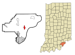
Coordinates: 38°27′7″N 85°40′2″W / 38.45194°N 85.66722°WCoordinates: 38°27′7″N 85°40′2″W / 38.45194°N 85.66722°W Country United States State Indiana County Clark Government - Mayor Bob Hall (R) Area - Total 2.3 sq mi (6.0 km2) - Land 2.3 sq mi (6.0 km2) - Water 0.0 sq mi (0.0 km2) Elevation 591 ft (180 m) Population (2010) - Total 7,585 - Density 2,572.1/sq mi (993.1/km2) Time zone EST (UTC-5) - Summer (DST) EDT (UTC-4) ZIP code 47111 Area code(s) 812 FIPS code 18-12124[1] GNIS feature ID 0432425[2] Website http://www.cityofcharlestown.com Charlestown is a city in Clark County, Indiana, United States. The population was 7,585 at the 2010 census.
Contents
History
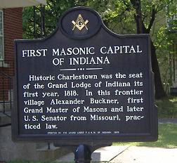
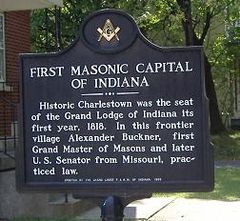 Marker denoting first Grand Lodge in Indiana
Charlestown was established in 1808, named after one of its surveyors, Charles Beggs, upon 300 acres (1.2 km2), of which 3 acres (12,000 m2) was designated for a town square. It was established one mile (1.6 km) northeast of Springville, and was responsible for Springville's demise.
Milling was important to the town, as the first mill was built in the area, on Fourteen Mile Creek, in 1804. This mill would be abandoned when John Work built a mill by use of a tunnel in 1814. Today, that mill is part of the Tunnel Mill Scout Reservation.
Charlestown was the home of the first Indiana state governor, Jonathan Jennings.
From 1811-1878 Charlestown was the county seat of Clark County, but as Jeffersonville had surpassed it economically, the county seat reverted back to Jeffersonville in 1878.
In 1818 the first Grand Lodge of Free & Accepted Masons in Indiana met in Charlestown, due to Jonathan Jennings' influence.
In 1940 the population of Charlestown was 900, but it swelled to 13,400 due to the building and operation of the Indiana Army Ammunition Plant (INAAP). This created a housing problem, as chicken, wood, and wash houses had to house all the new residents that flocked to area for the jobs created by the INAAP. Additional problems caused by the rapid influx of new residents was improper sanitation at restaurants, inefficient sewers, gambling, panhandling, and diseases such as typhoid and malaria.
Geography
Charlestown is located at 38°27′7″N 85°40′2″W / 38.45194°N 85.66722°W (38.451984, -85.667224)[3].
According to the United States Census Bureau, the city has a total area of 2.3 square miles (6.0 km2), all of it land.
Historical populations Census Pop. %± 1900 915 — 1910 864 −5.6% 1920 820 −5.1% 1930 859 4.8% 1940 939 9.3% 1950 4,785 409.6% 1960 5,726 19.7% 1970 5,933 3.6% 1980 5,596 −5.7% 1990 5,889 5.2% 2000 5,993 1.8% 2010 7,585 26.6% Demographics
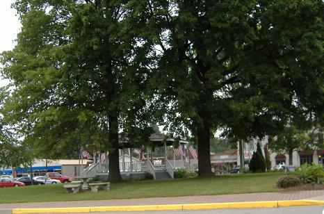
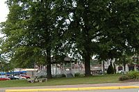 Charlestown town square
As of the census[1] of 2000, there were 5,993 people, 2,341 households, and 1,615 families residing in the city. The population density was 2,570.0 people per square mile (993.1/km²). There were 2,489 housing units at an average density of 1,067.4 per square mile (412.4/km²). The racial makeup of the city was 92.91% White, 2.47% African American, 0.27% Native American, 0.17% Asian, 0.07% Pacific Islander, 2.77% from other races, and 1.35% from two or more races. Hispanic or Latino of any race were 5.32% of the population.
There were 2,341 households out of which 37.0% had children under the age of 18 living with them, 45.9% were married couples living together, 18.5% had a female householder with no husband present, and 31.0% were non-families. 26.4% of all households were made up of individuals and 9.9% had someone living alone who was 65 years of age or older. The average household size was 2.56 and the average family size was 3.03.
In the city the population was spread out with 29.0% under the age of 18, 10.8% from 18 to 24, 30.4% from 25 to 44, 18.9% from 45 to 64, and 10.9% who were 65 years of age or older. The median age was 32 years. For every 100 females there were 92.1 males. For every 100 females age 18 and over, there were 87.2 males.
The median income for a household in the city was $28,238, and the median income for a family was $35,592. Males had a median income of $27,240 versus $21,901 for females. The per capita income for the city was $13,892. About 15.8% of families and 19.2% of the population were below the poverty line, including 23.8% of those under age 18 and 17.8% of those age 65 or over.
References
- ^ a b "American FactFinder". United States Census Bureau. http://factfinder.census.gov. Retrieved 2008-01-31.
- ^ "US Board on Geographic Names". United States Geological Survey. 2007-10-25. http://geonames.usgs.gov. Retrieved 2008-01-31.
- ^ "US Gazetteer files: 2010, 2000, and 1990". United States Census Bureau. 2011-02-12. http://www.census.gov/geo/www/gazetteer/gazette.html. Retrieved 2011-04-23.
External links
Municipalities and communities of Clark County, Indiana Cities Charlestown | Jeffersonville | Sellersburg

Towns Borden | Clarksville | Utica
Townships Bethlehem | Carr | Charlestown | Jeffersonville | Monroe | Oregon | Owen | Silver Creek | Union | Utica | Washington | Wood
Unincorporated
communitiesArctic Springs | Bennettsville | Bethlehem | Blue Lick | Broom Hill | Carwood | Cementville | Hamburg | Henryville | Hibernia | Longview Beach | Marysville | Memphis | Nabb | New Liberty | New Market | New Washington | Oak Park | Otisco | Otto | Owen | Perry Crossing | Prather | River Ridge | Rolling Hills | Runyantown | Speed | Starlight | Sunset Village | Underwood | Vesta | Watson | Wilson
Categories:- Cities in Indiana
- Charlestown, Indiana
- Louisville metropolitan area
- Populated places in Clark County, Indiana

Wikimedia Foundation. 2010.