- Sellersburg, Indiana
Infobox Settlement
official_name = Sellersburg, Indiana
settlement_type =Town
nickname =
motto =
imagesize =
image_caption =
image_
imagesize =
image_caption =
image_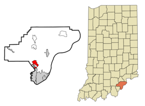
mapsize = 250x200px
map_caption = Location of Sellersburg in the state ofIndiana
mapsize1 =
map_caption1 =subdivision_type = Country
subdivision_name =United States
subdivision_type1 = State
subdivision_name1 =Indiana
subdivision_type2 = County
subdivision_name2 = Clark
subdivision_type3 = Township
subdivision_name3 = Silver Creek
government_footnotes =
government_type =
leader_title =
leader_name =
leader_title1 =
leader_name1 =
established_title =
established_date =area_footnotes =
unit_pref = Imperial
area_magnitude =
area_total_km2 = 10.4
area_land_km2 = 10.4
area_water_km2 = 0.0
area_total_sq_mi = 4.0
area_land_sq_mi = 4.0
area_water_sq_mi = 0.0population_as_of = 2000
population_footnotes =
population_total = 6071
population_density_km2 = 585.2
population_density_sq_mi = 1515.8timezone = Eastern (EST)
utc_offset = -5
timezone_DST = EDT
utc_offset_DST = -4
elevation_footnotes =
elevation_m = 148
elevation_ft = 486
latd = 38 |latm = 23 |lats = 13 |latNS = N
longd = 85 |longm = 45 |longs = 27 |longEW = Wpostal_code_type =
ZIP code
postal_code = 47172
area_code = 812
blank_name = FIPS code
blank_info = 18-68670GR|2
blank1_name = GNIS feature ID
blank1_info = 0449730GR|3
website =
footnotes =Sellersburg is a small
farm town in Silver Creek Township, Clark County,Indiana ,United States . The population was 6,071 at the 2000 census.Geography
Sellersburg is located at coor dms|38|23|13|N|85|45|27|W|city (38.386823, -85.757543)GR|1. It is approx. 11.14 miles north of
Louisville, Kentucky .According to the
United States Census Bureau , the town has a total area of 4.0square mile s (10.4km² ), of which, 4.0 square miles (10.4 km²) of it is land and 0.25% is water.Demographics
As of the
census GR|2 of 2000, there were 6,072 people, 2,407 households, and 1,757 families residing in the town. Thepopulation density was 1,515.8 people per square mile (584.5/km²). There were 2,535 housing units at an average density of 632.9/sq mi (244.1/km²).The racial makeup of the town was 98.48% White, 1.04% Hispanic or Latino of any race, 0.28% Native American, 0.25% African American, 0.16% Asian, 0.02% Pacific Islander, 0.28% from other races, and 0.53% from two or more races.
There were 2,407 households out of which 33.0% had children under the age of 18 living with them, 57.0% were married couples living together, 11.8% had a female householder with no husband present, and 27.0% were non-families. 23.3% of all households were made up of individuals and 7.2% had someone living alone who was 65 years of age or older. The average household size was 2.50 and the average family size was 2.92.
In the town the population was spread out with 24.5% under the age of 18, 8.4% from 18 to 24, 30.8% from 25 to 44, 23.4% from 45 to 64, and 12.8% who were 65 years of age or older. The median age was 37 years. For every 100 females there were 92.6 males. For every 100 females age 18 and over, there were 89.3 males.
The median income for a household in the town was $39,832, and the median income for a family was $46,512. Males had a median income of $30,977 versus $21,974 for females. The
per capita income for the town was $18,648. About 4.1% of families and 5.3% of the population were below thepoverty line , including 8.2% of those under age 18 and 2.6% of those age 65 or over.History
Sellersburg is named for its founder Moses Sellers who laid out the town in the early 1800s.
For many years the town was the site of the split of US-31 into US-31E and US-31W which reconnected in southern Kentucky. US-31 has been rerouted but still runs through the town.
In the early 1980s the town became home for
Clark Regional Airport , a regional airport handling small private aircraft.In 1994, local PGA golfer
Fuzzy Zoeller opened Covered Bridge Golf Club, which he designed. Covered Bridge has been host to many pro/celebrity golf tournaments which have raised money for local charities. The Wolf Challenge is held annually. Notable celebrities played in the2006 Wolf Challenge in Sellersburg, includingBill Murray ,Kevin Costner , John Daly, andCris Judd .President
George W. Bush visited Sellersburg onOctober 28 ,2006 .References
External links
Wikimedia Foundation. 2010.