- Charlestown Township, Clark County, Indiana
-
Charlestown Township — Township — Location of Charlestown Township in Clark County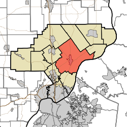
Coordinates: 38°27′34″N 85°39′46″W / 38.45944°N 85.66278°WCoordinates: 38°27′34″N 85°39′46″W / 38.45944°N 85.66278°W Country United States State Indiana County Clark Government - Type Indiana township Area - Total 64.65 sq mi (167.43 km2) - Land 64.5 sq mi (167.05 km2) - Water 0.15 sq mi (0.38 km2) Elevation[1] 610 ft (186 m) Population (2000) - Total 11,457 - Density 177.64/sq mi (68.59/km2) FIPS code 18-12142[2] GNIS feature ID 453197 Charlestown Township is one of twelve townships in Clark County, Indiana. As of the 2000 census, its population was 11,457.
Contents
Geography
Charlestown Township covers an area of 64.65 square miles (167.4 km2); 0.15 square miles (0.39 km2) (0.23 percent) of this is water.
Cities and towns
Unincorporated towns
- Otisco
- Rolling Hills
- Springville (extinct)
Adjacent townships
- Oregon Township (north)
- Owen Township (east)
- Utica Township (south)
- Silver Creek Township (southwest)
- Union Township (west)
- Monroe Township (northwest)
Major highways
Cemeteries
The township contains eight cemeteries: Bottoff, Fifty-four, Long, Pleasant Grove, Robinson, Saint Michaels, Seedtick and Worrell.
References
- "Charlestown Township, Clark County, Indiana". Geographic Names Information System, U.S. Geological Survey. http://geonames.usgs.gov/pls/gnispublic/f?p=gnispq:3:::NO::P3_FID:453197. Retrieved 2009-09-24.
- United States Census Bureau cartographic boundary files
- ^ "US Board on Geographic Names". United States Geological Survey. 2007-10-25. http://geonames.usgs.gov. Retrieved 2008-01-31.
- ^ "American FactFinder". United States Census Bureau. http://factfinder.census.gov. Retrieved 2008-01-31.
External links
Municipalities and communities of Clark County, Indiana Cities 
Towns Borden | Clarksville | Utica
Townships Bethlehem | Carr | Charlestown | Jeffersonville | Monroe | Oregon | Owen | Silver Creek | Union | Utica | Washington | Wood
Unincorporated
communitiesArctic Springs | Bennettsville | Bethlehem | Blue Lick | Broom Hill | Carwood | Cementville | Hamburg | Henryville | Hibernia | Longview Beach | Marysville | Memphis | Nabb | New Liberty | New Market | New Washington | Oak Park | Otisco | Otto | Owen | Perry Crossing | Prather | River Ridge | Rolling Hills | Runyantown | Speed | Starlight | Sunset Village | Underwood | Vesta | Watson | Wilson
Categories:- Townships in Clark County, Indiana

Wikimedia Foundation. 2010.