- Old Hunstanton
-
Coordinates: 52°57′03″N 0°30′18″E / 52.95089°N 0.50507°E
Old Hunstanton 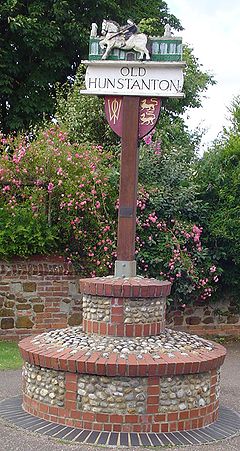
Signpost in Old Hunstanton
 Old Hunstanton
Old Hunstanton shown within NorfolkArea 5.35 km2 (2.07 sq mi) Population 47 - Density 9 /km2 (23 /sq mi) OS grid reference TF683422 Shire county Norfolk Region East Country England Sovereign state United Kingdom Post town HUNSTANTON Postcode district PE36 Police Norfolk Fire Norfolk Ambulance East of England EU Parliament East of England List of places: UK • England • Norfolk Old Hunstanton is a village and civil parish in the English county of Norfolk. It covers an area of 5.35 km2 (2.07 sq mi) and had a population of 47 in 25 households as of the 2001 census.[1] For the purposes of local government, it falls within the district of North Norfolk.
This small settlement adjoins to the north of the larger resort of Hunstanton. The quiet character of Old Hunstanton remains distinct from and complements that of its busy sibling, with clifftop walks past a disused lighthouse and the ruins of St. Edmund's Chapel, built in 1272. The River Hun runs to the coast just to the east of old Hunstanton.
At Old Hunstanton is a RNLI Lifeboat station with a B class (Atlantic) boat and a Hovercraft.
Notes
- ^ Census population and household counts for unparished urban areas and all parishes. Office for National Statistics & Norfolk County Council (2001). Retrieved 20 June 2009.
External links
Categories:- Villages in Norfolk
- Populated coastal places in Norfolk
- Civil parishes in Norfolk
- Norfolk geography stubs


Wikimedia Foundation. 2010.