- Batticaloa
-
This article is about the capital of the Eastern Province, Sri Lanka. For other uses, see Batticaloa (disambiguation).
Batticaloa
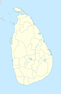
மட்டக்களப்பு— City — Coordinates: 7°43′0″N 81°42′0″E / 7.716667°N 81.7°E Country Sri Lanka Province Eastern District Batticaloa DS Division Manmunai North Government – Type Municipal Council – Mayor Sivageetha Prabhakaran (UPFA (TMVP)) Area – Total 2,854 km2 (1,101.9 sq mi) – Land 2,610 km2 (1,007.7 sq mi) – Water 244 km2 (94.2 sq mi) Population (2001) – Total 95,489 – Density 186/km2 (481.7/sq mi) – Demonym Batticaloan Time zone Sri Lanka Standard Time Zone (UTC+5:30) Website Batticaloa city website Batticaloa (Tamil: மட்டக்களப்பு, Sinhala: මඩකලපුව) is a city in the Eastern province of Sri Lanka. It is the seat of the Eastern University of Sri Lanka. It is on the east coast, 69 miles (111 km) south by south east of Trincomalee, and is situated on an island.
Contents
Etymology
Batticaloa is a Portuguese derivation. Some sources cite the original name of the region being the Sinhalese "Mudda Kalapuwa" (translation: Mud Lagoon). This is assumed to have been adapted by the later Tamil settlers.[1]
According to Mattakallappu Manmiyam (மட்டக்களப்பு மான்மியம்) the word Mattakkallpu consists Tamil words "Mattu"(மட்டு) means honey or Matta-derived from "Mattam"(மட்டம்) means (Flat) and geographical name KaLappu. Mukkuwa named this place[citation needed] as KaLappu-Mattam or boundary of lagoon later it became Matta-Kallappu or Flat Lagoon. Similarly the Mattu-Kallppu or "Confluence of honey river" became {citation or literary evidence needed}Mattakkallppu.
Geography
Geography
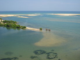
Batticaloa is in the eastern coast of Sri Lanka on a flat coastal plain boarded by the Indian Ocean in the east occupies the central part of the eastern Sri Lanka. Its average elevation is around 5 meters.[2] Scenic beauty of the Batticaloa is the Lagoons. Batticaloa district has three lagoons such as Batticaloa Lagoon, Valaichchenai Lagoon, and Vakari (Panichchankerni) Lagoon. Among these lagoon, Batticaloa Lagoon is the largest lagoon and has 56 km long 162 square km area, extending from Pankudaweli in North and Kalmunai in South.
There are several islands within the Batticaloa Lagoon such as Puliayantheevu, Buffaloa Island, Bone Island Many bridges are built across the lagoon connecting the landmasses and the islands. The Puliayantheevu is the metropolitan place of the city. The biggest bridge of all is Lady Manning bridge located at Kallady, which is the main access path to the city from the southern places of the district. This bridge is also famous for Singing fishes which was considered musical sounds heard in the Kallady lagoon in the full moon day. A priest named Father Lang recorded this musical charm and broadcast it in the 1960s over the (Sri Lanka Broadcasting Cooperation)
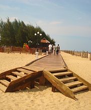
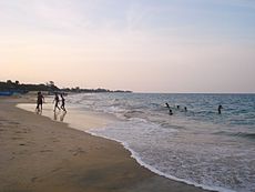
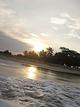
Batticaloa beaches are sandy and located along 4 km shoreline in the city and further extend through the neighboring places. Kallady beach, the popular serene beachfront where large numbers of people gather in the city. Also Batticaloa such as the heavenly beaches of Pasikudah and Kalkudah have rarely been molested. Pasikudah is a bay protected from the ocean. The significance of Pasikudah is that its bed is flat and sandy and has a pleasant effect on the feet. This can be experienced up to nearly 150 to 200 meters from the shore. Pasikudah is an ideal location for those who wish to learn swimming. Pasikudah is in perfect harmony with its stunning natural setting on the island's eastern tip. With its atmosphere of rarefied tranquility, it is a place for relaxation and renewal.
Climate
Batticaloa's features a tropical wet and dry climate under the Koppen climate classification. Batticaloa's climate is temperate all throughout the year. From March to May the temperature averages around 32 degrees Celsius (88 degrees Fahrenheit) maximum. These periods will be warmest throughout the year. During the monsoon season from November to February heavy rains are recorded, where the average temperature fallen to 15 degrees Celsius .Rainfall in Batticaloa averages around 1,400 millimeter (551 in). [3]
Climate data for Batticaloa(1961-1990) Month Jan Feb Mar Apr May Jun Jul Aug Sep Oct Nov Dec Year Average high °C (°F) 27.8
(82.0)28.6
(83.5)30.0
(86.0)31.6
(88.9)33.0
(91.4)34.0
(93.2)33.4
(92.1)33.1
(91.6)32.2
(90.0)30.9
(87.6)29.3
(84.7)28.1
(82.6)31.0 Average low °C (°F) 23.2
(73.8)23.6
(74.5)24.3
(75.7)25.3
(77.5)25.7
(78.3)25.6
(78.1)25.3
(77.5)25.1
(77.2)24.8
(76.6)24.3
(75.7)23.8
(74.8)23.5
(74.3)24.54 Precipitation mm (inches) 210.3
(8.28)128.4
(5.055)89.0
(3.504)55.0
(2.165)39.3
(1.547)23.9
(0.941)41.4
(1.63)48.5
(1.909)67.0
(2.638)180
(7.09)349.6
(13.764)418.5
(16.476)1,650.9
(64.996)Source: WMO History
Main article: History of Eastern TamilsThe earliest historical artifacts are a dagaba and Chatra from the Ruhuna kingdom of King Kavantissa (1st century BC), found in the Dutch fort built in the seventeenth century CE. Many archeological sites dating to pre-Christian times have been found in this region. Thus Lankavihara, Roththei (Roththa) temple, Kinnaragala, Rahathgala (Shanthamalai), Veheragalkanda (Pulukunai), eluvamulla (Pullumuilai), and Taaththon Kovil, are some sites identified and listed by the Government archaeological survey. Many towns of the area show toponymic evidence, as well as evidence from stone inscriptions, of ancient sites related to 'Seruvavila' and other Buddhist shrines of the area. Although a large number of ancient historical sites have been identified, archaeological excavations and detailed studies have been very limited. A map of the Buddhist sites in the eastern coastal belt near Batticaloa and extending towards Trincomalee has been given in a "Buddhist Times" publication.[4]
Early history
Mattakallappu Manmiyam refers (மட்டக்களப்பு மான்மியம்) Mukkuva or Mutkuhar are known as the first people migrated to this land and constructed seven villages in various areas. They immigrated their people from India and established the kingdom of Mukkuva. The name of the villages and towns in Batticaloa still holds the historical evidence of the ancient batticaloan people. When Mutkuhar intruded through the salty water and reached the destination of their voyage at the forests situated around the lagoon. When they finished. The name given by the Mukkuva was "Kallpu-Mattam" which literally means "boundary of lagoon". Later it was called "Matta-Kallappu" which indicates the destination of Mukkuva's voyage and the water is flat.
Later Karikala Chola invaded and took thousands of prisoners. Gajabahu went to Chola Nadu and brought those prisoners and their descendents back. Along with the released prisoners, thousands of Tamils were brought and settled. They were settled in the Eastern, Western and Central Provinces.
After that there was a local ruler who ruled from Digavapi. Later the capital shifted to Anuradhapura. When Anuradhapura was destroyed, the capital changed from Anuradhapura to Pollonaruwa. When Pollonaruwa was destroyed the capital moved to Kotte and then to Kandy. Anuradhapura was destroyed by Rajaraja Cholan and Pollonaruwa was destroyed by Kalinga Magha.
As a catalyst for change, Kalinga Magha is arguably one of the most significant rulers in Sri Lankan history. His invasion marks the final - cataclysmic - destruction of the kingdom of Rajarata, which had for so long been the heart of native power on the island. The great cities of the ancient kings were now lost and disappeared into the jungle, and were not rediscovered until the 19th century. Native power was henceforth centred on a kaleidoscopically shifting collection of kingdoms in south and central Sri Lanka. The north, in the meanwhile, eventually evolved into the Jaffna Kingdom, which was subjected colonial rule by the Portuguese in 1619.
Kalinga Magha's geopolitical impact is reflected in the changing language of the Culavamsa as well. The traditional divisions of Sri Lanka, into Rajarata, Dhakkinadesa, and Ruhuna, first undergo a change of names (Rajarata becomes Pathithadesa, Dhakkinadesa becomes Mayarata), and then slip into obsolescence altogether. Their successor kingdoms tended to be geographically smaller and centred on a strong citadel-capital, such as Yapahuwa or Gampola; they also tended to be much short lived, like Sitawaka.
The bitter memory of Magha's invasion also tainted the previously close relationship between the Sinhalese and the Chola, Chera and Pandya inhabitants of southern India. Whereas the great families of Rajarata had invariably been polity-spanning clans, with extensive intermarriage between Indian and Sri Lankan branches, the royal families of the Middle Ages became more distinctive and recognisably Sinhalese in the modern sense of the word. This is not to say however that south Indian influence in Sri Lankan politics ended altogether - witness the Nayakkar dynasty of Kandy. However the age of the great, Indo-Lankan clans like the Moriya and Lambakanna was over.
Native authority on Sri Lanka, already in decline before Magha's invasion, never fully recovered from the invasion; the next three centuries were marked by near-anarchy. This period of Sri Lanka's history ended only with the arrival of a foe that would eventually subsume both the great empires of south India and the kingdoms of Sri Lanka under its authority - the forces of colonial Europe.
The Kandyan Kings have ruled Eastern Province throughout history. Thus the racial mixture was ensured by the Kandyan kings marrying into the families of Batticaloa rulers. Dutch invasion took place through Batticaloa with the alliance of Batticaloa rulers and Kandyan king Rajasinghe. Both were Tamils and Hindus. even though the Kandyan Kingdom was Sinhala Buddhist to the core, the kings were Tamil Hindus of Madurai Nayakkar origin.
Since Kandyan kings were of Madurai origin they brought ship loads of Mappilla Muslims from Kerala as the trading partners of the kingdom and granted asylum when the Portuguese launched the Holocaust against the Muslims in Sri Lanka. Thus the Eastern Province is the residence of majority of Muslims and a safe haven for them during the Sri Lankan Civil War.
Places like Karadiyan Aru and Urugam contain stone inscriptions in Brāhmī script which are still in existence.
History after the fall of Polonnaruwa
With the decline of the Rohana sub-kingdom and the defeat of Polonnaruwa, coming with the rise of Chola power, i.e., from about the 13th century CE, these regions became wild. The many irrigation works (tanks etc., which exist even today) became home to malaria( see History of Sri Lanka). In the meantime, the eastern coastal region remained less affected by Malaria and began to be occupied. Thus sea faring people who had begun to settle down along the coast since the Anuradhapura times, circa 6th Century CE began to flourish. The forests continued to be dominated by the Veddha population which claimed kingship ("cross-cousins") with the Sinhala kings of Kandy.[5]
Parakramabahu's coronation took place in 1236. He turned his attention to the recovery of Polonnaruwa from the Tamils, and achieved this purpose by 1244. In this connection two kings are mentioned, Kalinga Magha and Jaya Bahu, who had been in power forty years, apparently reckoned from the time of the military rule after Sahasa Malla. As the Tamil war' and the `Malala war' as specifically mentioned by contemporary chronicles the two kings may have held different parts of the country. In the king's eleventh year (1244/5) Lanka was invaded by Chandrabhanu, a Javanese (Javaka) from Tambralinga, with a host armed with blow-pipes and poisoned arrows: he may have been a sea- robber, and though now repulsed descended on the Island later on.
The rest of the reign according to the contemporary records was spent in pious works; the king also held a convocation for the purpose of reforming the priesthood, whose discipline had been relaxed during the Tamil occupation. The chronicles make no mention of a great Pandyan invasion which seems to have taken place between 1254 and 1256, in which one of the kings of Lanka was slain and the other rendered tributary. From this it is clear that Parakramabahu- never had recovered the north of the Island, which certainly had been held by his great namesake.
Dutch Landing of 1602
From Cape Comorin the Dutch Admiral Spitzburgen steered his course to Point de Galle ; but, without landing there or at any of the other places which were strongly fortified by the Portuguese, he sailed round the south coast of the Island and made for Batticaloa, where he anchored on the 31st May, 1602.
He learnt that the town of Batticaloa, where the chief of the province resided, was about three miles (5 km) inland ; so he sent him a messenger proposing to enter into trade with him. In the meantime he learnt from some Tamils who came on board that there was plenty of pepper and cinnamon to be had, but that it was to be obtained from the chief of the place. These Tamils brought with them a Portuguese interpreter; for Portuguese was the only European language then heard or spoken in Ceylon, and the natives of the Island had no idea that there were other white people who spoke a different language.
The Admiral was taken from Batticaloa to Kandy and was given a liberation hero's welcome as King Rajasinghe seized the opportunity to get rid of the Portuguese, the oppressors who were slowly encroaching the island systematically and promoting subversion against Rajasinghe.
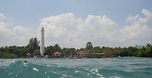
The Batticaloa fort was built by the Portuguese in 1628 and was the first to be captured by the Dutch (18 May 1638). It is one of the most picturesque of the small Dutch fort of Sri Lanka, it’s situated in an island, still in good condition. Near Batticaloa the Portuguese had a tiny fort at Tanavare (there is a map of it but no remains) There is a 1st century CE Buddhist Dagaba inside the Dutch fort.
World War II
In 1942, during World War II, the aircraft carrier HMS Hermes and escorting destroyer HMAS Vampire were stationed at Trincomalee. Both these ships came under Japanese aerial attack off Batticaloa and were sunk. Some of the remnants of HMS Hermes still remain at around 9 nautical miles (17 km) off Baticaloa.
Place in the civil war
The Batticaloa is claimed by Tamils organization like the LTTE as part of their Tamil Homeland, Tamil Eelam. The city has witnessed countless murders, rapes, mass massacres and wholesale disappearance of civilians, especially after Black July and the subsequent Sri Lankan civil war.[citation needed] From November 2008 to February 2009, the Ceylon Human Rights Authority reported 75 people went missing in Batticaloa district.[6] ] Batticaloa is the primary focus of attention of Vinayagamoorthy Muralitharan, better known as Karuna Amman, a former LTTE commander who broke away from the main organization in 2004. The LTTE claims that "Karuna" feared disciplinary action from the leadership for financial and personal malpractices. Karuna operated his own political (Not yet recognised as a political party even though an application was submitted three years before) and military group, the Tamil-Eala Makkal Viduthalai Pulikal, TMVP, though he is now a parliamentarian with the ruling political party in the country, the Sri Lanka Freedom Party (SLFP).[7] At first the LTTE attempted to eliminate the TMVP on its own and demanded that the Sri Lankan government not interfere. Subsequently, the LTTE called for the elimination of TMVP as part of the cease-fire agreement. However, TMVP claimed to be a political party and asked for protection from attacks from the LTTE. It had no real option except to covertly collaborate with the government forces and function as a paramilitary group of the Sri Lankan Army. Thus the TMVP (referred to as the Karuna Group) is strongly opposed to the LTTE. The Muslims, another Tamil-speaking group, have suffered ethnic cleansing at the hands of the LTTE, commencing with the murder of 140 Muslims during prayer[8] In a series of battles which began with the confrontation at Mavil aru and Sampur, Vaharai in August 2006, the Sri Lankan military on July 11, 2007, ousted the Tamil Tigers from their last stronghold of Thoppigala (Batticaloa province) in Eastern Sri Lanka.[9] The LTTE defeat is considered to be a major blow to the Tiger regime which after that controlled only the Vanni area of northern Sri Lanka.
2004 tsunami
The town was also one of the worst hit during the tsunami of December 26, 2004. The water rose up to 4.7 metres (15 ft) within 90 minutes of the beginning of the 2004 Indian Ocean earthquake.
Modern Batticaloa City
The city has four main divisions.
- Pullianthivu:Seat of many government department and offices, schools, banks religious places, General Hospital, Weber Stadium and Shops. Nowadays many NGO offices including ICRC, UN, UNICEF, WORLD VISION etc.are located also.
- Koddamunai: Schools, Banks, Sri Lanka Telecom regional office for East, Shops and many government offices are located. Two bridges called Perya Palam and Puthuppalam are connects Pulianthivu island with Koddaminai land mass.
- Kallady: Here there are many Government buildings and private industries, schools, hospitals and Eastern University Medical Faculty. Kallady Lady Manning bridge connects Kallady and Arasay.
- Puthur: This is where the domestic airport of Batticaloa is located.
Demography
Batticaloa is on the East coast, 314 km from Colombo. The population of 95,489 consists mainly of Tamils, Moors, Sinhalese, Euro-Asian Burghers(specifically Portuguese Burghers and Dutch Burghers) and indigenous Vedar population.
The District of Batticaloa itself consists of several administrative divisions, which are: Manmunai North, Manmunai West, Manmunai South West, Manmunai South & East Pattu, Manmunai Pattu, Koralai Pattu North, Porativu Pattu, Kattankudy, Eravur Pattu, Eravur Town, Koralai Pattu and Koralai Pattu West. Some 515,707 persons (50.9% female) were recorded in the 2000 census, constituting 128,689 families. Religion based statistics in the year 2000 are: Hindus 68%, Christians 5.9%, Muslims 25%, with a small numbers of Buddhists and others [Source: Department of Census & Statics, Sri Lanka]. These figures became even more polarized towards Hindus during the LTTE occupation which came to an end in 2007 (see Eelam War IV).[citation needed]
According to the 2001 census, the total population was 486,447. Of which 6,345 were Sinhalese, 362,431 Ceylonese Tamil, 727 Estate Tamil, 114,111 Moor, 2,696 Burgher and 21 Malay.[10]
Educational institutions
The first educational institution established in Batticaloa was Bt. Methodist Central College, Batticaloa, founded in 1814. Other noteworthy institutions are: Cecilias Convent, Hindu College, St. Vincent Girls High School, St. Michael's College, Batticaloa, Sinhala Maha Vidyalaya and Shivananda Maha Vidyalayam. The Eastern University, Sri Lanka(EUSL), located in Vantharumoolai 16 km north of Batticaloa, was founded in 1980. Its development has been interrupted by the civil war. It is the cultural and economic focal point of the district of Batticaloa and extends its influence towards Trincomalee as well.
Cultural institutions
Batticaloa has historically been a centre of Portuguese Burgher culture, supported in the modern era by the Catholic Burgher Union. In the 1980s, despite Burger immigration to Australia, the Union still numbered some 2,000 speakers of Sri Lankan Portuguese, making them the largest community still speaking the dialect.[11]
Religious institutions
Shri Mamangeshwarar Kovil is one of the main holy places for Hindus in the country is located in a place called Amirthakally which is 6 Kilometers away from Batticaloa town. Hindus believe that by bathing in the water of sacred water of Mamangeshwarar tank, the departed souls of their family will be receiving better attainments in their cycle of its transmigrations.
Puliyanthivu Anaipanthy Sri Sithy Vigneswarar Alayam, Puliyanthivu Sithiravelayutha Swamy Koyil, Puliyanthivu Thiroupathaiyaman Koyil,Kokaticholai Thanthondreeswaram Alayam, Sitrandy murukan kovil, Sri Thakkaiyageswara Kovil, and Arayampathy [12] Sri Kandaswamy/KannakaiAmman Kovil are important from a devotional point of view. The Mandur (மண்டூர்) temple is in the southern end, while the Mamangeshwarar temple is in the western-most edge at Muhaththuvaram (முகத்துவாரம்). The latter is a historic harbour and ancient Buddhist shrine, mentioned in the "Dhathu Vamsa". While the Dagaba and shrine in the Dutch Fort is the oldest (1st century CE), Mangalaramaya is a well known modern Buddhist temple in Batticaloa. The Colany Mosque, and the Koddamunai Dharga and Madrasa are two noteworthy Muslim institutions. There are a large number of mosques in the region.[13]
Economic activities
Rice and coconuts are the two staples of the district, and steamers trading round the island call regularly at the port. The lagoon is famous for its "singing fish," supposed to be shell-fish which give forth musical notes. The district has a remnant of Veddahs or wild men of the wood. Prior to the Sri Lankan civil war, there were large scale shrimp farms as well as fish and rice processing activities. Batticaloa shows a huge potential for tourism related industries.
- Kalladi Beach
Transport
Batticaloa is the terminus of a Broad gauge branch railway of the Sri Lanka Government Railway network. Batticaloa Airport is a military air force base.
See also
References
- ^ "Revising the place names of Sri Lanka". The Island. http://www.island.lk/2009/05/30/satmag2.html. Retrieved 2010-02-14.
- ^ Geographic Features
- ^ Weatherbase
- ^ Buddhist Times, March issue, 2007
- ^ G. Obesekera
- ^ « In peacetime, Sri Lankans still disappear Global Post
- ^ « East offers glimpse of post-war Sri Lanka GlobalPost
- ^ 2006 August « 1 MUSLIM NATION
- ^ "'War victory party' in Sri Lanka". BBC News. 2007-07-12. http://news.bbc.co.uk/2/hi/south_asia/6895809.stm. Retrieved 2010-04-26.
- ^ "Table 2 : Percentage distribution of population by district and age (Both sexes)" (PDF). http://www.statistics.gov.lk/PopHouSat/PDF/p7%20population%20and%20Housing%20Text-11-12-06.pdf. Retrieved 2010-07-05.
- ^ http://books.google.com/books?id=i7gPAQAAMAAJ&q=%22Catholic+Burgher+Union+%22&dq=%22Catholic+Burgher+Union+%22&hl=en
- ^ http://ta.wikipedia.org/wiki/ஆரையம்பதி
- ^ Mosques in the Batti region
 This article incorporates text from a publication now in the public domain: Chisholm, Hugh, ed (1911). Encyclopædia Britannica (11th ed.). Cambridge University Press.
External links
- Detailed map of Batticaloa and Sri Lanka
- History of Batticaloa(Tamil)
- History of Kaluthavalai(Tamil)
- The Hindu Temple(Tamil)
- Mattakkalappu Poorva Sariththiram
Urban councils of Sri Lanka Ambalangoda · Ampara · Anuradhapura · Balangoda · Bandarawela · Beruwala · Boralesgamuwa · Chavakacheri · Chilaw · Dehiwala-Mount Lavinia · Embilipitiya · Eravur · Gampola · Hambantota · Haputale · Hatton-Dickoya · Hikkaduwa · Horana · Ja-Ela · Kadugannawa · Kalutara · Kattankudi · Katunayaka-Seeduwa · Kegalle · Kesbewa · Kinniya · Kolonnawa · Kuliyapitiya · Maharagama · Mannar · Minuwangoda · Monaragala · Mullaitivu · Nawalapitiya · Panadura · Peliyagoda · Point Pedro · Polonnaruwa · Puttalam · Seethawakapura · Tangalle · Talawakele-Lindula · Trincomalee · Valvettithura · Vavuniya · Wattala-Mabola · Wattegama · WeligamaCities in Sri Lanka Capitals 
Other cities Anuradhapura · Badulla · Batticaloa · Dehiwala-Mount Lavinia · Galle · Hambantota · Jaffna · Kandy · Kurunegala · Maharagama · Matara · Moratuwa · Negombo · Nuwara Eliya · Polonnaruwa · Ratnapura · TrincomaleeCategories:- Batticaloa
- Populated places in Eastern Province, Sri Lanka
- Kingdom of Kandy
Wikimedia Foundation. 2010.

