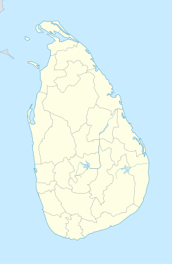
- Maharagama
-
Maharagama Coordinates: 6°51′N 79°59′E / 6.85°N 79.983°E Country Sri Lanka Province Western Province Government - Mayor Ms. Kanthi Kodikara Time zone Sri Lanka Standard Time Zone (UTC+5:30) Maharagama is a Town, Municipal Area in the Colombo District and a suburb of Colombo Sri Lanka. Situated on the High-Level (A4) Road about 15 km away from the centre of the commercial capital Colombo, Maharagama is the city with the third largest population (approx. 300,000), in Sri Lanka. It developed rapidly in the 1980s as a dormitory suburb of Colombo. Governed by the Maharagama Urban Council, the city possesses facilities like Super Markets, Department Stores, Clothing Shops, Food and Beverages Shops to fulfill the needs of Citizens.
Apart from that, there are number of Bus Routes passing the area as well as starting from the City itself that connect Maharagama to all the suburbs. Also there's a Depot of the Sri Lanka Transport Board located in Maharagama.
Surroundings - Boralesgamuwa, Nugegoda, Kottawa, Hokandara.
Important places around Maharagama
- National Youth Center
- National Institute of Education
- Cancer Hospital and Government Cancer Institute (National Cancer Institute)
- Sri Vajiragnana Dharmayatanaya (Bhikkhu Training Center)
- National Teachers' Training College
- National Ayurvedic Hospital
- lake
- University of Sri JayawardenaPura
Maps
Coordinates: 6°51′N 79°56′E / 6.85°N 79.933°E
Urban councils of Sri Lanka Ambalangoda · Ampara · Anuradhapura · Balangoda · Bandarawela · Beruwala · Boralesgamuwa · Chavakacheri · Chilaw · Dehiwala-Mount Lavinia · Embilipitiya · Eravur · Gampola · Hambantota · Haputale · Hatton-Dickoya · Hikkaduwa · Horana · Ja-Ela · Kadugannawa · Kalutara · Kattankudi · Katunayaka-Seeduwa · Kegalle · Kesbewa · Kinniya · Kolonnawa · Kuliyapitiya · Maharagama · Mannar · Minuwangoda · Monaragala · Mullaitivu · Nawalapitiya · Panadura · Peliyagoda · Point Pedro · Polonnaruwa · Puttalam · Seethawakapura · Tangalle · Talawakele-Lindula · Trincomalee · Valvettithura · Vavuniya · Wattala-Mabola · Wattegama · WeligamaCities in Sri Lanka Capitals 
Other cities Anuradhapura · Badulla · Batticaloa · Dehiwala-Mount Lavinia · Galle · Hambantota · Jaffna · Kandy · Kurunegala · Maharagama · Matara · Moratuwa · Negombo · Nuwara Eliya · Polonnaruwa · Ratnapura · TrincomaleeCategories:- Populated places in Western Province, Sri Lanka
- Colombo District
- Western Province, Sri Lanka geography stubs
Wikimedia Foundation. 2010.

