- Middletown, California
-
For the former town with this name in El Dorado County, see Middletown, El Dorado County, California. For the neighborhood in San Diego, see Middletown, San Diego, California.
Middletown — census-designated place — Location in Lake County and the state of California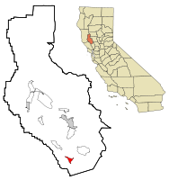
Coordinates: 38°45′09″N 122°36′54″W / 38.7525°N 122.615°WCoordinates: 38°45′09″N 122°36′54″W / 38.7525°N 122.615°W Country  United States
State  California
County Lake Area[1] – Total 1.844 sq mi (4.776 km2) – Land 1.844 sq mi (4.776 km2) – Water 0 sq mi (0 km2) 0% Elevation[2] 1,099 ft (335 m) Population (2010) – Total 1,323 – Density 717.5/sq mi (277/km2) Time zone Pacific (PST) (UTC-8) – Summer (DST) PDT (UTC-7) ZIP code 95461 Area code(s) 707 FIPS code 06-47332 GNIS feature ID 0228626 Middletown (formerly, Middle Station and Middleton) is a census-designated place (CDP) in Lake County, California, United States.[2] Middletown is located 11 miles (18 km) south of Lower Lake,[3] at an elevation of 1099 feet (335 m).[2] The population was 1,323 at the 2010 census, up from 1,020 at the 2000 census. Middletown was given its name because it is halfway between Lower Lake and Calistoga to the south.
Contents
Geography
According to the United States Census Bureau, the CDP has a total area of 1.8 square miles (4.7 km2), all of it land.
History
The first house was built at the site by J.H. Berry in 1870.[3] The town began in 1871.[3] The Middleton post office opened in 1871 and changed its name to Middletown in 1875.[3] Middletown enjoyed a robust quicksilver mining industry through the end of the 19th century. By the early 1900s, cattle and sheep ranching were prominent, along with some limited pear and walnut production. A resort economy sprung up around the various natural springs, and the area around Middletown attracted vacationers from the Bay Area through the 1950s. As travel costs decreased, tourism to the resorts diminished as patrons were able use air travel to vacation in more far flung places. Many of the resorts closed in the 1960s. In the 1970s and early 1980, exploitation of nearby geothermal resources brought an influx of workers into the local economy. Electrical power plants powered by "steam wells" were built in the mountains above Middletown. As housing prices in the Bay Area increased in the late 20th century, Middletown and nearby Hidden Valley Lake enjoyed a population boom as commuters moved to the Middletown area looking for affordable housing; keeping their jobs 50 to 100 miles away in Santa Rosa, Napa, and San Francisco. Middletown is currently populated primarily by commuters and retirees, enjoying a modest tourist trade based primarily on Harbin Hot Springs and the Twin Pine Casino located on the local Rancheria south of the town.
Demographics
2010
The 2010 United States Census[4] reported that Middletown had a population of 1,323. The population density was 717.4 people per square mile (277.0/km²). The racial makeup of Middletown was 985 (74.5%) White, 5 (0.4%) African American, 28 (2.1%) Native American, 18 (1.4%) Asian, 0 (0.0%) Pacific Islander, 225 (17.0%) from other races, and 62 (4.7%) from two or more races. Hispanic or Latino of any race were 413 persons (31.2%).
The Census reported that 1,317 people (99.5% of the population) lived in households, 6 (0.5%) lived in non-institutionalized group quarters, and 0 (0%) were institutionalized.
There were 508 households, out of which 189 (37.2%) had children under the age of 18 living in them, 223 (43.9%) were opposite-sex married couples living together, 72 (14.2%) had a female householder with no husband present, 41 (8.1%) had a male householder with no wife present. There were 36 (7.1%) unmarried opposite-sex partnerships, and 4 (0.8%) same-sex married couples or partnerships. 140 households (27.6%) were made up of individuals and 52 (10.2%) had someone living alone who was 65 years of age or older. The average household size was 2.59. There were 336 families (66.1% of all households); the average family size was 3.15.
The population was spread out with 376 people (28.4%) under the age of 18, 114 people (8.6%) aged 18 to 24, 309 people (23.4%) aged 25 to 44, 374 people (28.3%) aged 45 to 64, and 150 people (11.3%) who were 65 years of age or older. The median age was 37.4 years. For every 100 females there were 102.9 males. For every 100 females age 18 and over, there were 103.2 males.
There were 557 housing units at an average density of 302.0 per square mile (116.6/km²), of which 251 (49.4%) were owner-occupied, and 257 (50.6%) were occupied by renters. The homeowner vacancy rate was 3.8%; the rental vacancy rate was 4.1%. 659 people (49.8% of the population) lived in owner-occupied housing units and 658 people (49.7%) lived in rental housing units.
2000
As of the census[5] of 2000, there were 1,020 people, 392 households, and 263 families residing in the CDP. The population density was 395.6 people per square mile (152.6/km²). There were 427 housing units at an average density of 165.6 per square mile (63.9/km²). The racial makeup of the CDP was 83.73% White, 0.39% African American, 1.86% Native American, 1.67% Asian, 0.69% Pacific Islander, 8.24% from other races, and 3.43% from two or more races. Hispanic or Latino of any race were 22.84% of the population.
There were 392 households out of which 32.9% had children under the age of 18 living with them, 47.4% were married couples living together, 12.0% had a female householder with no husband present, and 32.7% were non-families. 24.0% of all households were made up of individuals and 10.2% had someone living alone who was 65 years of age or older. The average household size was 2.56 and the average family size was 3.05.
In the CDP the population was spread out with 26.6% under the age of 18, 7.5% from 18 to 24, 26.9% from 25 to 44, 23.9% from 45 to 64, and 15.2% who were 65 years of age or older. The median age was 38 years. For every 100 females there were 110.3 males. For every 100 females age 18 and over, there were 105.2 males.
The median income for a household in the CDP was $35,278, and the median income for a family was $38,571. Males had a median income of $33,214 versus $26,515 for females. The per capita income for the CDP was $14,135. About 21.2% of families and 20.9% of the population were below the poverty line, including 22.1% of those under age 18 and 28.3% of those age 65 or over.
Tourist attractions
Harbin Hot Springs, a New Age retreat center with spring pools, conference facilities, daily activities and classes, is located northwest of town.
The Middletown Rancheria, an Indian reservation of Pomo, Lake Miwok, Wappo, and Wintu is located just south of town.
Politics
In the state legislature Middletown is located in the 2nd Senate District, represented by Democrat Noreen Evans, and in the 1st Assembly District, represented by Democrat Wesley Chesbro. Federally, Middletown is located in California's 1st congressional district, which has a Cook PVI of D +10[6] and is represented by Democrat Mike Thompson.
Lake County has five districts. Middletown is a subset of District 1. As of January 2009, Jim Comstock is the supervisor of District 1.
References
- ^ U.S. Census
- ^ a b c U.S. Geological Survey Geographic Names Information System: Middletown, California
- ^ a b c d Durham, David L. (1998). California's Geographic Names: A Gazetteer of Historic and Modern Names of the State. Quill Driver Books. p. 106. ISBN 9781884995149.
- ^ All data are derived from the United States Census Bureau reports from the 2010 United States Census, and are accessible on-line here. The data on unmarried partnerships and same-sex married couples are from the Census report DEC_10_SF1_PCT15. All other housing and population data are from Census report DEC_10_DP_DPDP1. Both reports are viewable online or downloadable in a zip file containing a comma-delimited data file. The area data, from which densities are calculated, are available on-line here. Percentage totals may not add to 100% due to rounding. The Census Bureau defines families as a household containing one or more people related to the householder by birth, opposite-sex marriage, or adoption. People living in group quarters are tabulated by the Census Bureau as neither owners nor renters. For further details, see the text files accompanying the data files containing the Census reports mentioned above.
- ^ "American FactFinder". United States Census Bureau. http://factfinder.census.gov. Retrieved 2008-01-31.
- ^ "Will Gerrymandered Districts Stem the Wave of Voter Unrest?". Campaign Legal Center Blog. http://www.clcblog.org/blog_item-85.html. Retrieved 2007-10-20.
Further reading
- Our small town: a brief history of Middletown, Lake County, California community treasures (1999). OCLC 46540961
- Campbell, W. L. (Rohnert Park, Calif., 2000). The development of first, second, and third grade mathematics benchmark tests for the Middletown Unified School District: alignment with the state standards OCLC 46359225
- Moratto, M. J. (1974). An evaluation of the archaeological resources near Middletown, California OCLC 10261459 San Francisco: Archaeological Research Laboratory, Dept. of Anthropology, San Francisco State University
- Lusk, W. C., Reed, A. D., & Houston, C. E. (1963). Potential economic value of agricultural water in the Middletown Area of Lake County OCLC 24359273 Kelseyville, University of California, Agricultural Extension Service.
- United States. (1965). Project report on the recreation potentialities of the proposed Middletown Project, Lake County, California OCLC 24359190 San Francisco: The Service
- Tritchler, C. (1992). Middletown Cemetery, Butts Canyon Road and Highway 29, Lake County, Middletown, California: an inventory of gravesites, Middletown Cemetery District OCLC 28190358
External links
Municipalities and communities of Lake County, California Cities 
CDPs Clearlake Oaks | Clearlake Riviera | Cobb | Hidden Valley Lake | Kelseyville | Lower Lake | Lucerne | Middletown | Nice | North Lakeport | Soda Bay | Spring Valley | Upper Lake
Unincorporated
communitiesAdams | Bartlett Springs | Bonanza Springs | Buckingham Park | Caldwell Pines | Castle Rock Springs | Clear Lake Keys | Cooper | Crabtree Hot Springs | Crocker Place | Enterprise | Ettawa Springs | Finley | Forest Lake | Four Pines | Glenbrook | Glenhaven | Glenview | Harbin Springs | Harbin Springs Annex | Highland Springs | Hobergs | Hough Springs | Howard Springs | Loch Lomond | Mount Hannah Lodge | Newman Springs | Parramore Springs | Pepperwood Grove | Pine Grove | Pole Garden | Rice Fork Summer Homes | Riviera Estates | Riviera West | Rose Place | Salminas Resort | Saratoga Springs | Seigler Springs | Sunrise Vista | Three Crossing | Twin Lakes | Vann | Whispering Pines | Wild Bill Place
Indian
reservationsBig Valley Rancheria | Elem Indian Colony | Middletown Rancheria | Robinson Rancheria | Upper Lake Rancheria
Former
settlementsArabella | Baker Soda Spring | Barkerville | Bertha | Borax Springs | Bottle Rock | Dahnohabe | Eastlake | Elliott Springs | Ely's | Gifford Springs | Guenoc | Hopitsewah | Hoppins Springs | Howard Mill | Hullville | Kaci-badon | Kayote | Khawina | Knocti | Koi | Laurel Dell | Lolsel | Midlakes | Mirabel | Morgan | Nita | Olposel | Pences | Putah | Quicksilver | Reiff | Sanhedrin | Spiers Springs | Witter Springs
Categories:- Census-designated places in Lake County, California
- Populated places established in 1871


Wikimedia Foundation. 2010.