- Lucerne, Lake County, California
-
Lucerne — census-designated place — Location in Lake County and the state of California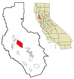
Coordinates: 39°05′25″N 122°47′47″W / 39.09028°N 122.79639°WCoordinates: 39°05′25″N 122°47′47″W / 39.09028°N 122.79639°W Country  United States
State  California
County Lake Area[1] – Total 4.988 sq mi (12.919 km2) – Land 4.978 sq mi (12.892 km2) – Water 0.010 sq mi (0.027 km2) 0.21% Elevation[2] 1,329 ft (405 m) Population (2010) – Total 3,067 – Density 614.9/sq mi (237.4/km2) ZIP code 95458 Area code(s) 707 Lucerne (formerly, Clear Lake Beach) is a census-designated place (CDP) in Lake County, California, United States.[2] Lucerne is located 7.25 miles (12 km) east-northeast of Lakeport,[3] at an elevation of 1329 feet (405 m).[2] The population was 3,067 at the 2010 census, up from 2,870 at the 2000 census.
Contents
Geography
According to the United States Census Bureau, the CDP has a total area of 5.0 square miles (13 km2), of which, over 99% is land.
At the 2000 census, according to the United States Census Bureau, the CDP had a total area of 19.5 square miles (51 km2), of which, 6.1 square miles (16 km2) of it was land and 13.4 square miles (35 km2) of it (68.67%) was water.
Demographics
2010
The 2010 United States Census[4] reported that Lucerne had a population of 3,067. The population density was 614.9 people per square mile (237.4/km²). The racial makeup of Lucerne was 2,581 (84.2%) White, 60 (2.0%) African American, 105 (3.4%) Native American, 26 (0.8%) Asian, 9 (0.3%) Pacific Islander, 94 (3.1%) from other races, and 192 (6.3%) from two or more races. Hispanic or Latino of any race were 367 persons (12.0%).
The Census reported that 3,032 people (98.9% of the population) lived in households, 35 (1.1%) lived in non-institutionalized group quarters, and 0 (0%) were institutionalized.
There were 1,372 households, out of which 308 (22.4%) had children under the age of 18 living in them, 454 (33.1%) were opposite-sex married couples living together, 183 (13.3%) had a female householder with no husband present, 78 (5.7%) had a male householder with no wife present. There were 165 (12.0%) unmarried opposite-sex partnerships, and 14 (1.0%) same-sex married couples or partnerships. 498 households (36.3%) were made up of individuals and 235 (17.1%) had someone living alone who was 65 years of age or older. The average household size was 2.21. There were 715 families (52.1% of all households); the average family size was 2.81.
The population was spread out with 554 people (18.1%) under the age of 18, 245 people (8.0%) aged 18 to 24, 593 people (19.3%) aged 25 to 44, 1,020 people (33.3%) aged 45 to 64, and 655 people (21.4%) who were 65 years of age or older. The median age was 48.5 years. For every 100 females there were 100.5 males. For every 100 females age 18 and over, there were 98.8 males.
There were 1,833 housing units at an average density of 367.5 per square mile (141.9/km²), of which 848 (61.8%) were owner-occupied, and 524 (38.2%) were occupied by renters. The homeowner vacancy rate was 3.8%; the rental vacancy rate was 8.0%. 1,736 people (56.6% of the population) lived in owner-occupied housing units and 1,296 people (42.3%) lived in rental housing units.
2000
As of the census[5] of 2000, there were 2,870 people, 1,325 households, and 744 families residing in the CDP. The population density was 469.8 people per square mile (181.4/km²). There were 1,814 housing units at an average density of 296.9 per square mile (114.6/km²). The racial makeup of the CDP was 87.87% White, 1.67% African American, 3.14% Native American, 0.42% Asian, 0.10% Pacific Islander, 3.41% from other races, and 3.38% from two or more races. Hispanic or Latino of any race were 8.54% of the population.
There were 1,325 households out of which 20.8% had children under the age of 18 living with them, 40.8% were married couples living together, 10.6% had a female householder with no husband present, and 43.8% were non-families. 36.6% of all households were made up of individuals and 20.0% had someone living alone who was 65 years of age or older. The average household size was 2.16 and the average family size was 2.78.
In the CDP the population was spread out with 20.8% under the age of 18, 4.9% from 18 to 24, 20.5% from 25 to 44, 28.3% from 45 to 64, and 25.5% who were 65 years of age or older. The median age was 47 years. For every 100 females there were 93.4 males. For every 100 females age 18 and over, there were 89.3 males.
The median income for a household in the CDP was $24,969, and the median income for a family was $27,656. Males had a median income of $26,612 versus $20,227 for females. The per capita income for the CDP was $13,396. About 13.7% of families and 15.9% of the population were below the poverty line, including 11.2% of those under age 18 and 10.2% of those age 65 or over.
Politics
In the state legislature Lucerne is located in the 2nd Senate District, represented by Democrat Noreen Evans, and in the 1st Assembly District, represented by Democrat Wesley Chesbro. Federally, Lucerne is located in California's 1st congressional district, which has a Cook PVI of D +10[6] and is represented by Democrat Mike Thompson.
References
- ^ U.S. Census
- ^ a b c U.S. Geological Survey Geographic Names Information System: Lucerne, Lake County, California
- ^ Durham, David L. (1998). California's Geographic Names: A Gazetteer of Historic and Modern Names of the State. Quill Driver Books. p. 100. ISBN 9781884995149.
- ^ All data are derived from the United States Census Bureau reports from the 2010 United States Census, and are accessible on-line here. The data on unmarried partnerships and same-sex married couples are from the Census report DEC_10_SF1_PCT15. All other housing and population data are from Census report DEC_10_DP_DPDP1. Both reports are viewable online or downloadable in a zip file containing a comma-delimited data file. The area data, from which densities are calculated, are available on-line here. Percentage totals may not add to 100% due to rounding. The Census Bureau defines families as a household containing one or more people related to the householder by birth, opposite-sex marriage, or adoption. People living in group quarters are tabulated by the Census Bureau as neither owners nor renters. For further details, see the text files accompanying the data files containing the Census reports mentioned above.
- ^ "American FactFinder". United States Census Bureau. http://factfinder.census.gov. Retrieved 2008-01-31.
- ^ "Will Gerrymandered Districts Stem the Wave of Voter Unrest?". Campaign Legal Center Blog. http://www.clcblog.org/blog_item-85.html. Retrieved 2007-10-20.
External links
Municipalities and communities of Lake County, California Cities 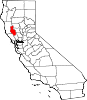
CDPs Clearlake Oaks | Clearlake Riviera | Cobb | Hidden Valley Lake | Kelseyville | Lower Lake | Lucerne | Middletown | Nice | North Lakeport | Soda Bay | Spring Valley | Upper Lake
Unincorporated
communitiesAdams | Bartlett Springs | Bonanza Springs | Buckingham Park | Caldwell Pines | Castle Rock Springs | Clear Lake Keys | Cooper | Crabtree Hot Springs | Crocker Place | Enterprise | Ettawa Springs | Finley | Forest Lake | Four Pines | Glenbrook | Glenhaven | Glenview | Harbin Springs | Harbin Springs Annex | Highland Springs | Hobergs | Hough Springs | Howard Springs | Loch Lomond | Mount Hannah Lodge | Newman Springs | Parramore Springs | Pepperwood Grove | Pine Grove | Pole Garden | Rice Fork Summer Homes | Riviera Estates | Riviera West | Rose Place | Salminas Resort | Saratoga Springs | Seigler Springs | Sunrise Vista | Three Crossing | Twin Lakes | Vann | Whispering Pines | Wild Bill Place
Indian
reservationsBig Valley Rancheria | Elem Indian Colony | Middletown Rancheria | Robinson Rancheria | Upper Lake Rancheria
Former
settlementsArabella | Baker Soda Spring | Barkerville | Bertha | Borax Springs | Bottle Rock | Dahnohabe | Eastlake | Elliott Springs | Ely's | Gifford Springs | Guenoc | Hopitsewah | Hoppins Springs | Howard Mill | Hullville | Kaci-badon | Kayote | Khawina | Knocti | Koi | Laurel Dell | Lolsel | Midlakes | Mirabel | Morgan | Nita | Olposel | Pences | Putah | Quicksilver | Reiff | Sanhedrin | Spiers Springs | Witter Springs
Categories:- Census-designated places in Lake County, California


Wikimedia Foundation. 2010.