- Datto, Arkansas
-
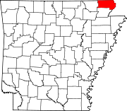
Datto, Arkansas — Town — Location in Clay County and the state of Arkansas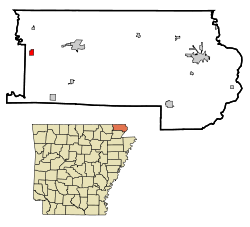
Coordinates: 36°23′32″N 90°43′46″W / 36.39222°N 90.72944°WCoordinates: 36°23′32″N 90°43′46″W / 36.39222°N 90.72944°W Country United States State Arkansas County Clay Area – Total 0.7 sq mi (1.8 km2) – Land 0.7 sq mi (1.8 km2) – Water 0 sq mi (0 km2) Elevation 289 ft (88 m) Population (2000) – Total 97 – Density 138.6/sq mi (53.9/km2) Time zone Central (CST) (UTC-6) – Summer (DST) CDT (UTC-5) ZIP code 72424 Area code(s) 870 FIPS code 05-17410 GNIS feature ID 0076749 Datto is a town in Clay County, Arkansas, United States. The population was 97 at the 2000 census.
Geography
Datto is located at 36°23′32″N 90°43′46″W / 36.39222°N 90.72944°W (36.392312, -90.729314)[1].
According to the United States Census Bureau, the town has a total area of 1.8 km² (0.7 mi²), all land.
Demographics
As of the census[2] of 2000, there were 97 people, 44 households, and 31 families residing in the town. The population density was 54.3/km² (141.1/mi²). There were 53 housing units at an average density of 29.7/km² (77.1/mi²). The racial makeup of the town was 100.00% White. Hispanic or Latino of any race were 1.03% of the population.
There were 44 households out of which 27.3% had children under the age of 18 living with them, 59.1% were married couples living together, 4.5% had a female householder with no husband present, and 29.5% were non-families. 29.5% of all households were made up of individuals and 18.2% had someone living alone who was 65 years of age or older. The average household size was 2.20 and the average family size was 2.71.
In the town the population was spread out with 21.6% under the age of 18, 6.2% from 18 to 24, 26.8% from 25 to 44, 23.7% from 45 to 64, and 21.6% who were 65 years of age or older. The median age was 44 years. For every 100 females there were 102.1 males. For every 100 females age 18 and over, there were 105.4 males.
The median income for a household in the town was $28,750, and the median income for a family was $34,375. Males had a median income of $26,250 versus $17,250 for females. The per capita income for the town was $12,790. There were no families and 8.0% of the population living below the poverty line, including no under eighteens and 41.2% of those over 64.
References
- ^ "US Gazetteer files: 2010, 2000, and 1990". United States Census Bureau. 2011-02-12. http://www.census.gov/geo/www/gazetteer/gazette.html. Retrieved 2011-04-23.
- ^ "American FactFinder". United States Census Bureau. http://factfinder.census.gov. Retrieved 2008-01-31.
Municipalities and communities of Clay County, Arkansas Cities Corning | Piggott | Rector | St. Francis
Towns Unincorporated
communityCategories:- Populated places in Clay County, Arkansas
- Towns in Arkansas


Wikimedia Foundation. 2010.