- Del Rio, Tennessee
-
Del Rio — Unincorporated community — Del Rio, Tennessee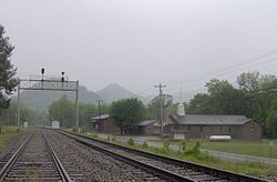 Location within the state of Tennessee
 Del Rio
Coordinates: 35°55′11″N 83°1′33″W / 35.91972°N 83.02583°WCoordinates: 35°55′11″N 83°1′33″W / 35.91972°N 83.02583°W Country United States State Tennessee County Cocke Population (2000) - Total 2,138 Time zone Eastern (EST) (UTC-5) - Summer (DST) EDT (UTC-4) ZIP codes FIPS code GNIS feature ID Del Rio is an unincorporated community in Cocke County, Tennessee, United States. Although it is not a census-designated place, the ZIP Code Tabulation Area for the ZIP Code (37727) that serves Del Rio had a population of 2,138, according to the 2000 census.[1]
Contents
Demographics
As of the census[2] of 2000, there were 2,138 people, 1,119 households, and 611 families residing in the Zip Code Tabulation Area for the zip code (37727) that serves Del Rio. The racial makeup of this area was 98.2% White, 0.1% Native American and 0.1% African American. Hispanics and Latinos comprise 0.7% of the population.
Of the 2,091 households, 21.2% had children under the age of 18 living with them, 55.6% were married couples living together, 9.9% had a female householder with no husband present, and 29.7% were non-families. 25.8% of all households were made up of individuals and 10.8% had someone living alone who was 65 years of age or older. The average household size was 2.46 and the average family size was 2.95.
76.8% of the population was 18 years of age or older with 12.4% being 65 years of age or older. The median age was 39.7 years. The population was 50.5% male and 49.5% female.
The median income for a household in the area was $23,333, and the median income for a family was $28,504. The per capita income for the area was $11,656. About 18.2% of families and 22.0% of the population were below the poverty line.
Geography
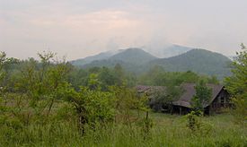 Stone Mountain rising prominently above Del Rio
Del Rio is located at 35°55′11″N 83°01′33″W / 35.91972°N 83.02583°W (35.9197, -83.0258).[1] The community is situated around the confluence of the French Broad River and Big Creek, the latter of which has its source high in the mountains to the south. In recent years, the town's central area has shifted to the junction of U.S. Route 70 and Tennessee Highway 107, along the north side of the French Broad.
The Appalachian Mountains surround Del Rio on all sides, and, along with the river, have been the key influence on the town's economic and cultural development. Stone Mountain rises some 2,000 feet (610 m) above Del Rio to the west. Snowbird Mountain and Max Patch Bald, both of which are traversed by the Appalachian Trail, rise over 3,000 feet (910 m) to the south. The Bald Mountains are to the east, and Neddy Mountain and Meadow Creek Mountain are to the north. The Cherokee National Forest borders much of Del Rio to the south and east.
Along US-70, Newport, Tennessee is just over 10 miles (16 km) to the west, and Hot Springs, North Carolina is nearly 15 miles (24 km) to the east. Del Rio is roughly halfway between Knoxville, Tennessee and Asheville, North Carolina. TN-107 connects Del Rio to a remote valley known as Lemon Gap, at the base of Max Patch Bald.
Like most Appalachian communities, Del Rio has several "satellite" towns, formed as early settlers branched out over the limited bottomlands in the mountain gaps and narrow coves. Among these are Nough (sometimes called "Slabtown") along Big Creek to the south, Paint Rock, which is further up the French Broad to the east, and Harmony Grove, to the southeast. Nough is the birthplace of opera singer and actress, Grace Moore. The Catherine Marshall novel, Christy, takes place at Chapel Hollow (called "Cutter Gap" in the novel), a small valley just west of Del Rio.
History
Early history
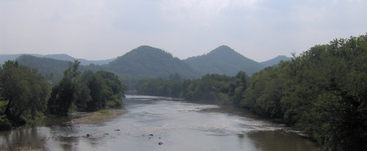
 The French Broad River in Del Rio
A Native American village once occupied the site along the French Broad River where Del Rio is now situated.[3] Frank Stokely, who lived in the area in the mid-20th century, collected a large number of artifacts left by the natives of this village and displayed them in a small museum.[4] The Knoxville Chapter of the Tennessee Archaeological Society also conducted excavations in the area.
The first European settler in what is now Del Rio was John Huff (1758–1843), a veteran of the American Revolution, and his wife Mary Corder (1766–1842). Huff, a hunter and trapper, received a 400-acre (1.6 km2) land grant at the confluence of Long Creek and the French Broad. Arriving around 1784, the Huffs erected a small blockhouse known as Huff's Fort,[5] which would serve as a stopping post for stagecoaches traveling between Knoxville, Tennessee and Warm Springs (now Hot Springs) in North Carolina. The community that arose in the vicinity became known as Big Creek.[6]
Shortly after the Huffs arrived, another Revolutionary War veteran, Jehu Stokely (1747–1816) settled in the Big Creek area. According to family lore, Stokely was impressed into the British navy, but escaped and fought under American captain John Paul Jones.[7] Stokely's tract was just over three miles (5 km) east of Huff's Fort. John Fugate (1764–1837), also a veteran of the Revolution, settled in the Paint Rock area. In 1986, the community held a ceremony marking Fugate's grave as a Revolutionary War hero.
In the decade following Huff's arrival, the constant stream of Euro-American settlers into East Tennessee agitated the Cherokee, who had lived and hunted in the region for centuries. Cattle were stolen, and some settlers were scalped and murdered, leading to massive reprisal attacks on Cherokee villages. Between 1783, a series of forts sprang in Cocke County along the Pigeon River and French Broad, one being Wood's Fort near modern Edwina, just west of Del Rio.[8] Historian J.G.M. Ramsey reports that by 1793, a series of blockhouses lined the French Broad, including the previously-mentioned Huff's (which Ramsey spells "Hough's"), one at Paint Rock, one at Burnt Cane, and another at Warm Springs. Guards stationed at the blockhouses regularly patrolled the area.[9] A treaty at the Tellico Blockhouse in 1794 eased much of the violence, although sporadic attacks occurred for years afterward.
19th century
 The old post office in Del Rio
As the threat of Cherokee attacks declined, Big Creek slowly transformed itself into a stopping point for pioneers crossing the mountains en route to Tennessee. The Huff family converted their fort to an inn, and Jehu's son, Royal, opened a frontier trading post.[10] Throughout the 19th century, the Allen family operated a 13-room log inn at nearby Wolf Creek.[11] Most early settlers raised cattle, which they would drive across the mountains to sell in North Carolina.[12]
Big Creek received a major economic boost in 1868, when the Southern Railway established a railroad line between Morristown, Tennessee and Wolf Creek.[13] Big Creek Station was established in 1870 near what is now the old post office, just south of the river.[14] While the railroad brought benefits, it also brought confusion in the postal system, since there was another town in Tennessee already using the name "Big Creek." The town decided to change its name, and after weighing several suggestions, chose the name Del Rio, which is Spanish for "by the river."[15]
The newly-named Del Rio quickly grew into a major shipping hub for lumber and shingles. Cocke County's first newspaper, The Excelsior, was established at Del Rio in 1875.[14] In the 1880s and 1890s, high demand and innovations such as the band saw brought about a boom in the lumber industry. After lowland forests were wiped out, lumber companies turned to the ancient forests of Appalachia to satisfy the increasing demand. Del Rio, perfectly situated at the base of the mountains, had become the center of a large logging operation by 1900.[16] Lumber camps crept deeper and deeper up the mountain slopes, with the high camp of Boomer operating at 3,000 feet (910 m), near the source of Big Creek, some 10 miles (16 km) south of Del Rio.
20th century
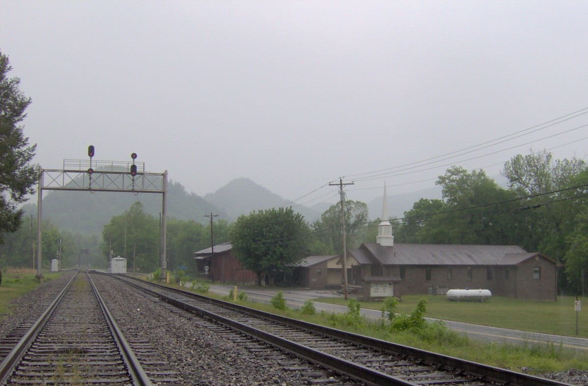
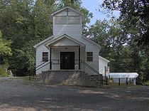 Ebenezer Missionary Baptist Church in Chapel Hollow, near Del Rio
Grace Moore, Del Rio's most famous resident, was born in Nough in 1898. Moore was the great-great-granddaughter of Jehu Stokely, one of Del Rio's original settlers.[2] She was probably born in the home of her maternal grandparents, William and Emma Stokely, which sat on the west bank of Big Creek near the entrance to Nough.[17] A Tennessee Historical Commission marker now recalls the site on TN-107, although the house no longer stands.
James R. Stokely and John Stokely— also great-great-grandchildren of Jehu— formed the Stokely Brothers Company, based in nearby Newport.[3] The company would later be known nationally as Stokely-Van Camp's, and is now a subsidiary of ConAgra.
In 1911, the Weeks Act put an end to the massive logging operations in Southern Appalachia, and Del Rio began to decline. The Great Smoky Mountains National Park didn't extend to cover Snowbird or Max Patch, so Del Rio missed out on the tourism boom that made towns such as Gatlinburg wealthy. Mary Bell Smith, who taught at an elementary school near Nough in the 1930s, recalled elements of the poverty she witnessed during this period:
Many students in large families brought their lunches in tin pails which had been emptied of the pure pork lard which was originally bought in them. These lunch pails contained either blackberry pie or dried beans and cornbread. Sharing equally, sisters and brothers dipped harmoniously from the same lunch bucket.[18]
Another economic blow for Del Rio came with the Interstate Highway Act. For decades, US-70 had been the main highway between Knoxville and Asheville, passing through Del Rio just before it ascended (or emerged from) the mountains. The new Interstate 40, however, ascended the mountains at Hartford, Tennessee to the south, rather than at Del Rio. Thus, the town's thru-traffic slowly died out.
Problems with moonshining and cockfighting
Like its neighbor Cosby, which is just over Stone Mountain to the west, Del Rio gained a reputation for moonshining during the first half of the 20th-century. Moonshining wasn't uncommon in Appalachian communities, where poor soil and low corn prices drove farmers to illegally distill liquor to supplement their income. Long-time Del Rio resident Nathan Jones stated that while moonshining occurred it was typically low-scale and mostly for personal use.[19]
While Del Rio's moonshining image may be exaggerated, Jones did acknowledge that cockfighting was common in the community as early as the 1950s .[19] Twice in the 1980s, federal agents raided an operation just off Happy Hollow Road known as "The Del Rio Cockfighting Pit".[20] On June 11, 2005 the pit was again raided by federal agents, resulting 143 arrests and a seizure of more than $40,000 in cash. Federal officials described the pit as the "largest and oldest illegal cockfighting pit" in the United States.[21]
References
- ^ U.S. Department of Commerce, Bureau of the Census, "Zip Tabulation Area 37727 Fact Sheet." Retrieved: 2 December 2007.
- ^ "American FactFinder". United States Census Bureau. http://factfinder.census.gov. Retrieved 2008-01-31.
- ^ Mary Ruble, "Del Rio", Newport (Newport, Tennessee: Clifton Club, 1970), 82.
- ^ The Tennessee Writers' Project of the Works Projects Administration, Tennessee: A Guide To the State (New York: Viking Press, 1939), 430.
- ^ Ruble, 85.
- ^ Nancy O'Neil, "Del Rio, Tennessee", Smoky Mountain Historical Society Newsletter 12, no. 4 (Winter 1986): 107.
- ^ O'Neil, 107.
- ^ J.G.M. Ramsey, Annals of Tennessee (Johnson City, Tennessee: Overmountain Press, 1999), 279.
- ^ Ramsey, 569-570.
- ^ Ruble, 82.
- ^ Mary Ruble, "Wolf Creek", Newport (Newport, Tennessee: Clifton Club, 1970), 89.
- ^ Nathan Jones, "Del Rio", Newport (Newport, Tennessee: Clifton Club, 1986), 86.
- ^ Carolyn Sakowski, Touring the Tennessee Backroads (Winston-Salem: J.F. Blair, 1993), 232-233.
- ^ a b Goodspeed Publishing Company, "The History of Cocke County," Goodspeed's History of Tennessee (Nashville: C. and R. Elder Booksellers, 1972).
- ^ Jones, 86.
- ^ Ruble, 81.
- ^ Sakowski, 232-233.
- ^ Mary Bell Smith, In the Shadow of the White Rock (Boone, N.C.: Minor's Publishing Company, 1979), 94.
- ^ a b Jones, 88.
- ^ "Cockfighting Pit at Center of Federal Investigation for Sale." The Newport Plain Talk, 7 April 2008. Retrieved: 2010-02-04.
- ^ J.J. Stambaugh, "Timeline: Cocke County Confidential", The Knoxville News-Sentinel 1 August 2005 (http://www.knoxnews.com/kns/local_news/article/0,1406,KNS_347_3967869,00.html) Accessed: 29 June 2007.
External links
- Cocke County Chamber of Commerce
- Cocke County at TNGenWeb Project
- Ebenezer Mission location - TopoQuest.com
- Grace Moore Birthplace (appx.) - TopoQuest.com
Municipalities and communities of Cocke County, Tennessee County seat: Newport City 
Town Unincorporated
communitiesCategories:- Populated places in Cocke County, Tennessee
- Unincorporated communities in Tennessee
- Appalachian culture


Wikimedia Foundation. 2010.