- Ninilchik, Alaska
-
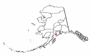
Ninilchik, Alaska — CDP — Ninilchik Village Location of Ninilchik, Alaska
Coordinates: 60°02′47″N 151°40′02″W / 60.04639°N 151.66722°WCoordinates: 60°02′47″N 151°40′02″W / 60.04639°N 151.66722°W Country United States State Alaska Borough Kenai Peninsula Area – Total 207.6 sq mi (537.7 km2) – Land 207.6 sq mi (537.6 km2) – Water 0.0 sq mi (0.1 km2) Population (2000) – Total 772 – Density 3.7/sq mi (1.4/km2) Time zone Alaska (AKST) (UTC-9) – Summer (DST) AKDT (UTC-8) ZIP code 99639 Area code(s) 907 FIPS code 02-54480 Ninilchik is a census-designated place (CDP) in Kenai Peninsula Borough, Alaska, United States. At the 2000 census the population was 772.
Contents
Geography
Ninilchik is on the west side of the Kenai Peninsula on the coast of Cook Inlet, 38 miles (61 km) southwest of Kenai, and 100 miles (160 km) southwest of Anchorage. Road access is by the Sterling Highway. By actual road miles it is a distance of 188 miles (303 km) from Anchorage and 44 miles (71 km) from Homer.[1]
According to the United States Census Bureau, the CDP has a total area of 207.6 square miles (538 km2), of which, 207.6 square miles (538 km2) of it is land and 0.04 square miles (0.10 km2) of it (0.01%) is water.
Demographics
As of the census[2] of 2000, there were 772 people, 320 households, and 223 families residing in the CDP. The population density was 3.7 people per square mile (1.4/km²). There were 762 housing units at an average density of 3.7/sq mi (1.4/km²). The racial makeup of the CDP was 82.25% White, 13.99% Native American, 0.52% Asian, 0.13% from other races, and 3.11% from two or more races. 0.65% of the population were Hispanic or Latino of any race.
There were 320 households out of which 29.4% had children under the age of 18 living with them, 59.4% were married couples living together, 6.9% had a female householder with no husband present, and 30.3% were non-families. 23.1% of all households were made up of individuals and 7.8% had someone living alone who was 65 years of age or older. The average household size was 2.41 and the average family size was 2.87.
In the CDP the population was spread out with 24.1% under the age of 18, 5.4% from 18 to 24, 26.3% from 25 to 44, 29.5% from 45 to 64, and 14.6% who were 65 years of age or older. The median age was 42 years. For every 100 females there were 110.4 males. For every 100 females age 18 and over, there were 114.7 males.
The median income for a household in the CDP was $36,250, and the median income for a family was $41,750. Males had a median income of $29,861 versus $22,750 for females. The per capita income for the CDP was $18,463. About 10.4% of families and 13.9% of the population were below the poverty line, including 13.2% of those under age 18 and 7.2% of those age 65 or over.
History
Before the arrival of Europeans in Alaska, Ninilchik was a Dena'ina Athabaskan lodging area used for hunting and fishing. The name Ninilchik probably derives from Niqnilchint, a Deni'ana Athabaskan word meaning "lodge is built place".
The first people who would permanently stay in the village moved there from Kodiak Island in 1847 before the Alaska Purchase. They were Russian Grigorii Kvasnikov (Anglicized to Kvasnikoff), his Russian-Alutiiq wife Mavra Rastorguev (daughter of Agrafena of Afognak), and their children. Their dialect[3] of Russian (plus a few words borrowed from Alaska Native languages) was the primary language spoken in Ninilchik long past the purchase of Russia's interests in Alaska by the U.S. in 1867. A few speakers of the Ninilchik Russian dialect are still alive in 2008, including one married couple who continues to speak the language to each other.
The 1880, United States Census listed 53 "Creoles" living in Ninilchik in nine extended families. All nine founding families of Ninilchik are descendants of the Kvasnikoffs and Alaska Natives.
In 1896, a school was built and staffed by Russian Orthodox priests and laymen. In 1901, the Russian Orthodox Church was redesigned and constructed at its current site. In 1911 the first school sanctioned by the U.S. government was started and early in 2011 the community celebrated its 100th anniversary of the Ninilchik School.
In the 1940s, a number of homesteaders came to the area. In 1949, Berman Packing Company began fish canning operations at Ninilchik. In 1950, the Sterling Highway was completed through Ninilchik.
2007 Caribou Hills Fire
A 2007 fire that burned near Ninilchik, known as the Caribou Hills Fire, moved toward the town and at its peak threatened approximately 300 structures. It eventually burned nearly 60,000 acres (240 km2) and destroyed 197 structures. For the main article, go to 2007 Caribou Hills fire.
Native Alaskans
The Alaska Native Claims Settlement Act recognized Ninilchik as an Alaska Native village, which led to the formation of the Ninilchik Native Association Incorporated and eventually to the further recognition, by the US Congress, that Ninilchik's descendants comprised a quasi-sovereign government (equivalent to American Indian tribes), thereby establishing the Ninilchik Traditional Council (NTC) as the governing body for Natives who live in the area surrounding Ninilchik or who descended from the original inhabitants.
Community
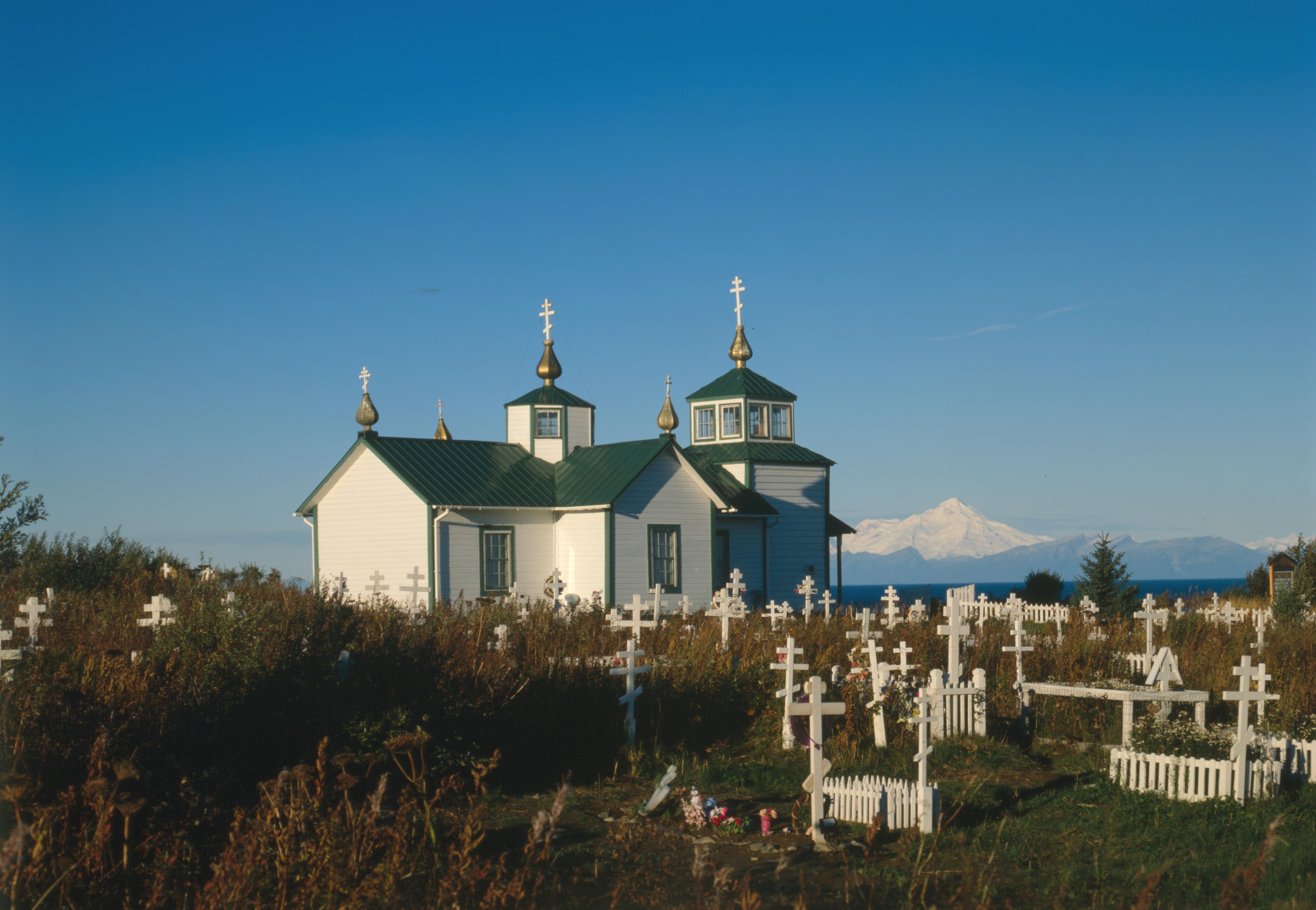
 Holy Transfiguration of Our Lord Chapel
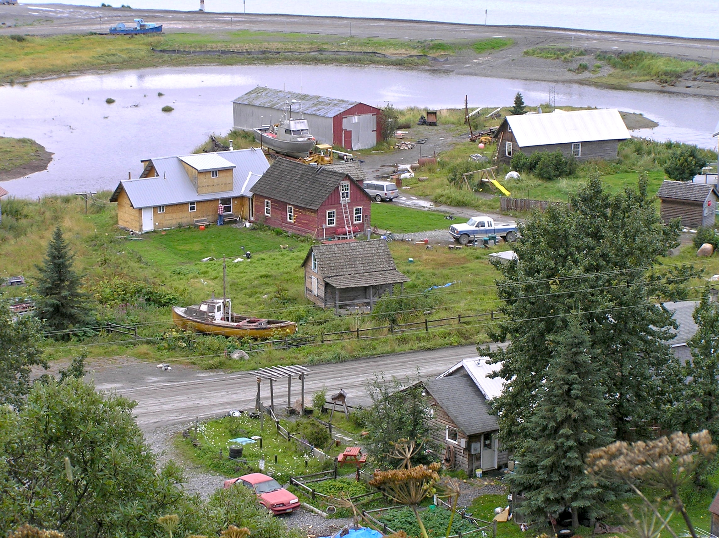
The original village is located at the mouth of the Ninilchik River. A small harbor has been constructed near the mouth of the river. The name "Ninilchik" is used today, however, to refer to the original village as well as the community that has grown up around it, extending several miles north, east, and south. Residents of Ninilchik sometimes refer to the original village as Ninilchik Village. Ninilchik as a town is not incorporated, but it is under the jurisdiction of the Kenai Peninsula Borough (KPB) and the State of Alaska. Volunteer groups, the NTC, the State of Alaska, and the KPB carry out most of the governmental functions in the area, like fire-fighting (volunteer), highway snow-removal (state), health services (NTC), and primary and secondary schooling (KPB). A Russian Orthodox church, the Holy Transfiguration of Our Lord Chapel, is located in the community.
Tourism
Ninilchik is a popular tourist attraction. Other attractions in the area are salmon fishing, typically now either with commercial guides or private commercial family operations, either along the beach north of Ninilchik River or in Cook Inlet whose waters touch the beach next to the village. Halibut can also be caught in Cook Inlet close to Ninilchik. Pacific Razor Clams [1] are popular for digging on the beaches near Ninilchik, when the tides are low enough.
Ninilchik is also the host community for the annual Kenai Peninsula State Fair.
References
- ^ The Milepost, 59th edition, page 630, ISBN#9-781892-15421
- ^ "American FactFinder". United States Census Bureau. http://factfinder.census.gov. Retrieved 2008-01-31.
- ^ See the online dictionary, Our Ninilchik Language
External links
Municipalities and communities of Kenai Peninsula Borough, Alaska Cities 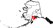
CDPs Anchor Point | Bear Creek | Beluga | Clam Gulch | Cohoe | Cooper Landing | Crown Point | Diamond Ridge | Fox River | Fritz Creek | Funny River | Halibut Cove | Happy Valley | Hope | Kalifornsky | Kasilof | Lowell Point | Miller Landing | Moose Pass | Nanwalek | Nikiski | Nikolaevsk | Ninilchik | Port Graham | Primrose | Ridgeway | Salamatof | Seldovia Village | Sterling | Sunrise | Tyonek
Unincorporated
communitiesKachemak Selo | Razdolna | Voznesenka
Categories:- Census-designated places in Alaska
- Populated places in Kenai Peninsula Borough, Alaska

Wikimedia Foundation. 2010.