- Nikiski, Alaska
-
Nikiski, Alaska — CDP — Location of Nikiski, Alaska
Coordinates: 60°42′28″N 151°15′46″W / 60.70778°N 151.26278°WCoordinates: 60°42′28″N 151°15′46″W / 60.70778°N 151.26278°W Country United States State Alaska Borough Kenai Peninsula Area - Total 76.2 sq mi (197.4 km2) - Land 69.6 sq mi (180.3 km2) - Water 6.6 sq mi (17.1 km2) Elevation 128 ft (39 m) Population (2000) - Total 4,327 - Density 62.2/sq mi (24.0/km2) Time zone Alaska (AKST) (UTC-9) - Summer (DST) AKDT (UTC-8) ZIP code 99635 Area code(s) 907 FIPS code 02-54050 GNIS feature ID 1416651 Nikiski is a census-designated place (CDP) in Kenai Peninsula Borough, Alaska, United States. The population was 4,327 at the 2000 census.
Contents
Geography
Nikiski is located at 60°42′28″N 151°15′46″W / 60.70778°N 151.26278°W (60.707891, -151.262646)[1].
According to the United States Census Bureau, the CDP has a total area of 76.2 square miles (197 km2), of which, 69.6 square miles (180 km2) of it is land and 6.6 square miles (17 km2) of it (8.66%) is water.
Demographics
As of the census[2] of 2000, there were 4,327 people, 1,514 households, and 1,130 families residing in the CDP. The population density was 62.2 people per square mile (24.0/km²). There were 1,766 housing units at an average density of 25.4/sq mi (9.8/km²). The racial makeup of the CDP was 87.15% White, 0.12% Black or African American, 7.56% Native American, 0.72% Asian, 0.51% Pacific Islander, 0.83% from other races, and 3.12% from two or more races. 1.32% of the population were Hispanic or Latino of any race.
There were 1,514 households out of which 41.7% had children under the age of 18 living with them, 60.9% were married couples living together, 7.9% had a female householder with no husband present, and 25.3% were non-families. 20.8% of all households were made up of individuals and 3.8% had someone living alone who was 65 years of age or older. The average household size was 2.86 and the average family size was 3.31.
In the CDP the population was spread out with 33.5% under the age of 18, 6.3% from 18 to 24, 29.8% from 25 to 44, 24.5% from 45 to 64, and 5.9% who were 65 years of age or older. The median age was 34 years. For every 100 females there were 109.0 males. For every 100 females age 18 and over, there were 111.3 males.
The median income for a household in the CDP was $51,176, and the median income for a family was $55,969. Males had a median income of $50,673 versus $26,779 for females. The per capita income for the CDP was $20,128. About 9.3% of families and 11.4% of the population were below the poverty line, including 13.0% of those under age 18 and 7.5% of those age 65 or over.
See also
References
- ^ "US Gazetteer files: 2010, 2000, and 1990". United States Census Bureau. 2011-02-12. http://www.census.gov/geo/www/gazetteer/gazette.html. Retrieved 2011-04-23.
- ^ "American FactFinder". United States Census Bureau. http://factfinder.census.gov. Retrieved 2008-01-31.
External links
Municipalities and communities of Kenai Peninsula Borough, Alaska Borough seat: Soldotna Cities 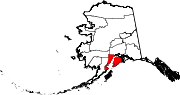
CDPs Anchor Point | Bear Creek | Beluga | Clam Gulch | Cohoe | Cooper Landing | Crown Point | Diamond Ridge | Fox River | Fritz Creek | Funny River | Halibut Cove | Happy Valley | Hope | Kalifornsky | Kasilof | Lowell Point | Miller Landing | Moose Pass | Nanwalek | Nikiski | Nikolaevsk | Ninilchik | Port Graham | Primrose | Ridgeway | Salamatof | Seldovia Village | Sterling | Sunrise | Tyonek
Unincorporated
communitiesKachemak Selo | Razdolna | Voznesenka
Categories:- Census-designated places in Alaska
- Populated places in Kenai Peninsula Borough, Alaska


Wikimedia Foundation. 2010.