- Mount Frankland National Park
-
Mount Frankland National Park 

Nearest city Walpole Coordinates 34°45′59″S 116°44′34″E / 34.76639°S 116.74278°ECoordinates: 34°45′59″S 116°44′34″E / 34.76639°S 116.74278°E Area 37,359 ha (92,316 acres)[1] Established 1988 Governing body Department of Environment and Conservation Official website Mount Frankland National Park is a national park in the South West region of Western Australia (Australia), 327 km south of Perth.
Contents
Geography
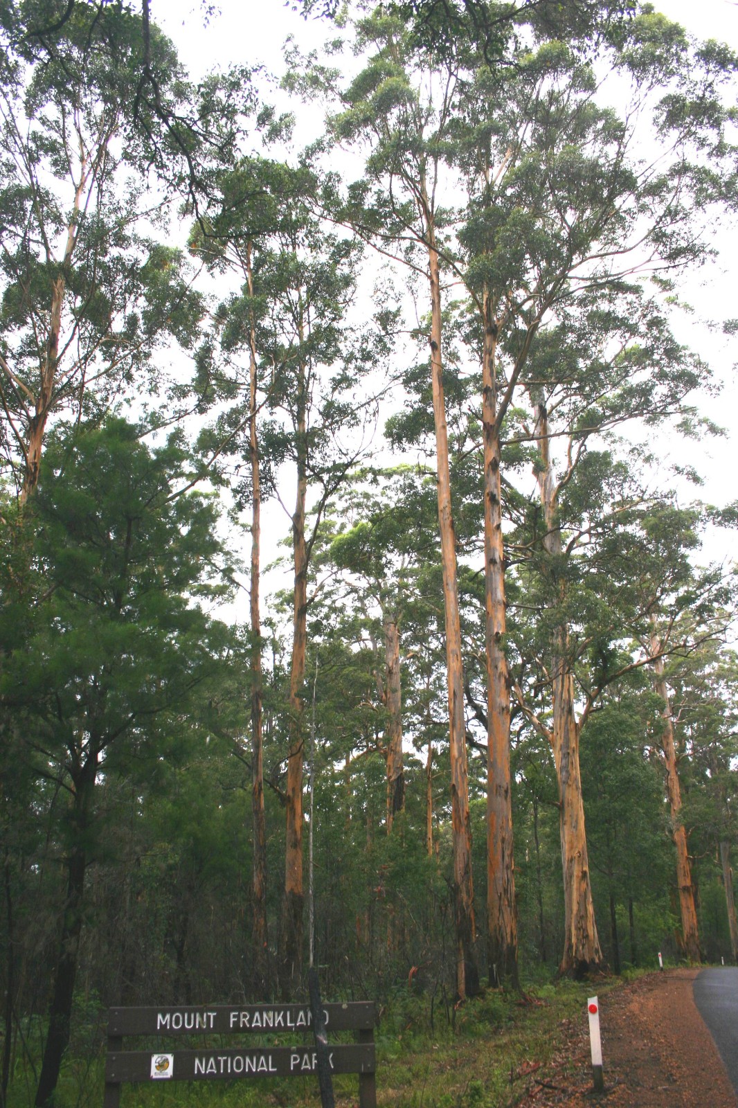
It covers the low granite hills to the north of the town of Walpole and is covered largely by forests of karri (Eucalyptus diversicolor) and red tingle (Eucalyptus jacksonii), two of the world's largest trees. The three tingle species are unique to the area between the park and the coast and the only eucalypts to be butressed, a feature which reflects the moist conditions prevailing within the park. On exposed areas where continuous rain washes away soil, a low heathland is the dominant vegetation.
Annual rainfall at Walpole is around 1,200 mm (47 in). On the 422-metre high peak of Mount Frankland, though no rain gauge has ever been installed, annual rainfall is probably around 1,500 mm (59 in). Most rain falls between May and August, but unlike drier parts of southwestern Australia, showers are not infrequent even during the summer.
Gallery
-

Mount Frankland National Park.
See also
References
- ^ Department of Environment and Conservation 2009–2010 Annual Report. Department of Environment and Conservation. 2010. pp. 48. ISSN 1835-114X. http://www.dec.wa.gov.au/content/view/6139/2345/.
National parks of Western Australia Alexander Morrison · Avon Valley · Badgingarra · Beedelup · Beelu · Boorabbin · Brockman · Cape Arid · Cape Le Grand · Cape Range · Collier Range · D’Entrecasteaux · Drovers Cave · Drysdale River · Eucla · Fitzgerald River · Francois Peron · Frank Hann · Geikie Gorge · Gloucester · Goongarrie · Gooseberry Hill · Greenmount · Gull Rock · Hassell · Hidden Valley · John Forrest · Kalamunda · Kalbarri · Karijini · Karlamilyi · Kennedy Range · Leeuwin-Naturaliste · Lesmurdie Falls · Lesueur · Millstream-Chichester · Mirima · Mitchell River · Moore River · Mount Augustus · Mount Frankland · Nambung · Neerabup · Peak Charles · Porongurup · Purnululu · Rudall River · Scott · Serpentine · Shannon · Sir James Mitchell · Stirling Range · Stokes · Tathra · Torndirrup · Tuart Forest · Tunnel Creek · Walpole-Nornalup · Walyunga · Warren · Watheroo · Waychinicup · West Cape Howe · William Bay · Windjana Gorge · Wolfe Creek Meteorite Crater · Yalgorup · YanchepCategories:- IUCN Category II
- National parks of Western Australia
- Protected areas established in 1988
-

Wikimedia Foundation. 2010.