Moore River National Park

Moore River National Park
IUCN Category II (National Park)
Map showing the location of Moore River National Park
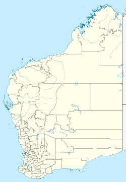
Location Wheatbelt
Nearest city Regans Ford
Coordinates 31°05′12″S 115°38′47″E / 31.08667°S 115.64639°E / -31.08667; 115.64639Coordinates: 31°05′12″S 115°38′47″E / 31.08667°S 115.64639°E / -31.08667; 115.64639
Area 17,254 ha (42,640 acres)[1]
Established 1969[2]
Governing body Department of Environment and Conservation
Official website

Moore River National Park is a national park in the Wheatbelt region of Western Australia (Australia), 95 km north of Perth. The Moore River runs through the park on its way to the Indian Ocean where the township of Guilderton is situated.

The park is situated west of the Brand Highway near Regans Ford and consists of mainly banksia heathland. There are no facilities in the park.

See also

References


Wikimedia Foundation. 2010.

Игры ⚽ Нужна курсовая?

Look at other dictionaries:

  • Moore River National Park — /mɔ/ (say maw) noun a national park established in 1969 in south western WA, near Perth. 17 500 ha …  

  • Drysdale River National Park — IUCN Category II (National Park) …   Wikipedia

  • Mitchell River National Park (Western Australia) — For the national park in Victoria, see Mitchell River National Park (Victoria). Mitchell River National Park IUCN Category II (National Park) …   Wikipedia

  • Moore-River-Nationalpark — Moore River Nationalpark …   Deutsch Wikipedia

  • Moore River (disambiguation) — Moore River in Western Australia can refer to a number of places: Moore River the river itself Moore River National Park national park that the river runs through Guilderton the township at the river mouth, often referred to by locals as Moore… …   Wikipedia

  • Moore River (Western Australia) — Moore River in Western Australia includes a catchment that extends from just south of Three Springs to Guilderton. The river mouth at Guilderton typically closes during the summer months due to insufficient water, creating a sandbar.The river is… …   Wikipedia

  • Moore River — For other uses, see Moore River (disambiguation). Moore River Origin Walebing Mouth Indian Ocean Basin countries Australia Length 193 kilometres (120 mi) …   Wikipedia

  • York River State Park — is located near the unincorporated town of Croaker in James City County, Virginia on the south bank of the York River about 10 miles downstream from West Point. The York River is formed from the confluence of the Mattaponi River and the Pamunkey… …   Wikipedia

  • Oleta River State Park — The beach at Oleta River State Park Type State Park Location North Miami, Miami, Fl …   Wikipedia

  • Dry Tortugas National Park — Fort Jefferson redirects here. For the fortification in Ohio, see Fort Jefferson (Ohio). Dry Tortugas National Park IUCN Category II (National Park) …   Wikipedia

Share the article and excerpts

Direct link
Do a right-click on the link above
and select “Copy Link”