- Purnululu National Park
Infobox World Heritage Site
WHS = Purnululu National Park
State Party = AUS
Type = Natural
Criteria = vii, viii
ID = 1094
Region = Asia-Pacific
Year = 2003
Session = 27th
Link = http://whc.unesco.org/en/list/1094Infobox_protected_area_of_Australia | name = Purnululu National Park
iucn_category = II
caption =
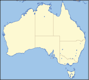
locator_x = 106
locator_y = 45
nearest_town_or_city = Halls Creek
coordinates = coord|17|27|47|S|128|33|51|E|type:landmark_region:AU
area = 2,397.23 km²
established = 1987
visitation_num =
visitation_year =
managing_authorities =Department of Environment and Conservation
official_site = [http://www.naturebase.net/component/option,com_hotproperty/task,view/id,39/ Purnululu National Park]Purnululu National Park is a
World Heritage Site inWestern Australia . It was created in 1987 [ "Bungle Bungle - declared a national park"The West Australian , 28 March 1987, p.25 ]Location
It is located in north east of Western Australia. The nearest major town is Kununurra to the north, or
Halls Creek to the south."Purnululu" is the name given to the
sandstone area of theBungle Bungle Range by theKija Aboriginal people. The name means sandstone or may be a corruption of "bundle grass". The range, lying fully within the park, has elevations as high as 578 metres above sea level. It is famous for the sandstone domes, unusual and visually striking with their striping in alternating orange and grey bands. The banding of the domes is due to differences in clay content and porosity of the sandstone layers: the orange bands consist of oxidisediron compounds in layers that dry out too quickly forcyanobacteria to multiply; the grey bands are composed of cyanobacteria growing on the surface of layers of sandstone where moisture accumulates.Access
Access to the park by road is via Spring Creek Track, from the
Great Northern Highway approximately 250 km south of Kununurra, to the track's end at the visitor centre. The track is 53 km long and is usable only in the dry season (about April 1 to December 31), and only by four-wheel-drive (4WD) vehicles. Safely navigating it takes approximately 3 hours. Access by air is less demanding; helicopter flights are available, from Turkey Creek Roadhouse atWarmun , 187 km south of Kununurra, and light aircraft, from Kununurra.ee also
*
Protected areas of Western Australia
*Kimberley region of Western Australia References
External links
* [http://www.environment.gov.au/heritage/places/world/purnululu/index.html World heritage listing for Purnululu National Park]
* [http://www.naturebase.net/component/option,com_hotproperty/task,view/id,39/Itemid,99999999/ Purnululu National Park]Further reading
* Hoatsan, Dean et al(1997) "Bungle Bungle Range : Purnululu National Park, East Kimberley, Western Australia : a guide to the rocks, landforms, plants, animals, and human impact" Canberra : Australian Geological Survey Organisation. ISBN 0642250103

Wikimedia Foundation. 2010.