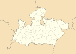
- Dabra, Gwalior
-
"Dabra" redirects here. For the Dragon Ball character, see Dabra (character).
Dabra — city — Coordinates 25°54′N 78°20′E / 25.9°N 78.33°ECoordinates: 25°54′N 78°20′E / 25.9°N 78.33°E Country India State Madhya Pradesh District(s) Gwalior Population 70,678 (2001[update]) Time zone IST (UTC+05:30) Area
• 201 metres (659 ft)
Dabra is a town and a municipality in Gwalior district in the state of Madhya Pradesh, India located near NH-75 national highway.
Contents
Overview
It was also known as Padmapawaya in ancient times. Great poet Bhavabhuti [1] had received his education at Dabra (ancient time Padmapawaya). Dabra has a sugar producing factory and is almost equidistant from New Delhi and Bhopal. It is connected to New Delhi, Mumbai, Bhopal, Agra, Mathura, Varanasi, Kanpur, Lucknow, Haridwar, Chhapra and Bhubaneshwar through rail network. Gwalior and Jhansi are the two big cities located 42 km and 52 km away from Dabra respectively. It is the biggest municipality in Madhya Pradesh as of now and naturally very beautiful. Sind river is just 5 km away from Dabra. Sonagir, a famous jain pilgrimage is located 15 km from Dabra. Datia, another famous tourist place is 30 km away from Dabra. Other famous sites are Bamrouli Hanuman Temple (5 km from Dabra towards Jhansi), Jaurasi Hanuman Temple (25 km from Dabra towards Gwalior), Dhumeshwar Mahadev Temple (30 km from Dabra towards Narwar), tomb of peer baba at Tekanpur and One of the Nince Jewels of Akbar Abdul Fazal (on the behest of Jehangir By Bir Singh Deo Maharaja of Orcha) was killed and has a tomb near Aantri village (30 km from Dabra towards Gwalior), Van Khandeshwar Mahadev Temple (2 km from Dabra towards Gwalior), Kale Baba Temple, Gayatri Temple and Thakur Baba Temple. Thakur Baba temple fair is held every year and is very famous locally. Recently,[when?] a special food processing zone (SEZ) has been scheduled to get started in Dabra in near future.
In fun, natives of Dabra use to rank its top six qualities in their own ways based on the easy availability of those ones, which are "Dhaan (Rice grain with chaff), Dhool (Dust), Dhoka (Betrayal, Suar (Pig), Machhar (Mosquito) and Neta (Politician)".
Education
Dabra has schools for primary and secondary education (affiliated with CBSE/ICSE/MP Boards). Some of the notable institutes are Mangla Higher Secondary School, Sant Kanwar Ram Higher Secondary School, Government Boys Higher Secondary School, Saraswati Shishu Mandir, Government Girls Higher Secondary School, D.A.V. Higher Secondary School st.peter school etc. Many students of these schools have been selected to institutes like IITs, NITs, GEC Jabalpur, MITS Gwalior, SGSITS Indore, SGS Medical College Mumbai, GRMC Medical College Gwalior, GMC Bhopal etc.
Dabra has also a polytechnic college and a government college for non-technical higher education named Vrindasahaye Government College. There are various private colleges for technical and non-technical education.
Medical facilities
Dabra has a government hospital and various private hospitals to serve health-related issues.
Social work activities
Non Government Organization "Nirmal Chaaya" has roots in Dabra to support for unprivileged people. It is led by a group of highly educated natives of Dabra. They are currently working to educate poor children (through a tie-up with Mangla Higher Secondary School) and are aiming to support old and helpless citizens by starting an old age home.
Geography
Dabra is located at 25°54′N 78°20′E / 25.9°N 78.33°E.[2] It has an average elevation of 201 metres (659 feet).
Demographics
As of 2001[update], India census[3], Dabra had a population of 70,678. Males constitute 54% of the population and females 46%. Dabra has an average literacy rate of 77%, higher than the national average of 59.5%: male literacy is 79% and, female literacy is 62%. In Dabra, 15% of the population is under 6 years of age.
Notes and references
- ^ Bhavabhuti
- ^ Falling Rain Genomics, Inc - Dabra
- ^ "Census of India 2001: Data from the 2001 Census, including cities, villages and towns (Provisional)". Census Commission of India. Archived from the original on 2004-06-16. http://web.archive.org/web/20040616075334/http://www.censusindia.net/results/town.php?stad=A&state5=999. Retrieved 2008-11-01.
Categories:- Cities and towns in Gwalior district
- Madhya Pradesh geography stubs
Wikimedia Foundation. 2010.


