Mullaghbawn

Mullaghbawn

Coordinates: 54°06′40″N 6°28′41″W / 54.111°N 6.478°W / 54.111; -6.478

Mullaghbawn
Irish: an Mullach Bán
Mullaghbawn is located in Northern Ireland

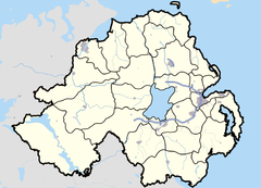
 Mullaghbawn shown within Northern Ireland
Population 402 (2001)
Irish grid reference H995191
District Newry & Mourne
County County Armagh
Country Northern Ireland
Sovereign state United Kingdom
Post town NEWRY
Postcode district BT35
Dialling code 028, +44 28
EU Parliament Northern Ireland
UK Parliament Newry & Armagh
NI Assembly Newry & Armagh
List of places: UK • Northern Ireland • Armagh

Mullaghbawn or Mullaghbane (from Irish: an Mullach Bán, meaning "the white hilltop")[1][2] is a small village and townland near Slieve Gullion in County Armagh, Northern Ireland. In the 2001 Census it had a population of 402. The name can be pronounced /mʌləˈbɔːn/ mul-ə-bawn or /mʌləˈbɑːn/ mul-ə-bahn.

Places of interest

  • Near Mullaghbawn there is a ruined church with the grave of Saint Moninne (a local saint) in its churchyard.
  • Mullaghbawn Folk Museum, a traditional two-roomed thatched farm house and outbuildings, restored by the Mullaghbawn Historical Group during the 1970s and filled with artefacts depicting the lifestyles of the people of the Ring of Gullion in the last century.
  • Ballykeel Dolmen is near Mullaghbawn at the western foot of Slieve Gullion. It is an outstanding example of a portal tomb. It is made up of two portal stones with a sill between and a lower backstone supporting a huge capstone.
  • Tí Chulainn is a cultural heritage centre, with accommodation and function rooms set at the bottom of Slieve Gullion.
  • Cashel Lake, a group of lakes on the outskirts of Mullaghbawn.

Neighbouring townlands

  • Tullymacrieve
  • Lislea
  • Carrive
  • Aughanduff
  • Lathbirget
  • Carricknadreen
  • Shanroe

References

  1. ^ Placenames NI
  2. ^ Placenames Database of Ireland

54°06′N 6°29′W / 54.1°N 6.483°W / 54.1; -6.483


Wikimedia Foundation. 2010.

Игры ⚽ Нужен реферат?

Look at other dictionaries:

  • Kieran McGeeney — Infobox GAA player | name =Kieran McGeeney nickname =Geezer irish = placeofbirth=Mullaghbawn, County Armagh bday= 18 bmonth=10 byear=1971 feet=6 inches=0 sport=Gaelic football code=Football county=Armagh province=Ulster clposition= Back… …   Wikipedia

  • Cúchulainn — IPA|/kuːˈxʊlɪnʲ/ (Audio|Cuchulain audio.ogg|pronunciation) (Irish for Hound of Culann ; also spelled Cú Chulainn, Cú Chulaind, Cúchulain, or Cuchullain) is an Irish mythological hero who appears in the stories of the Ulster Cycle, as well as in… …   Wikipedia

  • County Armagh — Contae Ard Mhacha Coontie Airmagh / Armagh Coat of arms …   Wikipedia

  • List of museums in Northern Ireland — This list of museums in Northern Ireland contains museums which are defined for this context as institutions (including nonprofit organizations, government entities, and private businesses) that collect and care for objects of cultural, artistic …   Wikipedia

  • List of primary schools in Northern Ireland — List of Primary schools in Northern IrelandThis article is a (so far partial) list of Primary schools in operation in Northern Ireland (as of August 2006). NOTOC A*Abercorn Primary School, Banbridge, County Down *Abbots Cross Primary School,… …   Wikipedia

  • St. Mary's Primary School — may refer to:*St. Mary s Primary School, Aughnacloy, Aughnacloy, County Tyrone, Northern Ireland *St. Mary s Primary School, Ballygawley, Ballygawley, County Tyrone, Northern Ireland *St. Mary s Primary School, Ballyward, Ballyward, County Down,… …   Wikipedia

  • Aughanduff — Infobox Irish Place name = Aughanduff gaeilge = Áth an Daimh crest Meaning = Ford of the Oxen map !200px pin coords = left: 141px; top: 106px north coord = 54.151 west coord = 6.513 irish grid = H969221 area = elevation = 71 m (232 ft) province …   Wikipedia

  • List of Irish ballads — The following are often sung Irish folk ballads. The songs are arranged by theme under two main categories of Political and Not Political and are not necessarily contemporary to the events to which they relate.Songs may fit into more than one… …   Wikipedia

  • Newry — For other uses, see Newry (disambiguation). Coordinates: 54°10′34″N 6°20′56″W / 54.176°N 6.349°W / 54.176; 6.349 …   Wikipedia

  • Craigavon — Coordinates: 54°26′50″N 6°23′18″W / 54.447222°N 6.388333°W / 54.447222; 6.388333 …   Wikipedia

Share the article and excerpts

Direct link
Do a right-click on the link above
and select “Copy Link”