- Napier, West Virginia
-
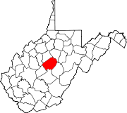
Napier — Unincorporated community — Location within the state of West Virginia
 Napier
Coordinates: 38°47′27″N 80°35′20″W / 38.79083°N 80.58889°WCoordinates: 38°47′27″N 80°35′20″W / 38.79083°N 80.58889°W Country United States State West Virginia County Braxton Time zone Eastern (EST) (UTC-5) – Summer (DST) EDT (UTC-4) ZIP codes 26631 FIPS code GNIS feature ID 1549844[1] Napier is an unincorporated community in Braxton County, West Virginia, United States, founded in 1894, with the ZIP code of 26631. Napier has two significant historical landmarks: the Cunningham House and Outbuildings and the Union Civil War Fortification, and both are listed on the National Register of Historic Places.[2]
References
- ^ "US Board on Geographic Names". United States Geological Survey. 2007-10-25. http://geonames.usgs.gov. Retrieved 2008-01-31.
- ^ "National Register Information System". National Register of Historic Places. National Park Service. 2009-03-13. http://nrhp.focus.nps.gov/natreg/docs/All_Data.html.
Municipalities and communities of Braxton County, West Virginia Towns Burnsville | Flatwoods | Gassaway | Sutton
Unincorporated
communitiesFootnotes ‡This populated place also has portions in an adjacent county or counties
Categories:- Mountain Lakes geography stubs
- Populated places in Braxton County, West Virginia
- Unincorporated communities in West Virginia


Wikimedia Foundation. 2010.