- Osa, Perm Krai
-
For other places with the same name, see Osa, Russia.
Osa (English)
Оса (Russian)- Town[citation needed] - 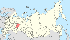
Location of Perm Krai in Russia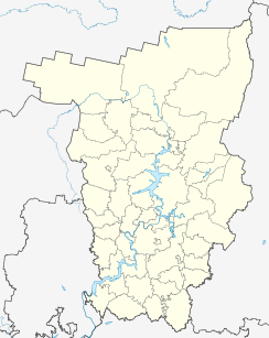
 Osa
OsaCoordinates: 57°17′N 55°27′E / 57.283°N 55.45°ECoordinates: 57°17′N 55°27′E / 57.283°N 55.45°E 

Coat of arms Flag Administrative status Country Russia Federal subject Perm Krai Administrative district Osinsky District[citation needed] Administrative center of Osinsky District[citation needed] Statistics Population (2010 Census,
preliminary)21,191 inhabitants[1] Population (2002 Census) 23,452 inhabitants[2] Time zone YEKST (UTC+06:00)[3] Official website Osa (Russian: Оса) is a town and the administrative center of Osinsky District of Perm Krai, Russia, located on the left bank of the Kama River near its confluence with the Tulva, 146 kilometers (91 mi) southwest of Perm. Population: 21,191 (2010 Census preliminary results);[1] 23,452 (2002 Census);[2] 24,132 (1989 Census).[4]
Historical population of Osa, Perm Krai 1939 1959 1979 1989 2002 2010 9,600[citation needed] 12,700[citation needed] 20,500[citation needed] 24,132[4] 23,452[2] 21,191[1] History
It was founded in 1591 (according to other sources—in 1596) as the sloboda of Novonikolskaya (Новонико́льская) and later became a fortress. In a 1623 document, the settlement is referred to as the sloboda of Osinskaya Nikolskaya (Осинская Никольская), in 1678—as the sloboda of Osinskaya (Осинская), in 1732—as the village (selo) of Osa. It was granted town status in 1739. An important stage in development of town is a discovery of oil fields near Osa in 1960. Oil extraction started in 1963.
References
- ^ a b c Федеральная служба государственной статистики (Federal State Statistics Service) (2011). "Предварительные итоги Всероссийской переписи населения 2010 года (Preliminary results of the 2010 All-Russian Population Census)" (in Russian). Всероссийская перепись населения 2010 года (All-Russia Population Census of 2010). Federal State Statistics Service. http://www.perepis-2010.ru/results_of_the_census/results-inform.php. Retrieved 2011-04-25.
- ^ a b c Федеральная служба государственной статистики (Federal State Statistics Service) (2004-05-21). "Численность населения России, субъектов Российской Федерации в составе федеральных округов, районов, городских поселений, сельских населённых пунктов – районных центров и сельских населённых пунктов с населением 3 тысячи и более человек (Population of Russia, its federal districts, federal subjects, districts, urban localities, rural localities—administrative centers, and rural localities with population of over 3,000)" (in Russian). Всероссийская перепись населения 2002 года (All-Russia Population Census of 2002). Federal State Statistics Service. http://www.perepis2002.ru/ct/doc/1_TOM_01_04.xls. Retrieved 2010-03-23.
- ^ Правительство Российской Федерации. Постановление №725 от 31 августа 2011 г. «О составе территорий, образующих каждую часовую зону, и порядке исчисления времени в часовых зонах, а также о признании утратившими силу отдельных Постановлений Правительства Российской Федерации». Вступил в силу по истечении 7 дней после дня официального опубликования. Опубликован: "Российская Газета", №197, 6 сентября 2011 г. (Government of the Russian Federation. Resolution #725 of August 31, 2011 On the Composition of the Territories Included into Each Time Zone and on the Procedures of Timekeeping in the Time Zones, as Well as on Abrogation of Several Resolutions of the Government of the Russian Federation. Effective as of after 7 days following the day of the official publication).
- ^ a b "Всесоюзная перепись населения 1989 г. Численность наличного населения союзных и автономных республик, автономных областей и округов, краёв, областей, районов, городских поселений и сёл-райцентров. (All Union Population Census of 1989. Present population of union and autonomous republics, autonomous oblasts and okrugs, krais, oblasts, districts, urban settlements, and villages serving as district administrative centers.)" (in Russian). Всесоюзная перепись населения 1989 года (All-Union Population Census of 1989). Demoscope Weekly (website of the Institute of Demographics of the State University—Higher School of Economics. 1989. http://demoscope.ru/weekly/ssp/rus89_reg.php. Retrieved 2010-03-23.
Administrative divisions of Perm Krai Administrative center: Perm 
Cities and towns Alexandrovsk · Berezniki · Chaykovsky · Cherdyn · Chernushka · Chusovoy · Chyormoz · Dobryanka · Gornozavodsk · Gremyachinsk · Gubakha · Kizel · Krasnokamsk · Krasnovishersk · Kudymkar · Kungur · Lysva · Nytva · Ochyor · Okhansk · Osa · Solikamsk · Usolye · Vereshchagino
Administrative districts Bardymsky · Beryozovsky · Bolshesosnovsky · Chastinsky · Cherdynsky · Chernushinsky · Gornozavodsky · Ilyinsky · Karagaysky · Kishertsky · Krasnovishersky · Kungursky · Kuyedinsky · Nytvensky · Ochyorsky · Okhansky · Oktyabrsky · Ordinsky · Osinsky · Permsky · Sivinsky · Solikamsky · Suksunsky · Uinsky · Usolsky · Vereshchaginsky · YelovskyDistricts of Komi-Permyak Okrug Gaynsky · Kochyovsky · Kosinsky · Kudymkarsky · Yurlinsky · YusvinskyCategories:- Cities and towns in Perm Krai
- Populated places established in the 1590s


Wikimedia Foundation. 2010.