- Cocoa Crater
-
Cocoa Crater 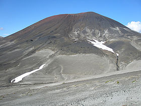
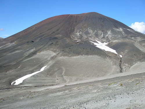
Elevation 2,123 m (6,965 ft) Prominence 168 m (551 ft) Location Location British Columbia, Canada Range Tahltan Highland Coordinates 57°39′N 130°42′W / 57.65°N 130.7°W Topo map NTS 104G/10 Geology Type Cinder cone Age of rock Holocene Last eruption Holocene Cocoa Crater is a cinder cone in the Stikine Country of northwestern British Columbia, Canada. It is located 38 km southeast of Telegraph Creek and 8 m (26 ft) southwest of Mount Edziza. Cocoa Crater is one of the 30 cinder cones around the Mount Edziza conplex that formed in the year 700. The ash around Cocoa Crater is quite deep, its summit is a jet black color and its summit is red. It is quite a different color from the brown color of Coffee Crater, which is to the south of Cocoa Crater.
See also
- Mount Edziza
- Northern Cordilleran Volcanic Province
- List of volcanoes in Canada
- List of Northern Cordilleran volcanoes
- Volcanic history of the Northern Cordilleran Volcanic Province
- Volcanism of Canada
- Volcanism of Western Canada
References
- "Cocoa Crater". BC Geographical Names. http://apps.gov.bc.ca/pub/bcgnws/names/10266.html.
Categories:- Northern Cordilleran Volcanic Province
- Cinder cones of British Columbia
- Stikine Country
- Holocene volcanoes
- Monogenetic volcanoes
- Tahltan Highland
- British Columbia Interior geography stubs
Wikimedia Foundation. 2010.