- Charghat Upazila
-
Charghat
চারঘাট— Upazila — Location in Bangladesh
 Charghat
Coordinates: 24°17′N 88°46.5′E / 24.283°N 88.775°ECoordinates: 24°17′N 88°46.5′E / 24.283°N 88.775°E Country  Bangladesh
Division Rajshahi Division District Rajshahi District Area - Total 164.52 km2 (63.5 sq mi) Population (1991) - Total 163,862 - Density 996/km2 (2,579.6/sq mi) Time zone BST (UTC+6) Website Official Map of Charghat Charghat (Bengali: চারঘাট) is an Upazila of Rajshahi District in the Division of Rajshahi, Bangladesh.
Contents
Background
Charghat is on the bank of the river Padma. There is the only Police Academy at Sardah & a cadet college. Charghat was declared Pourashava in 1998. Md. Anwar Hossain was the first chairman. Charghat is famous for Khoer industry. Mangoes are produced here in plenty. The noted village of Charghat is Mokterpur. A sand mine is located here. Rajshahi Cadet College is situated here. There is a club named Mokterpur Shobuj Shangha. A charity organization named BOTBRIKKHO is also there which works for the poor people. It was established by Md. Oashimul Bari (Oashim), a student of Dhaka University, Dept. of English. Charghat is a centre of cultural programs. Projonmo Theatre of Dakra & Botbrikkho are at the helm of arranging the programs. Sports are held here frequently. All these are supervised by the honourable Mp Md. shahariar Alam of AL. Shardah college is the top level one in Charghat.
Geography
Charghat is located at 24°17′00″N 88°46′30″E / 24.2833°N 88.7750°E . It has 30799 units of house hold and total area 164.52 km².
Demographics
As of the 1991 Bangladesh census, Charghat has a population of 163862. Males constitute are 51.62% of the population, and females 48.38%. This Upazila's eighteen up population is 82597. Charghat has an average literacy rate of 26.6% (7+ years), and the national average of 32.4% literate.[1]
Administrative
Charghat has 6 Unions/Wards, 93 Mauzas/Mahallas, and 129 villages.
See also
References
- ^ "Population Census Wing, BBS.". Archived from the original on 2005-03-27. http://web.archive.org/web/20050327072826/http://www.bangladeshgov.org/mop/ndb/arpc91_v1/tables04.htm. Retrieved November 10, 2006.
 Upazilas of the Rajshahi Division
Capital: Rajshahi Bogra District Adamdighi · Bogra · Dhunat · Dupchanchia · Gabtali · Kahaloo · Nandigram · Sariakandi · Sahajanpur · Sherpur · Shibganj · Sonatala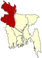
Joypurhat District Naogaon District Atrai · Badalgachhi · Dhamoirhat · Manda · Mahadevpur · Naogaon · Niamatpur · Patnitala · Porsha · Raninagar · SapapharNatore District Nawabganj District Pabna District Rajshahi District Sirajganj District Thakurgaon District Categories:- Upazilas of Rajshahi District
- Rajshahi Division geography stubs


Wikimedia Foundation. 2010.