- Chilmari Upazila
-
Chilmari
চিলমারী— Upazila — Location in Bangladesh
 Chilmari
Coordinates: 25°34′N 89°41.5′E / 25.567°N 89.6917°ECoordinates: 25°34′N 89°41.5′E / 25.567°N 89.6917°E Country  Bangladesh
Division Rajshahi Division District Kurigram District Area - Total 224.97 km2 (86.9 sq mi) Population (1991) - Total 100,516 - Density 447/km2 (1,157.7/sq mi) Time zone BST (UTC+6) Website Official Map of Chilmari Chilmari (Bengali: চিলমারী) is an Upazila of Kurigram District in the Division of Rajshahi, Bangladesh.
Contents
Geography
Chilmari is located at 25°34′00″N 89°41′30″E / 25.5667°N 89.6917°E . It has 20129 units of house hold and total area 224.97 km². Situated in the northern part of Bangladesh, it is located by the Indo-Bangladesh frontier. Chilmari Upazila is intersected by the mighty Brahmaputra River.
Demographics
As of the 1991 Bangladesh census, Chilmari has a population of 100516. Males constitute are 49.98% of the population, and females 50.02%. This Upazila's eighteen up population is 47851. Chilmari has an average literacy rate of 23.7% (7+ years), and the national average of 32.4% literate.[1]
Administrative
Chilmari has 6 Unions/Wards:
1. Ashtamir Char (অষ্টমির চর)
2. Nayar Hat (নয়ার হাট)
3. Chilmari (চিলমারী)
4. Ramna (রমনা)
5. Thanahat (থানাহাট)
6. Raniganj (রানীগঞ্জ)
Under these 6 unions, there are 58 Mauzas/Mahallas, and 152 villages.Fame
Chilmari was once a famous river port during the Pakistani and British Rule. Chilmari has been famous all over Bangladesh for the Bhawaiya song "ওকি গাড়িয়াল ভাই হাকাও গাড়ি তুই চিলমারীর বন্দরে - Oki gariyal bhai hakao gari tui Chilmarir bondorey O my dear brother carter, drive your cart to the port of Chilmari".
Ninth Parliament election from Kurigram-4
 Brahmaputra at sunset ব্রহ্মপুত্রে সূর্যাস্ত
In the ninth parliament election (জাতীয় সংসদ নির্বাচন) held on 29 December, 2008 a total of eight candidates, including two independent ones, are contesting but the contest will be mainly limited to three candidates: former JP MP Md. Golam Habib Dulal from JP-Ershad, Md. Jakir Hossain from AL and Md. Nur Alam Mukul from Jamaat-e Islami candidate of BNP-led four-party alliance. The Jamaat-e Islami candidate is using 'Scale' as the symbol.
The majority voters are in the eastern side of the Brahmaputtra river. There are 1,56,822 voters in Raumari and Rajipur upazilas, while 71,730 voters in Chilmari upazila. Of the Chilmari voters, there are about 20,000 voters in Astomir Char and Nayarhat unions under Chilmari that is situated on the eastern side of the Brahmaputra river.
Finally Md. Jakir Hossain from AL elected MP for the 9th Parliament election, 2008 ( Kurigram-4)[2]
See also
References
- ^ "Population Census Wing, BBS.". Archived from the original on 2005-03-27. http://web.archive.org/web/20050327072826/http://www.bangladeshgov.org/mop/ndb/arpc91_v1/tables04.htm. Retrieved November 10, 2006.
- ^ Engr. Md. Momenul Islam (DIPU), B.Sc.Eng (BUET),M Sc.Eng (NUS),MIEB, MIES,PE(NY) MBA(LU)Assistant Chief Engg. AT&T Contact Email:mmdipu@yahoo.com)(USA-Bechtelcorporation)and Reserve engineering Officer US NAVY
 Upazilas of the Rajshahi DivisionCapital: Rajshahi
Bogra District Adamdighi · Bogra · Dhunat · Dupchanchia · Gabtali · Kahaloo · Nandigram · Sariakandi · Sahajanpur · Sherpur · Shibganj · Sonatala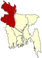
Joypurhat District Naogaon District Atrai · Badalgachhi · Dhamoirhat · Manda · Mahadevpur · Naogaon · Niamatpur · Patnitala · Porsha · Raninagar · SapapharNatore District Nawabganj District Pabna District Rajshahi District Sirajganj District Thakurgaon District Categories:- Upazilas of Kurigram District


Wikimedia Foundation. 2010.