- Chirirbandar Upazila
-
Chirirbandar
চিরিরবন্দর— Upazila — Location in Bangladesh
 Chirirbandar
Coordinates: 25°39.8′N 88°47′E / 25.6633°N 88.783°ECoordinates: 25°39.8′N 88°47′E / 25.6633°N 88.783°E Country  Bangladesh
Division Rajshahi Division District Dinajpur District Area – Total 308.68 km2 (119.2 sq mi) Population (1991) – Total 232,409 – Density 753/km2 (1,950.3/sq mi) Time zone BST (UTC+6) Website Official Map of Chirirbandar Chirirbandar (Bengali: চিরিরবন্দর) is an Upazila of Dinajpur District in the Division of Rajshahi, Bangladesh.
Contents
Geography
Chirirbandar is located at 25°39′45″N 88°47′00″E / 25.6625°N 88.7833°E . It has 42790 units of house hold and total area 308.68 km².
Demographics
As of the 1991 Bangladesh census, Chirirbandar has a population of 232409. Males constitute are 51.43% of the population, and females 48.57%. This Upazila's eighteen up population is 114095. Chirirbandar has an average literacy rate of 28.6% (7+ years), and the national average of 32.4% literate.[1]
Administrative
Chirirbandar has 12 Unions/Wards, 145 Mauzas/Mahallas, and 141 villages.
See also
References
- ^ "Population Census Wing, BBS.". Archived from the original on 2005-03-27. http://web.archive.org/web/20050327072826/http://www.bangladeshgov.org/mop/ndb/arpc91_v1/tables04.htm. Retrieved November 10, 2006.
 Upazilas of the Rajshahi DivisionCapital: Rajshahi
Bogra District Adamdighi · Bogra · Dhunat · Dupchanchia · Gabtali · Kahaloo · Nandigram · Sariakandi · Sahajanpur · Sherpur · Shibganj · Sonatala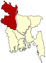
Joypurhat District Naogaon District Atrai · Badalgachhi · Dhamoirhat · Manda · Mahadevpur · Naogaon · Niamatpur · Patnitala · Porsha · Raninagar · SapapharNatore District Nawabganj District Pabna District Rajshahi District Sirajganj District Thakurgaon District Categories:- Upazilas of Dinajpur District
- Rajshahi Division geography stubs


Wikimedia Foundation. 2010.